Directions to Perry's Debra Vocal Dev Studio (New Bedford) with public transportation
The following transit lines have routes that pass near Perry's Debra Vocal Dev Studio
 Bus: 202, 221.
- Train: FALL RIVER/NEW BEDFORD.
How to get to Perry's Debra Vocal Dev Studio by bus?
Click on the bus route to see step by step directions with maps, line arrival times and updated time schedules.
From Walmart Fall River Supercenter, Fall River
101 minFrom Bristol Community College, Fall River
88 minFrom Lizzy Borden House, Fall River
65 minFrom B.M.C. Durfee High School, Fall River
87 minFrom Amazon Fulfillment Bos7, Fall River
113 minFrom RMV New Bedford, New Bedford
56 minFrom Bedford Industrial Park, New Bedford
58 minFrom Charlton Memorial Hospital, Fall River
106 minFrom Mass Maritime Academy, Buzzards Bay
152 min
How to get to Perry's Debra Vocal Dev Studio by train?
Click on the train route to see step by step directions with maps, line arrival times and updated time schedules.
Bus stops near Perry's Debra Vocal Dev Studio in New Bedford
Train station near Perry's Debra Vocal Dev Studio in New Bedford
- Church Street, 19 min walk,VIEW
Bus lines to Perry's Debra Vocal Dev Studio in New Bedford
What are the closest stations to Perry's Debra Vocal Dev Studio?
The closest stations to Perry's Debra Vocal Dev Studio are:
- Acushnet Ave And Conduit St is 184 yards away, 3 min walk.
- Lund's Corner is 1339 yards away, 16 min walk.
- Church Street is 1565 yards away, 19 min walk.
Which bus lines stop near Perry's Debra Vocal Dev Studio?
These bus lines stop near Perry's Debra Vocal Dev Studio: 202, 221.
Which train line stops near Perry's Debra Vocal Dev Studio?
FALL RIVER/NEW BEDFORD (#2011 | New Bedford)
What’s the nearest train station to Perry's Debra Vocal Dev Studio in New Bedford?
The nearest train station to Perry's Debra Vocal Dev Studio in New Bedford is Church Street. It’s a 19 min walk away.
What’s the nearest bus station to Perry's Debra Vocal Dev Studio in New Bedford?
The nearest bus station to Perry's Debra Vocal Dev Studio in New Bedford is Acushnet Ave And Conduit St. It’s a 3 min walk away.
What time is the first train to Perry's Debra Vocal Dev Studio in New Bedford?
The FALL RIVER/NEW BEDFORD is the first train that goes to Perry's Debra Vocal Dev Studio in New Bedford. It stops nearby at 4:16 AM.
What time is the last train to Perry's Debra Vocal Dev Studio in New Bedford?
The FALL RIVER/NEW BEDFORD is the last train that goes to Perry's Debra Vocal Dev Studio in New Bedford. It stops nearby at 1:38 AM.
What time is the first bus to Perry's Debra Vocal Dev Studio in New Bedford?
The 202 is the first bus that goes to Perry's Debra Vocal Dev Studio in New Bedford. It stops nearby at 5:33 AM.
What time is the last bus to Perry's Debra Vocal Dev Studio in New Bedford?
The 202 is the last bus that goes to Perry's Debra Vocal Dev Studio in New Bedford. It stops nearby at 9:42 PM.
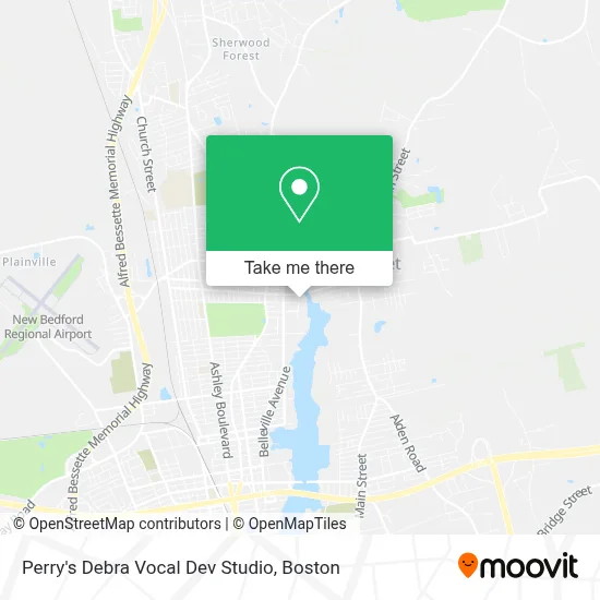
See Perry's Debra Vocal Dev Studio, New Bedford, on the map
Public Transit to Perry's Debra Vocal Dev Studio in New Bedford
Wondering how to get to Perry's Debra Vocal Dev Studio in New Bedford? Moovit helps you find the best way to get to Perry's Debra Vocal Dev Studio with step-by-step directions from the nearest public transit station.
Moovit provides free maps and live directions to help you navigate through your city. View schedules, routes, timetables, and find out how long does it take to get to Perry's Debra Vocal Dev Studio in real time.
Looking for the nearest stop or station to Perry's Debra Vocal Dev Studio? Check out this list of stops closest to your destination: Acushnet Ave And Conduit St; Lund's Corner; Church Street.
Bus: 202, 221.Train: FALL RIVER/NEW BEDFORD.
Want to see if there’s another route that gets you there at an earlier time? Moovit helps you find alternative routes or times. Get directions from and directions to Perry's Debra Vocal Dev Studio easily from the Moovit App or Website.
We make riding to Perry's Debra Vocal Dev Studio easy, which is why over 1.7 million users, including users in New Bedford, trust Moovit as the best app for public transit. You don’t need to download an individual bus app or train app, Moovit is your all-in-one transit app that helps you find the best bus time or train time available.
For information on prices of bus and train, costs and ride fares to Perry's Debra Vocal Dev Studio, please check the Moovit app.
Use the app to navigate to popular places including to the airport, hospital, stadium, grocery store, mall, coffee shop, school, college, and university.
Perry's Debra Vocal Dev Studio Address: 138 River Rd street in New Bedford
- Vocal Development Studio,
- Pico Stone Imports & Supply,
- Ajmal Perfumes Usa,
- Azorean Maritime Heritage Society,
- Gifts To Give,
- Whaling City Fitness,
- Statewide Software & Systems,
- Armatherm Us,
- Vaz Construction Inc.,
- Earthtree,
- Town Of Acushnet,
- Ventura Products,
- Atm CVS,
- Salon Sav,
- Nonb,
- Polochick Chiropractic And Wellness Center,
- Minuteman Press Of New Bedford,
- Almeida Realty Group,
- Mr. Chimney,
- Citizens Atm
Places Near Perry's Debra Vocal Dev Studio (New Bedford)
- Td Garden, Boston,
- Quincy Market, Boston,
- Boston Common, Boston,
- Isabella Stewart Gardner Museum, Boston,
- Cheers, Boston,
- Faneuil Hall, Boston,
- Prudential Center, Boston,
- Leader Bank Pavilion (Leader Bank Pavillion), Boston,
- Boston Children's Hospital, Boston,
- Boston Medical Center, Boston,
- Castle Island, Boston,
- Museum Of Science, Boston,
- North End, Boston,
- Mgm Music Hall, Boston,
- Seaport District, Boston,
- Wilbur Theatre, Boston,
- Wang Theater, Boston,
- Boston Convention & Exhibition Center, Boston,
- Massachusetts General Hospital, Boston,
- House Of Blues, Boston
How to get to popular places in Boston with public transit
Get around New Bedford by public transit!
Traveling around New Bedford has never been so easy. See step by step directions as you travel to any attraction, street or major public transit station. View bus and train schedules, arrival times, service alerts and detailed routes on a map, so you know exactly how to get to anywhere in New Bedford.
When traveling to any destination around New Bedford use Moovit's Live Directions with Get Off Notifications to know exactly where and how far to walk, how long to wait for your line, and how many stops are left. Moovit will alert you when it's time to get off — no need to constantly re-check whether yours is the next stop.
Wondering how to use public transit in New Bedford or how to pay for public transit in New Bedford? Moovit public transit app can help you navigate your way with public transit easily, and at minimum cost. It includes public transit fees, ticket prices, and costs. Looking for a map of New Bedford public transit lines? Moovit public transit app shows all public transit maps in New Bedford with all Bus, Train, Subway and Ferry routes and stops on an interactive map.
Boston has 4 transit type(s), including: Bus, Train, Subway and Ferry, operated by several transit agencies, including MBTA, Southeastern Regional Transit Authority, MetroWest Regional Transit Authority, Rhode Island Public Transit Authority, WRTA, Lowell Regional Transit Authority, Merrimack Valley Transit, Montachusett Regional Transit Authority, Cape Cod Regional Transit Authority, Brockton Area Transit Authority, Martha's Vineyard Transit Authority, the WAVE - Nantucket Regional Transit Authority, GATRA, Cape Ann Transportation Authority and Massport