How to get to Perspective as by bus?
Click on the bus route to see step by step directions with maps, line arrival times and updated time schedules.
From Rj Rénovations, Lorient
79 minFrom Kerpont Plastique, Lanester
80 minFrom Jalrenovtoiture56, Lorient
79 minFrom 2 Allée Joseph de la Haichois, Lorient
78 minFrom Z.a. Lann Gazec, Lanester
81 minFrom Docteur Micro, Lorient
79 minFrom Agence de Lorient Chazelles, Lorient
79 minFrom Entreprise Ziegler, Lorient
79 minFrom Opale Beauté, Lanester
76 minFrom Marie-Lise Esthétique, Lanester
86 min
Bus stop near Perspective as in Hennebont
- Le Temple, 4 min walk,VIEW
Bus lines to Perspective as in Hennebont
- 301, Keralvé,VIEW
What are the closest stations to Perspective as?
The closest stations to Perspective as are:
- Le Temple is 230 meters away, 4 min walk.
Which bus line stops near Perspective as?
T5 (La Base - K3→Mané Bihan)
What’s the nearest bus station to Perspective as in Hennebont?
The nearest bus station to Perspective as in Hennebont is Le Temple. It’s a 4 min walk away.
What time is the first bus to Perspective as in Hennebont?
The 301 is the first bus that goes to Perspective as in Hennebont. It stops nearby at 6:55 AM.
What time is the last bus to Perspective as in Hennebont?
The 301 is the last bus that goes to Perspective as in Hennebont. It stops nearby at 6:45 PM.
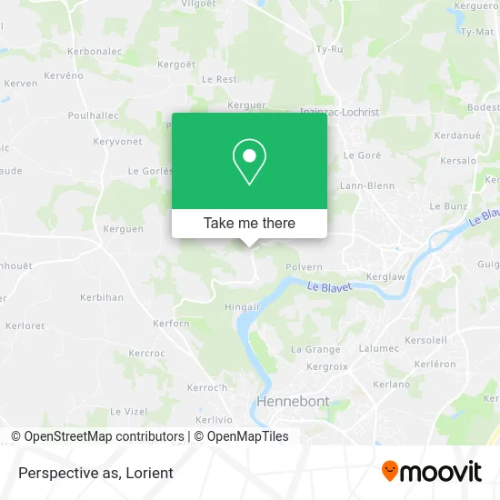
See Perspective as, Hennebont, on the map
Public Transit to Perspective as in Hennebont
Wondering how to get to Perspective as in Hennebont? Moovit helps you find the best way to get to Perspective as with step-by-step directions from the nearest public transit station.
Moovit provides free maps and live directions to help you navigate through your city. View schedules, routes, timetables, and find out how long does it take to get to Perspective as in real time.
Looking for the nearest stop or station to Perspective as? Check out this list of stops closest to your destination: Le Temple.
Bus: T5, 301.
Want to see if there’s another route that gets you there at an earlier time? Moovit helps you find alternative routes or times. Get directions from and directions to Perspective as easily from the Moovit App or Website.
We make riding to Perspective as easy, which is why over 1.5 million users, including users in Hennebont, trust Moovit as the best app for public transit. You don’t need to download an individual bus app or train app, Moovit is your all-in-one transit app that helps you find the best bus time or train time available.
For information on prices of bus, costs and ride fares to Perspective as, please check the Moovit app.
Use the app to navigate to popular places including to the airport, hospital, stadium, grocery store, mall, coffee shop, school, college, and university.
Perspective as Address: Villeneuve Saint-Caradec 56700 Hennebont street in Hennebont
- Moulin de Polvern,
- Aire D'Accueil Des Gens Du Voyage D'Inzinzac-Lochrist,
- Stade Mané-braz,
- Rue de Lann Blenn,
- Haras National d'Hennebont,
- Michel Et Marie-Laure Le Huec,
- Cité Marine,
- Epik ou Rien,
- Le Tohu Bohu,
- Le Theatre a la Coque,
- Sur les Routes du Morbihan - Circuit Court Alimentaire,
- Netto,
- Services Techniques D'Inzinzac-Lochrist,
- Le Petit Korrigan-Gîtes de France,
- David Corlay,
- Pasco Stéphane,
- 26 Cité Jean Jaurès,
- Le Poteau Rouge,
- Le Pressoir,
- Micro Brasserie la Belle Joie
Places Near Perspective as (Hennebont)
- Stade Du Moustoir, Lorient,
- Batobus Lorient Quai des Indes <> Locmiquélic Pen Mané <> Port-Louis La Pointe, Lorient,
- Hôpital du Scorff, Lorient,
- Lycée Polyvalent Colbert, Lorient,
- Ecole des Fusiliers Marins et Commandos, Lorient,
- Clinique Mutualiste, Lorient,
- Clinique Du Ter, Ploemeur,
- Collège et Lycée Saint-Joseph, Lorient,
- Port de Pêche, Lorient,
- CHBS - Centre Hospitalier de Bretagne Sud, Lorient,
- Kerletu, Lorient,
- Clinique du ter, Lorient,
- Clinique Mutualiste De La Porte De Lorient, Lorient,
- Leroy Merlin Quéven-Lorient, Quéven,
- Géant Casino Lanester, Lanester,
- Parc des Expositions, Lanester,
- Lycée Professionnel Marie Le Franc, Lorient,
- Festival Interceltique de Lorient, Lorient,
- E. Leclerc, Lanester,
- Decathlon, Lorient
How to get to popular places in Lorient with public transit
Get around Hennebont by public transit!
Traveling around Hennebont has never been so easy. See step by step directions as you travel to any attraction, street or major public transit station. View bus and train schedules, arrival times, service alerts and detailed routes on a map, so you know exactly how to get to anywhere in Hennebont.
When traveling to any destination around Hennebont use Moovit's Live Directions with Get Off Notifications to know exactly where and how far to walk, how long to wait for your line, and how many stops are left. Moovit will alert you when it's time to get off — no need to constantly re-check whether yours is the next stop.
Wondering how to use public transit in Hennebont or how to pay for public transit in Hennebont? Moovit public transit app can help you navigate your way with public transit easily, and at minimum cost. It includes public transit fees, ticket prices, and costs. Looking for a map of Hennebont public transit lines? Moovit public transit app shows all public transit maps in Hennebont with all Bus and Ferry routes and stops on an interactive map.
Lorient has 2 transit type(s), including: Bus and Ferry, operated by several transit agencies, including IZILO