Directions to Pesky's Pole (Boston) with public transportation
The following transit lines have routes that pass near Pesky's Pole
 Bus: 19, 39, 8, 85, BB.
- Train: FRAMINGHAM/WORCESTER.
- Subway: GREEN LINE B, GREEN LINE C, GREEN LINE D.
How to get to Pesky's Pole by bus?
Click on the bus route to see step by step directions with maps, line arrival times and updated time schedules.
From Wollaston Beach, Quincy
121 minFrom Melrose Wakefield Hospital, Malden
106 minFrom Milton Academy, Milton
100 minFrom Tufts University, Medford
77 minFrom Costco, Everett
74 minFrom Heartbreak Hill, Newton
58 minFrom Milton, MA, Milton
88 minFrom Doubletree-Boston Bayside, Boston
59 minFrom Beth Israel Deaconess Hospital-Milton, Milton
91 minFrom Silver Line Stop Terminal B, Boston
34 min
How to get to Pesky's Pole by train?
Click on the train route to see step by step directions with maps, line arrival times and updated time schedules.
How to get to Pesky's Pole by subway?
Click on the subway route to see step by step directions with maps, line arrival times and updated time schedules.
From Wollaston Beach, Quincy
66 minFrom Melrose Wakefield Hospital, Malden
56 minFrom Silver Line Stop Terminal B, Boston
61 minFrom Milton Academy, Milton
77 minFrom Tufts University, Medford
53 minFrom Costco, Everett
58 minFrom Heartbreak Hill, Newton
45 minFrom Milton, MA, Milton
91 minFrom Doubletree-Boston Bayside, Boston
45 minFrom Beth Israel Deaconess Hospital-Milton, Milton
90 min
Subway stations near Pesky's Pole in Boston
Bus stops near Pesky's Pole in Boston
Train station near Pesky's Pole in Boston
- Lansdowne, 10 min walk,VIEW
Bus lines to Pesky's Pole in Boston
- 55, West Fenway,VIEW
- 57, Haymarket Via Kenmore,VIEW
- 8, Kenmore via South Bay Center - Harbor Point via South Bay Center,VIEW
- 19, Kenmore - Fields Corner,VIEW
- 60, Kenmore - Chestnut Hill Mall,VIEW
- 65, Kenmore - Brighton Center,VIEW
- GREEN LINE B SHUTTLE, Boston University East - Back Bay,VIEW
- GREEN LINE C SHUTTLE, Saint Mary's Street - Kenmore,VIEW
- GREEN LINE C SHUTTLE, Saint Mary's Street - Back Bay,VIEW
- GREEN LINE D SHUTTLE, Riverside - Kenmore via Saint Mary's Street,VIEW
- GREEN LINE D SHUTTLE, Newton Highlands - Kenmore via Saint Mary's Street,VIEW
- GREEN LINE SHUTTLE, Boston University East - Park Street,VIEW
- 9, Kenmore Via Boston Latin,VIEW
- 1 BU (CHARLES RIVER-MEDICAL CAMPUS), 1 BU (Charles River-Medical Campus),VIEW
- GREEN LINE B SHUTTLE, Babcock Street - Back Bay,VIEW
- GREEN LINE B SHUTTLE, Boston College - Back Bay (Shuttle),VIEW
- GREEN LINE B SHUTTLE, Babcock Street - Copley,VIEW
- GREEN LINE B SHUTTLE, Babcock Street - Back Bay via Copley (Shuttle),VIEW
- GREEN LINE B SHUTTLE, Kenmore - Back Bay via Copley (Shuttle),VIEW
- GREEN LINE B SHUTTLE, Babcock Street - Kenmore,VIEW
What are the closest stations to Pesky's Pole?
The closest stations to Pesky's Pole are:
- Boston Univ. East is 21 yards away, 1 min walk.
- Ipswich St Opp Lansdowne St is 30 yards away, 1 min walk.
- Beacon St @ Raleigh St is 314 yards away, 4 min walk.
- Brookline Ave Opp Newbury St is 352 yards away, 5 min walk.
- Kenmore - 660 Beacon St is 360 yards away, 5 min walk.
- Brookline Ave @ Newbury St is 382 yards away, 5 min walk.
- Kenmore is 427 yards away, 6 min walk.
- Lansdowne is 760 yards away, 10 min walk.
Which bus lines stop near Pesky's Pole?
These bus lines stop near Pesky's Pole: 19, 39, 8, 85, BB.
Which train line stops near Pesky's Pole?
FRAMINGHAM/WORCESTER (#525 | Worcester)
Which subway lines stop near Pesky's Pole?
These subway lines stop near Pesky's Pole: GREEN LINE B, GREEN LINE C, GREEN LINE D.
What’s the nearest subway station to Pesky's Pole in Boston?
The nearest subway station to Pesky's Pole in Boston is Boston Univ. East. It’s a 1 min walk away.
What’s the nearest train station to Pesky's Pole in Boston?
The nearest train station to Pesky's Pole in Boston is Lansdowne. It’s a 10 min walk away.
What’s the nearest bus station to Pesky's Pole in Boston?
The nearest bus station to Pesky's Pole in Boston is Ipswich St Opp Lansdowne St. It’s a 1 min walk away.
What time is the first subway to Pesky's Pole in Boston?
The GREEN LINE D is the first subway that goes to Pesky's Pole in Boston. It stops nearby at 4:56 AM.
What time is the last subway to Pesky's Pole in Boston?
The GREEN LINE D is the last subway that goes to Pesky's Pole in Boston. It stops nearby at 2:21 AM.
What time is the first train to Pesky's Pole in Boston?
The FRAMINGHAM/WORCESTER is the first train that goes to Pesky's Pole in Boston. It stops nearby at 4:55 AM.
What time is the last train to Pesky's Pole in Boston?
The FRAMINGHAM/WORCESTER is the last train that goes to Pesky's Pole in Boston. It stops nearby at 12:06 AM.
What time is the first bus to Pesky's Pole in Boston?
The 57 is the first bus that goes to Pesky's Pole in Boston. It stops nearby at 4:46 AM.
What time is the last bus to Pesky's Pole in Boston?
The 57 is the last bus that goes to Pesky's Pole in Boston. It stops nearby at 2:09 AM.
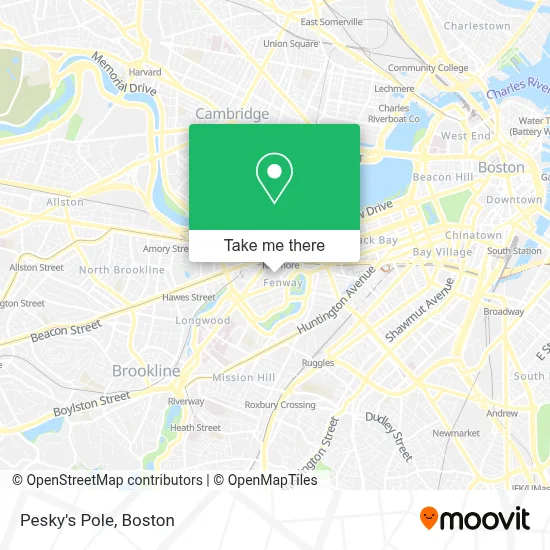
See Pesky's Pole, Boston, on the map
Public Transit to Pesky's Pole in Boston
Wondering how to get to Pesky's Pole in Boston? Moovit helps you find the best way to get to Pesky's Pole with step-by-step directions from the nearest public transit station.
Moovit provides free maps and live directions to help you navigate through your city. View schedules, routes, timetables, and find out how long does it take to get to Pesky's Pole in real time.
Looking for the nearest stop or station to Pesky's Pole? Check out this list of stops closest to your destination: Boston Univ. East; Ipswich St Opp Lansdowne St; Beacon St @ Raleigh St; Brookline Ave Opp Newbury St; Kenmore - 660 Beacon St; Brookline Ave @ Newbury St; Kenmore; Lansdowne.
Bus: 19, 39, 8, 85, BB, 55, 57, 60, 65.Train: FRAMINGHAM/WORCESTER.Subway: GREEN LINE B, GREEN LINE C, GREEN LINE D.
Want to see if there’s another route that gets you there at an earlier time? Moovit helps you find alternative routes or times. Get directions from and directions to Pesky's Pole easily from the Moovit App or Website.
We make riding to Pesky's Pole easy, which is why over 1.7 million users, including users in Boston, trust Moovit as the best app for public transit. You don’t need to download an individual bus app or train app, Moovit is your all-in-one transit app that helps you find the best bus time or train time available.
For information on prices of subway, bus and train, costs and ride fares to Pesky's Pole, please check the Moovit app.
Use the app to navigate to popular places including to the airport, hospital, stadium, grocery store, mall, coffee shop, school, college, and university.
Pesky's Pole Address: Fenway Park, 4 Jersey St street in Boston
- Game on,
- Pavillion Restaurant,
- Carl Yastrzemski Statue,
- Fenway Park (Fenway Park, Home of the Boston Red Sox),
- Budweiser Right Field Roof Deck,
- Van Ness St / Ipswich St,
- Fenway Park Bleachers 36 Row 22 SEAT 1,
- Right Field Grandstand,
- Right Field Beer Stand,
- Teammates Statue,
- Fenway Park-Gate C Entrance,
- Jack Richman Od,
- Devon Locksmith,
- Guitar Center,
- Tour Boston's Rock & Roll Past & Present by Soundscape Tours,
- Fenway Park,
- 521 Overlook,
- Aramark,
- Devora,
- Standard Parking
Places Near Pesky's Pole (Boston)
- Quincy Market, Boston,
- Museum Of Science, Boston,
- Td Garden, Boston,
- Wang Theater, Boston,
- Boston Children's Hospital, Boston,
- Castle Island, Boston,
- Wilbur Theatre, Boston,
- Massachusetts General Hospital, Boston,
- Cheers, Boston,
- Prudential Center, Boston,
- Faneuil Hall, Boston,
- Boston Common, Boston,
- Boston Convention & Exhibition Center, Boston,
- Mgm Music Hall, Boston,
- Boston Medical Center, Boston,
- House Of Blues, Boston,
- Isabella Stewart Gardner Museum, Boston,
- North End, Boston,
- Seaport District, Boston,
- Leader Bank Pavilion (Leader Bank Pavillion), Boston
How to get to popular places in Boston with public transit
Get around Boston by public transit!
Traveling around Boston has never been so easy. See step by step directions as you travel to any attraction, street or major public transit station. View bus and train schedules, arrival times, service alerts and detailed routes on a map, so you know exactly how to get to anywhere in Boston.
When traveling to any destination around Boston use Moovit's Live Directions with Get Off Notifications to know exactly where and how far to walk, how long to wait for your line, and how many stops are left. Moovit will alert you when it's time to get off — no need to constantly re-check whether yours is the next stop.
Wondering how to use public transit in Boston or how to pay for public transit in Boston? Moovit public transit app can help you navigate your way with public transit easily, and at minimum cost. It includes public transit fees, ticket prices, and costs. Looking for a map of Boston public transit lines? Moovit public transit app shows all public transit maps in Boston with all Bus, Train, Subway and Ferry routes and stops on an interactive map.
Boston has 4 transit type(s), including: Bus, Train, Subway and Ferry, operated by several transit agencies, including MBTA, Southeastern Regional Transit Authority, MetroWest Regional Transit Authority, Rhode Island Public Transit Authority, WRTA, Lowell Regional Transit Authority, Merrimack Valley Transit, Montachusett Regional Transit Authority, Cape Cod Regional Transit Authority, Brockton Area Transit Authority, Martha's Vineyard Transit Authority, the WAVE - Nantucket Regional Transit Authority, GATRA, Cape Ann Transportation Authority and Massport