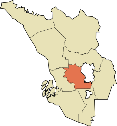
See Petaling, Petaling Jaya, on the map
Directions to Petaling (Petaling Jaya) with public transportation
The following transit lines have routes that pass near Petaling
 Bus:
Bus: - Train:
- MRT & LRT:
How to get to Petaling by bus?
Click on the bus route to see step by step directions with maps, line arrival times and updated time schedules.
How to get to Petaling by MRT & LRT?
Click on the MRT & LRT route to see step by step directions with maps, line arrival times and updated time schedules.
Bus stations near Petaling in Petaling Jaya
- Aeon Big Subang Jaya (Sj57),3 min walk,
- KTM / LRT Subang Jaya (Selatan) (Sj699),8 min walk,
- KTM / LRT Subang Jaya (Utara) (Sj63),13 min walk,
- Isola Condo (Sj590),17 min walk,
Train stations near Petaling in Petaling Jaya
- Subang Jaya,10 min walk,
Bus lines to Petaling in Petaling Jaya
- 641,KTM / LRT Subang Jaya,
- 708,Klang Via Hentian Bandar Shah Alam,
- 771,USJ 1 Subang Mewah,
- 783,LRT Kelana Jaya ↺ Subang Parade,
- SJ01,Brt / LRT Usj7 ↺ KTM / LRT Subang Jaya,
- TU2A,Tu2a,
- 700,Klang ⇌ Hab Pasar Seni,
- P701,Pelabuhan Klang ⇌ Kota Raya, Kuala Lumpur,
- 710,Klang ⇌ Pasar Seni via KL Sentral,
- 750,Hab Pasar Seni ⇌ UiTM Seksyen 2, Shah Alam,
- 751,Hab Pasar Seni ⇌ Taman Sri Muda, Shah Alam,
What are the closest stations to Petaling?
The closest stations to Petaling are:
- Aeon Big Subang Jaya (Sj57) is 163 meters away, 3 min walk.
- KTM / LRT Subang Jaya (Selatan) (Sj699) is 541 meters away, 8 min walk.
- Subang Jaya is 775 meters away, 10 min walk.
- KTM / LRT Subang Jaya (Utara) (Sj63) is 954 meters away, 13 min walk.
- Isola Condo (Sj590) is 1213 meters away, 17 min walk.
Which bus lines stop near Petaling?
These bus lines stop near Petaling: 700, 710, 751, P701.
Which train line stops near Petaling?
10
Which MRT & LRT line stops near Petaling?
5
What’s the nearest train station to Petaling in Petaling Jaya?
The nearest train station to Petaling in Petaling Jaya is Subang Jaya. It’s a 10 min walk away.
What’s the nearest bus stop to Petaling in Petaling Jaya?
The nearest bus stop to Petaling in Petaling Jaya is Aeon Big Subang Jaya (Sj57). It’s a 3 min walk away.
What time is the first MRT & LRT to Petaling in Petaling Jaya?
The 5 is the first MRT & LRT that goes to Petaling in Petaling Jaya. It stops nearby at 5:48 AM.
What time is the last MRT & LRT to Petaling in Petaling Jaya?
The 5 is the last MRT & LRT that goes to Petaling in Petaling Jaya. It stops nearby at 12:43 AM.
What time is the first train to Petaling in Petaling Jaya?
The 2 is the first train that goes to Petaling in Petaling Jaya. It stops nearby at 6:06 AM.
What time is the last train to Petaling in Petaling Jaya?
The 2 is the last train that goes to Petaling in Petaling Jaya. It stops nearby at 11:38 PM.
What time is the first bus to Petaling in Petaling Jaya?
The 641 is the first bus that goes to Petaling in Petaling Jaya. It stops nearby at 5:30 AM.
What time is the last bus to Petaling in Petaling Jaya?
The 641 is the last bus that goes to Petaling in Petaling Jaya. It stops nearby at 12:17 AM.
How much is the train fare to Petaling?
The train fare to Petaling costs about RM2.00 - RM3.50.
How much is the MRT & LRT fare to Petaling?
The MRT & LRT fare to Petaling costs about RM1.10 - RM5.30.
See Petaling, Petaling Jaya, on the map
Public Transit to Petaling in Petaling Jaya
Wondering how to get to Petaling in Petaling Jaya, Malaysia? Moovit helps you find the best way to get to Petaling with step-by-step directions from the nearest public transit station.
Moovit provides free maps and live directions to help you navigate through your city. View schedules, routes, timetables, and find out how long does it take to get to Petaling in real time.
Looking for the nearest stop or station to Petaling? Check out this list of stops closest to your destination: Aeon Big Subang Jaya (Sj57); KTM / LRT Subang Jaya (Selatan) (Sj699); Subang Jaya; KTM / LRT Subang Jaya (Utara) (Sj63); Isola Condo (Sj590).
Bus:Train:MRT & LRT:
Want to see if there’s another route that gets you there at an earlier time? Moovit helps you find alternative routes or times. Get directions from and directions to Petaling easily from the Moovit App or Website.
We make riding to Petaling easy, which is why over 1.5 million users, including users in Petaling Jaya, trust Moovit as the best app for public transit. You don’t need to download an individual bus app or train app, Moovit is your all-in-one transit app that helps you find the best bus time or train time available.
For information on prices of bus, MRT & LRT and train, costs and ride fares to Petaling, please check the Moovit app.
Use the app to navigate to popular places including to the airport, hospital, stadium, grocery store, mall, coffee shop, school, college, and university.
Petaling Address: Lebuhraya Persekutuan street in Petaling Jaya
Attractions near Petaling
Federal Highway toward K.L,Mynews.Com,Starbucks Petronas Federal Highway,PETRONAS Starbucks Temasya Federal Highway,ChargEV,AEON Mall Bukit Tinggi,Syam Restaurant Kota Bharu,Cohn & Wolfe XPR Malaysia,Hui Lau Shan Malaysia Official,Lavender,Starbucks Drive Thru Federal Highway,Lavender Confectionery & Bakery,Empire Shopping Gallery-North Entrance,Saujana Residency,Madam Kwan's Empire Shopping Gallery,Tempat Pengecasan Kenderaan Elektrik,Saujana Residency,Red Box @ Empire Shopping Gallery,Petronas Batu 3, Shah Alam,Ev ChargerHow to get to popular attractions in Petaling Jaya with public transit
Burger King, Klang,Presint 5 (Precinct), Sepang,Pizza Hut, Seremban,Farzana Corner, Petaling Jaya,Hangar 77, Airod Aerospace Technology, Petaling Jaya,Maxis Centre, Seremban,Terminal Bersepadu Selatan (Tbs), Kuala Lumpur,Plaza Jelutong, Shah Alam,Restoran Mei Qing (美景海鲜饭店), Klang,Bandar Nusaputra, Precinct 1, Sepang,Blok 29, Flat PKNS, Seksyen 7, Shah Alam,Tune Hotel, Sepang,Pangsapuri Seri Bintang, Petaling Jaya,Kampung Sungai Tua, Gombak,KFC Dengkil, Sepang,Highway PLUS utara selatan, Hulu Langat,Regent International School, Klang,Subang Permai, Petaling Jaya,Seri Sentosa, Kuala Lumpur,1 Utama (New Wing), PetalingGet around Petaling Jaya by public transit!
Traveling around Petaling Jaya has never been so easy. See step by step directions as you travel to any attraction, street or major public transit station. View bus and train schedules, arrival times, service alerts and detailed routes on a map, so you know exactly how to get to anywhere in Petaling Jaya.
When traveling to any destination around Petaling Jaya use Moovit's Live Directions with Get Off Notifications to know exactly where and how far to walk, how long to wait for your line, and how many stops are left. Moovit will alert you when it's time to get off — no need to constantly re-check whether yours is the next stop.
Wondering how to use public transit in Petaling Jaya or how to pay for public transit in Petaling Jaya? Moovit public transit app can help you navigate your way with public transit easily, and at minimum cost. It includes public transit fees, ticket prices, and costs. Looking for a map of Petaling Jaya public transit lines? Moovit public transit app shows all public transit maps in Petaling Jaya with all bus, MRT & LRT or train routes and stops on an interactive map.
Petaling Jaya has 3 transit type(s), including: bus, MRT & LRT or train, operated by several transit agencies, including rapidKL, rapidKL MRT, rapidKL, Express Rail Link - ERL, Keretapi Tanah Melayu - KTM, rapidKL BRT, rapidKL Bus, MRT Feeder Bus (Operated by RapidKL), GOKL City Bus, PJ City Bus (operated by rapidKL), Smart Selangor (operated by rapidKL), Smart Selangor, Nadiputra (Operated by RapidKL), Free Shuttle Service and Causeway Link (Handal Ceria Sdn Bhd)