Directions to Petaluma Municipal Airport with public transportation
The following transit lines have routes that pass near Petaluma Municipal Airport
How to get to Petaluma Municipal Airport by bus?
Click on the bus route to see step by step directions with maps, line arrival times and updated time schedules.
How to get to Petaluma Municipal Airport by train?
Click on the train route to see step by step directions with maps, line arrival times and updated time schedules.
Which bus lines stop near Petaluma Municipal Airport?
These bus lines stop near Petaluma Municipal Airport: 11, 3.
Which train line stops near Petaluma Municipal Airport?
SMART
See Petaluma Municipal Airport on the map
Public Transportation to Petaluma Municipal Airport
Wondering how to get to Petaluma Municipal Airport, United States? Moovit helps you find the best way to get to Petaluma Municipal Airport with step-by-step directions from the nearest public transit station.
Moovit provides free maps and live directions to help you navigate through your city. View schedules, routes, timetables, and find out how long does it take to get to Petaluma Municipal Airport in real time.
Bus: 11, 3.Train: SMART.
Want to see if there’s another route that gets you there at an earlier time? Moovit helps you find alternative routes or times. Get directions from and directions to Petaluma Municipal Airport easily from the Moovit App or Website.
We make riding to Petaluma Municipal Airport easy, which is why over 1.5 million users, including users in Petaluma, trust Moovit as the best app for public transit. You don’t need to download an individual bus app or train app, Moovit is your all-in-one transit app that helps you find the best bus time or train time available.
For information on prices of bus and train, costs and ride fares to Petaluma Municipal Airport, please check the Moovit app.
Use the app to navigate to popular places including to the airport, hospital, stadium, grocery store, mall, coffee shop, school, college, and university.
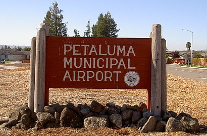
Petaluma Municipal Airport Address: 2198 Caulfield Lane, Petaluma, CA 94954 street in Petaluma
Attractions near Petaluma Municipal Airport
Baker Chris Trucking & Hay Sales,Two Niner Diner,Lint Extractors,Palomino Court,S V Situm,Wiseman Park Playground,James B Oliver,P-town,Lincoln Lane,Fire Innovations,Wiseman Park,Redwood Helicopters,Spirits Up,Aeroventure,Petaluma Pilot Training Center,Wiseman Airport Park,Old Adobe Elementary School,The Hand Group, Inc,Crown & Shield Exterminators,Potter Rug & Furniture CleanersHow to get to popular attractions in Petaluma with public transit
Googleplex - B40 Gym,Costco Wholesale,Westgate Shopping Center, San Jose,Fentons Creamery & Restaurant, Oakland,Peju Province Winery,Highway 4, Pacheco,Santa Rosa Plaza, Santa Rosa,City of Rohnert Park, Rohnert Park,Lagunitas Brewing Company, Petaluma,Whole Foods Market, San Ramon,Domaine Chandon,Campbell, CA, Campbell,City of Milpitas, Milpitas,Sharks Ice at San Jose, San Jose,Napa Valley, Yountville,Costco Wholesale, San Jose,Sfo, Sfo,City of Morgan Hill, Morgan Hill,Menlo Park Caltrain Station, Menlo Park,City College Of San Francisco, San FranciscoGet around San Francisco - San Jose, CA by public transit!
Traveling around San Francisco - San Jose, CA has never been so easy. See step by step directions as you travel to any attraction, street or major public transit station. View bus and train schedules, arrival times, service alerts and detailed routes on a map, so you know exactly how to get to anywhere in San Francisco - San Jose, CA.
When traveling to any destination around San Francisco - San Jose, CA use Moovit's Live Directions with Get Off Notifications to know exactly where and how far to walk, how long to wait for your line, and how many stops are left. Moovit will alert you when it's time to get off — no need to constantly re-check whether yours is the next stop.
Wondering how to use public transit in San Francisco - San Jose, CA or how to pay for public transit in San Francisco - San Jose, CA? Moovit public transit app can help you navigate your way with public transit easily, and at minimum cost. It includes public transit fees, ticket prices, and costs. Looking for a map of San Francisco - San Jose, CA public transit lines? Moovit public transit app shows all public transit maps in San Francisco - San Jose, CA with all Bus, Train, BART, Light Rail, Ferry and Cable Car routes and stops on an interactive map.
San Francisco - San Jose, CA has 6 transit type(s), including: Bus, Train, BART, Light Rail, Ferry and Cable Car, operated by several transit agencies, including BART, Bay Area Rapid Transit, Muni Metro, Caltrain, VTA, Capitol Corridor, Sonoma Marin Area Rail Transit, MUNI, SF Cable Car, AC Transit, Dumbarton Express, Golden Gate Transit, County Connection, SamTrans, SamTrans / City of Menlo Park