How to get to Peter Paglio by bus?
Click on the bus route to see step by step directions with maps, line arrival times and updated time schedules.
From Sibley Memorial Hospital, Washington
41 minFrom Seven Corners Center (Seven Corners Shopping Center Falls Church VA), Fairfax County
74 minFrom Sheraton-Pentagon City Hotel (Sheraton Arlington), Arlington County
54 minFrom I-295 Exit 1 - Naval Research Lab, Washington
96 minFrom Silver Spring Civic Building (Silver Spring Civic Center), Montgomery County
34 minFrom The Westin Arlington Gateway, Arlington County
62 minFrom George H.W. Bush Center For Intelligence (CIA Headquarters), Fairfax County
105 minFrom St Elizabeths Hospital, Washington
80 minFrom Baileys Crossroads, Fairfax County
67 minFrom Eden Center, Falls Church
73 min
How to get to Peter Paglio by train?
Click on the train route to see step by step directions with maps, line arrival times and updated time schedules.
How to get to Peter Paglio by metro?
Click on the metro route to see step by step directions with maps, line arrival times and updated time schedules.
From Seven Corners Center (Seven Corners Shopping Center Falls Church VA), Fairfax County
57 minFrom Sheraton-Pentagon City Hotel (Sheraton Arlington), Arlington County
50 minFrom Silver Spring Civic Building (Silver Spring Civic Center), Montgomery County
38 minFrom The Westin Arlington Gateway, Arlington County
36 minFrom St Elizabeths Hospital, Washington
43 minFrom Eden Center, Falls Church
50 min
Bus stops near Peter Paglio in Washington
Metro stations near Peter Paglio in Washington
Bus lines to Peter Paglio in Washington
- D70, South To Farragut Sq,VIEW
- D72, South To Lafayette Sq,VIEW
- C91, East To Ledroit Park,VIEW
- D94, East To Gallery Place,VIEW
- D96, South To Potomac Park,VIEW
- D74, East To Rhode Island Av,VIEW
- D90, West To Tenleytown,VIEW
- FLIXBUS 2601, New York (Hudson Yards),VIEW
- 305, 305/5 Columbia,VIEW
- 325, 325/4 Columbia,VIEW
What are the closest stations to Peter Paglio?
The closest stations to Peter Paglio are:
- Connecticut Av Nw+N St NW is 79 yards away, 2 min walk.
- P St Nw+21 St NW is 90 yards away, 2 min walk.
- Massachusetts Av Nw+20 St NW is 91 yards away, 2 min walk.
- Washington Dc (Dupont Circle) is 268 yards away, 4 min walk.
- New Hampshire & Dupont Cir NW Sb is 306 yards away, 4 min walk.
- Mcpherson Sq Metro Station is 372 yards away, 5 min walk.
- Farragut North - NE Corner Connecticut Ave. &Amp; K St., NW (Elevator) is 643 yards away, 8 min walk.
Which bus lines stop near Peter Paglio?
These bus lines stop near Peter Paglio: 325, A58, C53, C91, D94, D96.
Which train line stops near Peter Paglio?
MARC (Outbound - Washington)
Which metro line stops near Peter Paglio?
RED (Shady Grove)
What’s the nearest metro station to Peter Paglio in Washington?
The nearest metro station to Peter Paglio in Washington is Mcpherson Sq Metro Station. It’s a 5 min walk away.
What’s the nearest bus station to Peter Paglio in Washington?
The nearest bus stations to Peter Paglio in Washington are Connecticut Av Nw+N St NW, P St Nw+21 St NW and Massachusetts Av Nw+20 St NW. The closest one is a 2 min walk away.
What time is the first metro to Peter Paglio in Washington?
The BLUE is the first metro that goes to Peter Paglio in Washington. It stops nearby at 5:23 AM.
What time is the last metro to Peter Paglio in Washington?
The RED is the last metro that goes to Peter Paglio in Washington. It stops nearby at 12:10 AM.
What time is the first bus to Peter Paglio in Washington?
The D72 is the first bus that goes to Peter Paglio in Washington. It stops nearby at 4:21 AM.
What time is the last bus to Peter Paglio in Washington?
The FLIXBUS 2601 is the last bus that goes to Peter Paglio in Washington. It stops nearby at 1:40 AM.
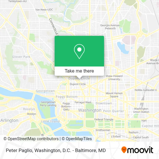
See Peter Paglio, Washington, on the map
Public Transit to Peter Paglio in Washington
Wondering how to get to Peter Paglio in Washington? Moovit helps you find the best way to get to Peter Paglio with step-by-step directions from the nearest public transit station.
Moovit provides free maps and live directions to help you navigate through your city. View schedules, routes, timetables, and find out how long does it take to get to Peter Paglio in real time.
Looking for the nearest stop or station to Peter Paglio? Check out this list of stops closest to your destination: Connecticut Av Nw+N St NW; P St Nw+21 St NW; Massachusetts Av Nw+20 St NW; Washington Dc (Dupont Circle); New Hampshire & Dupont Cir NW Sb; Mcpherson Sq Metro Station; Farragut North - NE Corner Connecticut Ave. &Amp; K St..
Bus: 325, A58, C53, C91, D94, D96, D70, D72, D74, D90, FLIXBUS 2601.Train: MARC.Metro: RED, BLUE, ORANGE, SILVER.
Want to see if there’s another route that gets you there at an earlier time? Moovit helps you find alternative routes or times. Get directions from and directions to Peter Paglio easily from the Moovit App or Website.
We make riding to Peter Paglio easy, which is why over 1.7 million users, including users in Washington, trust Moovit as the best app for public transit. You don’t need to download an individual bus app or train app, Moovit is your all-in-one transit app that helps you find the best bus time or train time available.
For information on prices of metro, bus and train, costs and ride fares to Peter Paglio, please check the Moovit app.
Use the app to navigate to popular places including to the airport, hospital, stadium, grocery store, mall, coffee shop, school, college, and university.
Peter Paglio Address: 11 Dupont Cir NW street in Washington
- Metronando,
- Sean Garganio,
- The Dupont Circle Hotel,
- Association Of Prosecuting Attorneys,
- Real Living | at Home,
- Embassy Of Jamaica,
- Metro Dc Houses,
- Pembroke,
- Placemakr Dupont Circle,
- School For Ethics And Global,
- Oakwood Suites & Studios Dupont Circle Washington Dc,
- Embassy of Botswana,
- One District Therapy,
- Capital Clubhouse Inc.,
- Dc Holiday Market,
- Toni A. Ghazi (The Art of City Living),
- Press Club Cocktail Bar,
- Embassy Of Argentina,
- Consulate of the Republic of Iraq,
- Rakuya
Places Near Peter Paglio (Washington)
- Amazon Hq2, Arlington County,
- PG Mall, Prince George's County,
- Capital One Arena, Washington,
- National Theatre, Washington,
- Westfield Montgomery Mall, Montgomery County,
- Warner Theatre, Washington,
- Museum Of The Bible, Washington,
- National Zoo, Washington,
- Washington DC VA Medical Center, Washington,
- Rock Creek Tennis Center, Washington,
- Georgetown, Washington,
- Marriott Marquis Washington, DC, Washington,
- Camden Yards, Baltimore,
- The Anthem, Washington,
- Pennsylvania Ave NW (3rd st and pennsylvania), Washington,
- Washington National Cathedral, Washington,
- M&T Bank Stadium, Baltimore,
- National Museum of African American History and Culture, Washington,
- Sibley Memorial Hospital, Washington,
- Basilica of the National Shrine, Washington
How to get to popular places in Washington, D.C. - Baltimore, MD with public transit
Get around Washington by public transit!
Traveling around Washington has never been so easy. See step by step directions as you travel to any attraction, street or major public transit station. View bus and train schedules, arrival times, service alerts and detailed routes on a map, so you know exactly how to get to anywhere in Washington.
When traveling to any destination around Washington use Moovit's Live Directions with Get Off Notifications to know exactly where and how far to walk, how long to wait for your line, and how many stops are left. Moovit will alert you when it's time to get off — no need to constantly re-check whether yours is the next stop.
Wondering how to use public transit in Washington or how to pay for public transit in Washington? Moovit public transit app can help you navigate your way with public transit easily, and at minimum cost. It includes public transit fees, ticket prices, and costs. Looking for a map of Washington public transit lines? Moovit public transit app shows all public transit maps in Washington with all Bus, Train, Metro, Light Rail and Ferry routes and stops on an interactive map.
Washington, D.C. - Baltimore, MD has 5 transit type(s), including: Bus, Train, Metro, Light Rail and Ferry, operated by several transit agencies, including WMATA, Montgomery County Ride On, Fairfax Connector, TheBus, PRTC, DASH - Alexandria, Arlington Transit (ART), RTA of Central Maryland, MDOT MTA, MDOT MTA Light RailLink, MDOT MTA Commuter Bus, MDOT MTA Local Bus, FXBGO!, Virginia Railway Express (VRE) and MARC