How to get to Pi Sigma Alpha by bus?
Click on the bus route to see step by step directions with maps, line arrival times and updated time schedules.
From Baileys Crossroads, Fairfax County
68 minFrom Echostage, Washington
58 minFrom I-295 Exit 1 - Naval Research Lab, Washington
91 minFrom Nationals Park, Washington
50 minFrom George H.W. Bush Center For Intelligence (CIA Headquarters), Fairfax County
105 minFrom Eden Center, Falls Church
73 minFrom Nova- Alexandria Campus, Alexandria
87 minFrom National Guard Bureau, Arlington County
61 minFrom Foreign Service Institute, Arlington County
68 minFrom Chevy Chase Metro Plaza, Washington
42 min
How to get to Pi Sigma Alpha by metro?
Click on the metro route to see step by step directions with maps, line arrival times and updated time schedules.
Bus stops near Pi Sigma Alpha in Washington
Metro stations near Pi Sigma Alpha in Washington
Bus lines to Pi Sigma Alpha in Washington
What are the closest stations to Pi Sigma Alpha?
The closest stations to Pi Sigma Alpha are:
- New Hampshire & Dupont Cir NW Sb is 137 yards away, 2 min walk.
- Massachusetts Av Nw+18 St NW is 259 yards away, 4 min walk.
- P St Nw+18 St NW is 319 yards away, 4 min walk.
- P St Nw+20 St NW is 342 yards away, 5 min walk.
- Washington Dc (Dupont Circle) is 409 yards away, 5 min walk.
- 20 St Nw+O St NW is 435 yards away, 6 min walk.
- Massachusetts Av Nw+20 St NW is 480 yards away, 6 min walk.
- Foggy Bottom Gwu Kennedy Center Metro Station is 616 yards away, 8 min walk.
- Dupont Circle - Connecticut Ave. &Amp; Q St. NW is 892 yards away, 11 min walk.
- U Street is 1156 yards away, 14 min walk.
Which bus lines stop near Pi Sigma Alpha?
These bus lines stop near Pi Sigma Alpha: A58, C51, C91, D94, D96.
Which metro line stops near Pi Sigma Alpha?
RED (Shady Grove)
What’s the nearest metro station to Pi Sigma Alpha in Washington?
The nearest metro station to Pi Sigma Alpha in Washington is Foggy Bottom Gwu Kennedy Center Metro Station. It’s a 8 min walk away.
What’s the nearest bus station to Pi Sigma Alpha in Washington?
The nearest bus station to Pi Sigma Alpha in Washington is New Hampshire & Dupont Cir NW Sb. It’s a 2 min walk away.
What time is the first metro to Pi Sigma Alpha in Washington?
The GREEN is the first metro that goes to Pi Sigma Alpha in Washington. It stops nearby at 5:18 AM.
What time is the last metro to Pi Sigma Alpha in Washington?
The GREEN is the last metro that goes to Pi Sigma Alpha in Washington. It stops nearby at 12:23 AM.
What time is the first bus to Pi Sigma Alpha in Washington?
The D94 is the first bus that goes to Pi Sigma Alpha in Washington. It stops nearby at 5:12 AM.
What time is the last bus to Pi Sigma Alpha in Washington?
The FLIXBUS 2601 is the last bus that goes to Pi Sigma Alpha in Washington. It stops nearby at 1:40 AM.
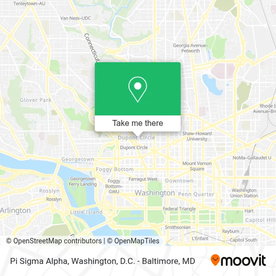
See Pi Sigma Alpha, Washington, on the map
Public Transit to Pi Sigma Alpha in Washington
Wondering how to get to Pi Sigma Alpha in Washington? Moovit helps you find the best way to get to Pi Sigma Alpha with step-by-step directions from the nearest public transit station.
Moovit provides free maps and live directions to help you navigate through your city. View schedules, routes, timetables, and find out how long does it take to get to Pi Sigma Alpha in real time.
Looking for the nearest stop or station to Pi Sigma Alpha? Check out this list of stops closest to your destination: New Hampshire & Dupont Cir NW Sb; Massachusetts Av Nw+18 St NW; P St Nw+18 St NW; P St Nw+20 St NW; Washington Dc (Dupont Circle); 20 St Nw+O St NW; Massachusetts Av Nw+20 St NW; Foggy Bottom Gwu Kennedy Center Metro Station; Dupont Circle - Connecticut Ave. &Amp; Q St. NW; U Street.
Bus: A58, C51, C91, D94, D96, 305, 325, D90.Metro: RED, BLUE, ORANGE, SILVER, GREEN, YELLOW.
Want to see if there’s another route that gets you there at an earlier time? Moovit helps you find alternative routes or times. Get directions from and directions to Pi Sigma Alpha easily from the Moovit App or Website.
We make riding to Pi Sigma Alpha easy, which is why over 1.7 million users, including users in Washington, trust Moovit as the best app for public transit. You don’t need to download an individual bus app or train app, Moovit is your all-in-one transit app that helps you find the best bus time or train time available.
For information on prices of bus and metro, costs and ride fares to Pi Sigma Alpha, please check the Moovit app.
Use the app to navigate to popular places including to the airport, hospital, stadium, grocery store, mall, coffee shop, school, college, and university.
Pi Sigma Alpha Address: 1527 New Hampshire Ave NW street in Washington
- School For Ethics And Global,
- Embassy of Botswana,
- Embassy Of Jamaica,
- Metronando,
- Association Of Prosecuting Attorneys,
- Sean Garganio,
- Real Living | at Home,
- The Phi Beta Kappa Society,
- Embassy Of Argentina,
- The Dupont Circle Hotel,
- Capital Clubhouse Inc.,
- Pembroke,
- Metro Dc Houses,
- Embassy Of Zimbabwe,
- Placemakr Dupont Circle,
- Embassy Of the Republic Of Zimbabwe To the Usa,
- Oakwood Suites & Studios Dupont Circle Washington Dc,
- One District Therapy,
- Euroconsultants Inc,
- The Odeum
Places Near Pi Sigma Alpha (Washington)
- Georgetown, Washington,
- Rock Creek Tennis Center, Washington,
- National Zoo, Washington,
- Washington National Cathedral, Washington,
- The Anthem, Washington,
- Camden Yards, Baltimore,
- Westfield Montgomery Mall, Montgomery County,
- Sibley Memorial Hospital, Washington,
- Basilica of the National Shrine, Washington,
- Marriott Marquis Washington, DC, Washington,
- Amazon Hq2, Arlington County,
- Pennsylvania Ave NW (3rd st and pennsylvania), Washington,
- National Theatre, Washington,
- National Museum of African American History and Culture, Washington,
- M&T Bank Stadium, Baltimore,
- Museum Of The Bible, Washington,
- Capital One Arena, Washington,
- Washington DC VA Medical Center, Washington,
- Warner Theatre, Washington,
- PG Mall, Prince George's County
How to get to popular places in Washington, D.C. - Baltimore, MD with public transit
Get around Washington by public transit!
Traveling around Washington has never been so easy. See step by step directions as you travel to any attraction, street or major public transit station. View bus and train schedules, arrival times, service alerts and detailed routes on a map, so you know exactly how to get to anywhere in Washington.
When traveling to any destination around Washington use Moovit's Live Directions with Get Off Notifications to know exactly where and how far to walk, how long to wait for your line, and how many stops are left. Moovit will alert you when it's time to get off — no need to constantly re-check whether yours is the next stop.
Wondering how to use public transit in Washington or how to pay for public transit in Washington? Moovit public transit app can help you navigate your way with public transit easily, and at minimum cost. It includes public transit fees, ticket prices, and costs. Looking for a map of Washington public transit lines? Moovit public transit app shows all public transit maps in Washington with all Bus, Train, Metro, Light Rail and Ferry routes and stops on an interactive map.
Washington, D.C. - Baltimore, MD has 5 transit type(s), including: Bus, Train, Metro, Light Rail and Ferry, operated by several transit agencies, including WMATA, Montgomery County Ride On, Fairfax Connector, TheBus, PRTC, DASH - Alexandria, Arlington Transit (ART), RTA of Central Maryland, MDOT MTA, MDOT MTA Light RailLink, MDOT MTA Commuter Bus, MDOT MTA Local Bus, FXBGO!, Virginia Railway Express (VRE) and MARC