Directions to Petrobras (Praça Da Bandeira) with public transportation
The following transit lines have routes that pass near Petrobras
 Bus: 110, 220, 302, 415, 432.
- Metro: L1, L4, L2.
- Train: RAMAL DEODORO, RAMAL SANTA CRUZ, RAMAL SARACURUNA, RAMAL JAPERI.
How to get to Petrobras by bus?
Click on the bus route to see step by step directions with maps, line arrival times and updated time schedules.
From Estádio Nilton Santos (Engenhão), Engenho De Dentro
51 minFrom Ônibus Rio Minho ( Niteroi X Nova Iguaçu), Niterói
31 minFrom Policlínica José Paranhos Fontenelle, Penha
43 minFrom Supermercados Guanabara, Niterói
31 minFrom Clube Monte Líbano, Leblon
32 minFrom BRT - Estação Cardoso de Moraes (Viúva Garcia), Ramos
31 minFrom Fashion Mall, São Conrado
34 minFrom Rua Doutor Tavares de Macedo, Niterói
54 minFrom Hospital Piedade/Rj, Piedade
44 minFrom Praia Vermelha, Urca
37 min
How to get to Petrobras by train?
Click on the train route to see step by step directions with maps, line arrival times and updated time schedules.
How to get to Petrobras by metro?
Click on the metro route to see step by step directions with maps, line arrival times and updated time schedules.
Bus stops near Petrobras in Praça Da Bandeira
Metro stations near Petrobras in Praça Da Bandeira
Train station near Petrobras in Praça Da Bandeira
- Praça Da Bandeira, 15 min walk,VIEW
Bus lines to Petrobras in Praça Da Bandeira
- 108C, Caxias ↔ Estácio (Parador),VIEW
- 133, Largo Do Machado,VIEW
- SN 133, Largo Do Machado,VIEW
- 635, Bananal - Saens Peña (Brs 6 - via Linha Vermelha / São Cristóvão),VIEW
- SP 635, BRT Fundão - Saens Peña (Brs 6 - via Linha Vermelha / São Cristóvão),VIEW
- 711, Rocha Miranda - Rio Comprido (Brs 6 - Via Inhaúma / Benfica),VIEW
- 111, LECD134 - Central - Leblon (Brs 1 - via Rebouças / Jardim Botânico),VIEW
- 229, Usina - Castelo / Carioca (Brs 2 - Via Saens Peña),VIEW
- 238, Água Santa - Castelo (Brs 4 - Via Grajaú / Lapa),VIEW
- SN 238, Água Santa - Castelo (Brs 4 - Via Grajaú / Lapa),VIEW
- 239, Água Santa - Passeio (Brs 4 - Via 24 de Maio),VIEW
- 409, Saens Peña - Horto (Brs 2 - Via Lapa),VIEW
- 416, Saens Peña - Horto (Brs 2 - Expresso - Via Túnel Rebouças),VIEW
- 426, Usina - Jardim de Alah (Brs 2 - Via Rio Comprido / Túnel Santa Bárbara),VIEW
- 456, LECD132 - Norte Shopping - Copacabana (Brs 3 - via Vila Isabel / Estácio / Santa Bárbara),VIEW
- 607, Cascadura - Rio Comprido (Brs 6 - Via Estácio),VIEW
- 473, São Januário,VIEW
- 220, Usina - Candelária (Brs 2 - Via Saens Peña / Central),VIEW
- 301, Terminal Gentileza - Terminal Alvorada (Brs 5 - Via Av. das Américas),VIEW
- 302, Terminal Gentileza - Terminal Alvorada (Brs 5 - Via Barrinha / Praia da Barra),VIEW
What are the closest stations to Petrobras?
The closest stations to Petrobras are:
- Rua Do Matoso | Rua Haddock Lobo is 197 meters away, 3 min walk.
- BRS 4 5 6 I - São Vicente is 250 meters away, 4 min walk.
- BRS 1,2,4,6: Paulo De Frontin is 261 meters away, 4 min walk.
- Avenida Paulo De Frontin, 125 is 287 meters away, 4 min walk.
- BRS 2 4 5 - Barão De Ubá is 292 meters away, 4 min walk.
- Estácio is 541 meters away, 8 min walk.
- Cidade Nova is 963 meters away, 13 min walk.
- Praça Da Bandeira is 1111 meters away, 15 min walk.
Which bus lines stop near Petrobras?
These bus lines stop near Petrobras: 110, 220, 302, 415, 432, 433, 634, 750D.
Which metro line stops near Petrobras?
L1, L4 (Uruguai)
Which train lines stop near Petrobras?
These train lines stop near Petrobras: RAMAL DEODORO, RAMAL SANTA CRUZ, RAMAL SARACURUNA.
What’s the nearest metro station to Petrobras in Praça Da Bandeira?
The nearest metro station to Petrobras in Praça Da Bandeira is Estácio. It’s a 8 min walk away.
What’s the nearest train station to Petrobras in Praça Da Bandeira?
The nearest train station to Petrobras in Praça Da Bandeira is Praça Da Bandeira. It’s a 15 min walk away.
What’s the nearest bus station to Petrobras in Praça Da Bandeira?
The nearest bus station to Petrobras in Praça Da Bandeira is Rua Do Matoso | Rua Haddock Lobo. It’s a 3 min walk away.
What time is the first metro to Petrobras in Praça Da Bandeira?
The L1, L4 is the first metro that goes to Petrobras in Praça Da Bandeira. It stops nearby at 5:05 AM.
What time is the last metro to Petrobras in Praça Da Bandeira?
The L1, L4 is the last metro that goes to Petrobras in Praça Da Bandeira. It stops nearby at 12:37 AM.
What time is the first train to Petrobras in Praça Da Bandeira?
The RAMAL DEODORO is the first train that goes to Petrobras in Praça Da Bandeira. It stops nearby at 4:11 AM.
What time is the last train to Petrobras in Praça Da Bandeira?
The RAMAL SANTA CRUZ is the last train that goes to Petrobras in Praça Da Bandeira. It stops nearby at 11:57 PM.
What time is the first bus to Petrobras in Praça Da Bandeira?
The SN 238 is the first bus that goes to Petrobras in Praça Da Bandeira. It stops nearby at 3:10 AM.
What time is the last bus to Petrobras in Praça Da Bandeira?
The SN 634 is the last bus that goes to Petrobras in Praça Da Bandeira. It stops nearby at 3:47 AM.
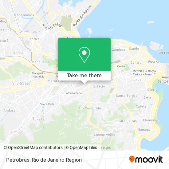
See Petrobras, Praça Da Bandeira, on the map
Public Transit to Petrobras in Praça Da Bandeira
Wondering how to get to Petrobras in Praça Da Bandeira? Moovit helps you find the best way to get to Petrobras with step-by-step directions from the nearest public transit station.
Moovit provides free maps and live directions to help you navigate through your city. View schedules, routes, timetables, and find out how long does it take to get to Petrobras in real time.
Looking for the nearest stop or station to Petrobras? Check out this list of stops closest to your destination: Rua Do Matoso | Rua Haddock Lobo; BRS 4 5 6 I - São Vicente; BRS 1,2,4,6: Paulo De Frontin; Avenida Paulo De Frontin; BRS 2 4 5 - Barão De Ubá; Estácio; Cidade Nova; Praça Da Bandeira.
Bus: 110, 220, 302, 415, 432, 433, 634, 750D, 108C, 133, SN 133, 635, SP 635, 711, 111, 229, 238, SN 238, 239.Metro: L1, L4, L2.Train: RAMAL DEODORO, RAMAL SANTA CRUZ, RAMAL SARACURUNA, RAMAL JAPERI.
Want to see if there’s another route that gets you there at an earlier time? Moovit helps you find alternative routes or times. Get directions from and directions to Petrobras easily from the Moovit App or Website.
We make riding to Petrobras easy, which is why over 1.5 million users, including users in Praça Da Bandeira, trust Moovit as the best app for public transit. You don’t need to download an individual bus app or train app, Moovit is your all-in-one transit app that helps you find the best bus time or train time available.
For information on prices of bus, train and metro, costs and ride fares to Petrobras, please check the Moovit app.
Use the app to navigate to popular places including to the airport, hospital, stadium, grocery store, mall, coffee shop, school, college, and university.
Petrobras Address: Rua Santa Amélia street in Praça Da Bandeira
- Central dos Aquecedores,
- Rua Santa Amélia, 50,
- AABB Tijuca - Kung Fu Garra De Águia,
- Rua Doutor Satamini / Rua João Paulo I,
- Rua Barão de Ubá / Rua João Paulo I,
- Rua do Matoso / Rua Doutor Satamini,
- Tenda Espírita Pai Jerônimo,
- Rua do Matoso,
- Brs 1, 4, 5, 6, I - Barão de Ubá,
- Grau Técnico Tijuca,
- Rua do Matoso 132,
- Casa Das Beiras,
- Rua Barão de Ubá 399,
- Colégio Estadual Paulo de Frontin,
- Matosão,
- Escola Municipal Azevedo Sodré,
- Praça Da Medalha Milagrosa,
- Ponto de Onibus - 303, 304 e 345,
- boteco do peixe,
- 18 DP
Places Near Petrobras (Praça Da Bandeira)
- Norte Shopping, Cachambi,
- Museu Do Amanhã, Centro,
- Rio De Janeiro,
- Shopping RioSul, Botafogo,
- Hospital Federal Cardoso Fontes, Jacarepaguá,
- Shopping Downtown, Barra Da Tijuca,
- Rua Licínio Cardoso, São Francisco Xavier,
- Avenida Rio Branco, Centro,
- Rodoviária Novo Rio (Rodoviária do Rio de Janeiro), Santo Cristo,
- Feirão De Malhas, Duque De Caxias,
- Shopping Nova América, Del Castilho,
- Feira Livre da Gloria, Glória,
- Rua Ulysses Guimarães 16, Cidade Nova,
- Avenida Venezuela 134, Saúde,
- Shopping Rio Sul, Botafogo,
- Praia do Arpoador, Ipanema,
- Hospital Pedro Ernesto, Vila Isabel,
- Hospital Federal Do Andaraí, Andaraí,
- Hospital Municipal Ronaldo Gazolla, Acari,
- Niterói, Niterói
How to get to popular places in Rio de Janeiro Region with public transit
Get around Praça Da Bandeira by public transit!
Traveling around Praça Da Bandeira has never been so easy. See step by step directions as you travel to any attraction, street or major public transit station. View bus and train schedules, arrival times, service alerts and detailed routes on a map, so you know exactly how to get to anywhere in Praça Da Bandeira.
When traveling to any destination around Praça Da Bandeira use Moovit's Live Directions with Get Off Notifications to know exactly where and how far to walk, how long to wait for your line, and how many stops are left. Moovit will alert you when it's time to get off — no need to constantly re-check whether yours is the next stop.
Wondering how to use public transit in Praça Da Bandeira or how to pay for public transit in Praça Da Bandeira? Moovit public transit app can help you navigate your way with public transit easily, and at minimum cost. It includes public transit fees, ticket prices, and costs. Looking for a map of Praça Da Bandeira public transit lines? Moovit public transit app shows all public transit maps in Praça Da Bandeira with all Bus, Train, Metro, Light Rail, Ferry, Cable Car, Gondola and Funicular routes and stops on an interactive map.
Rio de Janeiro Region has 8 transit type(s), including: Bus, Train, Metro, Light Rail, Ferry, Cable Car, Gondola and Funicular, operated by several transit agencies, including TrensRJ, Metrô Rio, VLT Carioca, Barcas Rio, BRT MOBI-Rio, Auto Viação Alpha, Auto Viação Tijuca, Gire Transportes, Transurb, Viação Nossa Senhora das Graças, Consórcio INTERSUL, Braso Lisboa (Municipal), Caprichosa Auto Ônibus, Auto Viação Três Amigos and Rodoviária Âncora Matias