See Phú Nhuận on the map
Directions to Phú Nhuận with public transportation
The following transit lines have routes that pass near Phú Nhuận
 Bus:
Bus: - Train:
- Ferry:
How to get to Phú Nhuận by bus?
Click on the bus route to see step by step directions with maps, line arrival times and updated time schedules.
Bus stations near Phú Nhuận
- Nhà Truyền Thông,3 min walk,
- Ngã Tư Phú Nhuận,8 min walk,
- Tháp Nước,9 min walk,
Ferry stations near Phú Nhuận
- Bến Tàu Khách Cao Tốc Bạch Đằng,13 min walk,
Train stations near Phú Nhuận
- Ga Sài Gòn,37 min walk,
Bus lines to Phú Nhuận
- 03,Thạnh Xuân,
- 55,Bến Xe Buýt Công Viên Phần Mềm Quang Trung,
- 08,Bến Xe Buýt Đh Quốc Gia Tphcm (Mới),
- 104,Bến Xe An Sương,
- 60-7,Bến Xe Buýt Tân Phú,
- 64,Bến Xe Miền Đông,
- 60-7,Bến Xe Biên Hòa,
- 07,Bến Xe Buýt Chợ Lớn,
What are the closest stations to Phú Nhuận?
The closest stations to Phú Nhuận are:
- Nhà Truyền Thông is 161 meters away, 3 min walk.
- Ngã Tư Phú Nhuận is 588 meters away, 8 min walk.
- Tháp Nước is 650 meters away, 9 min walk.
- Bến Tàu Khách Cao Tốc Bạch Đằng is 1012 meters away, 13 min walk.
- Ga Sài Gòn is 2796 meters away, 37 min walk.
Which bus lines stop near Phú Nhuận?
These bus lines stop near Phú Nhuận: 03, 55.
What’s the nearest bus stop to Phú Nhuận?
The nearest bus stop to Phú Nhuận is Nhà Truyền Thông. It’s a 3 min walk away.
What’s the nearest ferry station to Phú Nhuận?
The nearest ferry station to Phú Nhuận is Bến Tàu Khách Cao Tốc Bạch Đằng. It’s a 13 min walk away.
What time is the first train to Phú Nhuận?
The SE8 is the first train that goes to Phú Nhuận. It stops nearby at 6:00 AM.
What time is the last train to Phú Nhuận?
The SE1 is the last train that goes to Phú Nhuận. It stops nearby at 4:31 PM.
What time is the first bus to Phú Nhuận?
The 03 is the first bus that goes to Phú Nhuận. It stops nearby at 4:28 AM.
What time is the last bus to Phú Nhuận?
The 08 is the last bus that goes to Phú Nhuận. It stops nearby at 9:14 PM.
What time is the first ferry to Phú Nhuận?
The TP.HỒ CHÍ MINH – VŨNG TÀU is the first ferry that goes to Phú Nhuận. It stops nearby at 8:00 AM.
What time is the last ferry to Phú Nhuận?
The SWB1 is the last ferry that goes to Phú Nhuận. It stops nearby at 6:57 PM.
See Phú Nhuận on the map
Public Transportation to Phú Nhuận
Wondering how to get to Phú Nhuận, Vietnam? Moovit helps you find the best way to get to Phú Nhuận with step-by-step directions from the nearest public transit station.
Moovit provides free maps and live directions to help you navigate through your city. View schedules, routes, timetables, and find out how long does it take to get to Phú Nhuận in real time.
Looking for the nearest stop or station to Phú Nhuận? Check out this list of stops closest to your destination: Nhà Truyền Thông; Ngã Tư Phú Nhuận; Tháp Nước; Bến Tàu Khách Cao Tốc Bạch Đằng; Ga Sài Gòn.
Bus:Train:Ferry:
Want to see if there’s another route that gets you there at an earlier time? Moovit helps you find alternative routes or times. Get directions from and directions to Phú Nhuận easily from the Moovit App or Website.
We make riding to Phú Nhuận easy, which is why over 1.5 million users, including users in Phú Nhuận, trust Moovit as the best app for public transit. You don’t need to download an individual bus app or train app, Moovit is your all-in-one transit app that helps you find the best bus time or train time available.
For information on prices of bus, costs and ride fares to Phú Nhuận, please check the Moovit app.
Use the app to navigate to popular places including to the airport, hospital, stadium, grocery store, mall, coffee shop, school, college, and university.
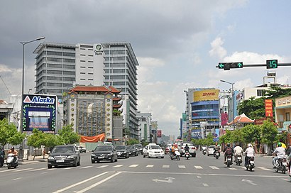
Phú Nhuận Address: 30B1, Đường Nguyễn Kiệm, Phường 05, Quận Phú Nhuận, Phường 9, Phú Nhuận, Hồ Chí Minh, Việt Nam street in Phú Nhuận
Attractions near Phú Nhuận
Nguyễn Kiệm 485,Shop Quỳnh Anh,Công Ty TNHH Thiết Kế Xây Dựng Luci,Phương Uyên,Wico,Công Ty TNHH MTV DV In Ngọc Sơn,Nha Khoa Khương,Phòng Khám Răng Nha Sĩ Khương,Phòng Tranh Art Gallery,Công Ty Sản Xuất-Thương Mại-Dịch Vụ Cây Cọ Vàng,Nhà Sách Fahasa,Cháo Trắng Ngọc Liên,Shop Hoa Tươi Violet,Lò Bánh Mì Điện Vũ Hải,Phòng Tranh Ngọc Tín,Tiệm Photocopy Mỹ Lệ,Lộc Uyển Fitness & Yoga,Bánh Bò Thốt Nốt Nguyễn Sơn,Trường Trung Cấp Nghề Tư Thục DL Khôi Việt,Cty Khai Nguyên TNHH Thương Mại Dịch VụHow to get to popular attractions in Phú Nhuận with public transit
Co.Opmart Xa Lộ Hà Nội, Quận 9,Trường Đại Học Sài Gòn, Quận 5,Bệnh Viện Phạm Ngọc Thạch, Quận 5,Hiệp Hội Thương Mại Đài Loan, Quận 8,Công Viên Phú Lâm, Quận 6,Thpt Thủ Đức, Thủ Đức,Nhà Thờ Đồng Tiến, Quận 10,Vu Anh International Hospital, Gò Vấp,Colusa Miliket JSC, Thủ Đức,Viva Star Coffee, Quận 10,Vườn Ẩm Thực Bến Xưa, Quận 12,Bảo Tàng Chứng Tích Chiến Tranh, Quận 3,Aeon Mall Tân Phú, Tan Phu,4S Riverside, Thủ Đức,Trạm Thu Phí Xa Lộ Hà Nội, Quận 9,Nhà Thờ Thủ Đức, Thủ Đức,Đường Phạm Huy Thông, Gò Vấp,Trường Thpt Nguyễn Thị Minh Khai, Quận 3,Bệnh Viện Nguyễn Tri Phương, Quận 5,Rmit University Vietnam - Saigon South Campus, Quận 7Get around Phú Nhuận by public transit!
Traveling around Phú Nhuận has never been so easy. See step by step directions as you travel to any attraction, street or major public transit station. View bus and train schedules, arrival times, service alerts and detailed routes on a map, so you know exactly how to get to anywhere in Phú Nhuận.
When traveling to any destination around Phú Nhuận use Moovit's Live Directions with Get Off Notifications to know exactly where and how far to walk, how long to wait for your line, and how many stops are left. Moovit will alert you when it's time to get off — no need to constantly re-check whether yours is the next stop.
Wondering how to use public transit in Phú Nhuận or how to pay for public transit in Phú Nhuận? Moovit public transit app can help you navigate your way with public transit easily, and at minimum cost. It includes public transit fees, ticket prices, and costs. Looking for a map of Phú Nhuận public transit lines? Moovit public transit app shows all public transit maps in Phú Nhuận with all bus routes and stops on an interactive map.
Phú Nhuận has 1 transit type(s), including: bus, operated by several transit agencies, including MAUR - Metro Thành phố Hồ Chí Minh, Saigon Railway – Vận tải Đường sắt Sài Gòn, Buýt Thành phố Hồ Chí Minh - Buyttphcm, Xe buýt Đồng Nai, VinBus Phú Quốc, Xe buýt Bình Dương, Xe buýt Cần Thơ (Futabuslines), Xe Khách (Passenger Service Buses), Xe buýt Bình Phước, VinBus Hồ Chí Minh, Xe buýt Vũng Tàu, Tàu phà ra Phú Quốc (Ferries from mainland to PQ), Tàu phà từ đất liền ra Côn Đảo (Ferries from mainland to CĐ), Xí nghiệp Quản lý phà Thanh niên xung phong and Saigon Waterbus