How to get to Phdelivery by bus?
Click on the bus route to see step by step directions with maps, line arrival times and updated time schedules.
From Aeroporto Galeão, Galeão
56 minFrom Estrada Dos Tres Rios, Freguesia (Jacarepaguá)
58 minFrom Hospital Estadual Da Mãe, Mesquita
56 minFrom Rua Araguaia, Freguesia (Jacarepaguá)
57 minFrom Cemitério Jardim Da Saudade, Jardim Sulacap
53 minFrom Policlínica Rodolpho Rocco, Inhaúma
53 minFrom Hospital Geral De Bonsucesso/Rj, Bonsucesso
52 minFrom Estádio Olímpico Nilton Santos (Estádio Nilton Santos (Engenhão)), Engenho De Dentro
48 minFrom Ponto de ônibus - Passarela 10 - Av. Brasil, Maré
53 minFrom Linha 915 - Bonsucesso / Aeroporto Internacional do Rio de Janeiro, Maré
53 min
How to get to Phdelivery by train?
Click on the train route to see step by step directions with maps, line arrival times and updated time schedules.
How to get to Phdelivery by metro?
Click on the metro route to see step by step directions with maps, line arrival times and updated time schedules.
Bus stops near Phdelivery in Colégio
Metro station near Phdelivery in Colégio
- Colégio, 16 min walk,VIEW
Train station near Phdelivery in Colégio
- Rocha Miranda, 20 min walk,VIEW
Bus lines to Phdelivery in Colégio
- 298, Castelo (Desvio Na Pça. Da Cruz Vermelha),VIEW
- SN 298, Castelo,VIEW
- 551, Nova Iguaçu,VIEW
- 562, Pau-Ferro,VIEW
- 563, Caxias,VIEW
- 569, Madureira,VIEW
- 639, Jardim América,VIEW
- SN 639, Jardim América,VIEW
- 711, Rio Comprido,VIEW
- 734L, Vila Norma / Cosmorama,VIEW
- 736L, Jardim Botânico,VIEW
- 737, Cascadura,VIEW
- 926, Penha,VIEW
- 349, Castelo,VIEW
- 738L, Cascadura,VIEW
- 785, Marechal Hermes,VIEW
What are the closest stations to Phdelivery?
The closest stations to Phdelivery are:
- Estrada Do Barro Vermelho, 1143 is 443 meters away, 6 min walk.
- Estrada Do Barro Vermelho, 864 is 486 meters away, 7 min walk.
- Rua Lageado, 65 is 555 meters away, 8 min walk.
- Colégio is 1201 meters away, 16 min walk.
- Rocha Miranda is 1518 meters away, 20 min walk.
Which bus lines stop near Phdelivery?
These bus lines stop near Phdelivery: 551, 562, 569, 639, 711, 734L, 736L.
Which metro line stops near Phdelivery?
L2 (Pavuna)
Which train line stops near Phdelivery?
RAMAL BELFORD ROXO (Belford Roxo)
What’s the nearest metro station to Phdelivery in Colégio?
The nearest metro station to Phdelivery in Colégio is Colégio. It’s a 16 min walk away.
What’s the nearest train station to Phdelivery in Colégio?
The nearest train station to Phdelivery in Colégio is Rocha Miranda. It’s a 20 min walk away.
What’s the nearest bus station to Phdelivery in Colégio?
The nearest bus station to Phdelivery in Colégio is Estrada Do Barro Vermelho, 1143. It’s a 6 min walk away.
What time is the first metro to Phdelivery in Colégio?
The L2 is the first metro that goes to Phdelivery in Colégio. It stops nearby at 5:05 AM.
What time is the last metro to Phdelivery in Colégio?
The L2 is the last metro that goes to Phdelivery in Colégio. It stops nearby at 12:45 AM.
What time is the first train to Phdelivery in Colégio?
The RAMAL BELFORD ROXO is the first train that goes to Phdelivery in Colégio. It stops nearby at 5:03 AM.
What time is the last train to Phdelivery in Colégio?
The RAMAL BELFORD ROXO is the last train that goes to Phdelivery in Colégio. It stops nearby at 10:05 PM.
What time is the first bus to Phdelivery in Colégio?
The SN 298 is the first bus that goes to Phdelivery in Colégio. It stops nearby at 3:00 AM.
What time is the last bus to Phdelivery in Colégio?
The SN 639 is the last bus that goes to Phdelivery in Colégio. It stops nearby at 3:28 AM.
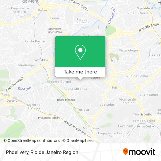
See Phdelivery, Colégio, on the map
Public Transit to Phdelivery in Colégio
Wondering how to get to Phdelivery in Colégio? Moovit helps you find the best way to get to Phdelivery with step-by-step directions from the nearest public transit station.
Moovit provides free maps and live directions to help you navigate through your city. View schedules, routes, timetables, and find out how long does it take to get to Phdelivery in real time.
Looking for the nearest stop or station to Phdelivery? Check out this list of stops closest to your destination: Estrada Do Barro Vermelho; Estrada Do Barro Vermelho; Rua Lageado; Colégio; Rocha Miranda.
Bus: 551, 562, 569, 639, 711, 734L, 736L, 298, SN 298, 563, 349, 738L, 785.Metro: L2.Train: RAMAL BELFORD ROXO.
Want to see if there’s another route that gets you there at an earlier time? Moovit helps you find alternative routes or times. Get directions from and directions to Phdelivery easily from the Moovit App or Website.
We make riding to Phdelivery easy, which is why over 1.5 million users, including users in Colégio, trust Moovit as the best app for public transit. You don’t need to download an individual bus app or train app, Moovit is your all-in-one transit app that helps you find the best bus time or train time available.
For information on prices of bus, train and metro, costs and ride fares to Phdelivery, please check the Moovit app.
Use the app to navigate to popular places including to the airport, hospital, stadium, grocery store, mall, coffee shop, school, college, and university.
Phdelivery Address: Rua Juruce, 631 Colégio Rio de Janeiro-RJ 21545-170 street in Colégio
- D Avila Geladu S Sorvete Acai e Picole,
- Rua Juruce,
- escola Luis de Camoes,
- Caldos da Deia,
- Rua Juruce 713,
- Bombeirinho,
- Rua Faia, 553,
- Eliane S Almeida Costureira,
- Ana Paula do Nascimento,
- Bitencourt Style Store,
- Espaco Bela Moca Esmalteria,
- Rua Jace,
- Escola Municipal Francisco Frias De Mesquita,
- Assembleia de Deus de Cordovil,
- Rua Coema, 103,
- Rua Caiuá,
- Mercearia Penylane,
- rua jacê,
- Rua Itaperoa,
- Ponto 639 Barro Vermelho
Places Near Phdelivery (Colégio)
- Shopping Downtown, Barra Da Tijuca,
- Shopping Nova América, Del Castilho,
- Shopping Rio Sul, Botafogo,
- Niterói, Niterói,
- Feira Livre da Gloria, Glória,
- Norte Shopping, Cachambi,
- Rua Ulysses Guimarães 16, Cidade Nova,
- Hospital Pedro Ernesto, Vila Isabel,
- Avenida Venezuela 134, Saúde,
- Rodoviária Novo Rio (Rodoviária do Rio de Janeiro), Santo Cristo,
- Feirão De Malhas, Duque De Caxias,
- Praia do Arpoador, Ipanema,
- Hospital Federal Cardoso Fontes, Jacarepaguá,
- Museu Do Amanhã, Centro,
- Avenida Rio Branco, Centro,
- Hospital Federal Do Andaraí, Andaraí,
- Shopping RioSul, Botafogo,
- Rua Licínio Cardoso, São Francisco Xavier,
- Rio De Janeiro,
- Hospital Municipal Ronaldo Gazolla, Acari
How to get to popular places in Rio de Janeiro Region with public transit
Get around Colégio by public transit!
Traveling around Colégio has never been so easy. See step by step directions as you travel to any attraction, street or major public transit station. View bus and train schedules, arrival times, service alerts and detailed routes on a map, so you know exactly how to get to anywhere in Colégio.
When traveling to any destination around Colégio use Moovit's Live Directions with Get Off Notifications to know exactly where and how far to walk, how long to wait for your line, and how many stops are left. Moovit will alert you when it's time to get off — no need to constantly re-check whether yours is the next stop.
Wondering how to use public transit in Colégio or how to pay for public transit in Colégio? Moovit public transit app can help you navigate your way with public transit easily, and at minimum cost. It includes public transit fees, ticket prices, and costs. Looking for a map of Colégio public transit lines? Moovit public transit app shows all public transit maps in Colégio with all Bus, Train, Metro, Light Rail, Ferry, Cable Car, Gondola and Funicular routes and stops on an interactive map.
Rio de Janeiro Region has 8 transit type(s), including: Bus, Train, Metro, Light Rail, Ferry, Cable Car, Gondola and Funicular, operated by several transit agencies, including TrensRJ, Metrô Rio, VLT Carioca, Barcas Rio, BRT MOBI-Rio, Auto Viação Alpha, Auto Viação Tijuca, Gire Transportes, Transurb, Viação Nossa Senhora das Graças, Consórcio INTERSUL, Braso Lisboa (Municipal), Caprichosa Auto Ônibus, Auto Viação Três Amigos and Rodoviária Âncora Matias