Directions to Philip M Robitaille, D.D.S. & Associates (Somerset) with public transportation
The following transit lines have routes that pass near Philip M Robitaille, D.D.S. & Associates
 Bus: 114.
- Train: FALL RIVER/NEW BEDFORD.
How to get to Philip M Robitaille, D.D.S. & Associates by bus?
Click on the bus route to see step by step directions with maps, line arrival times and updated time schedules.
From Bedford Industrial Park, New Bedford
192 minFrom Barahona Express, Providence
160 minFrom RMV New Bedford, New Bedford
193 minFrom Providence Amtrak Station, Providence
133 minFrom Bristol Community College, Fall River
53 minFrom Lizzy Borden House, Fall River
57 minFrom Walmart Fall River Supercenter, Fall River
77 min
Train station near Philip M Robitaille, D.D.S. & Associates in Somerset
- Fall River Depot, 40 min walk,VIEW
What are the closest stations to Philip M Robitaille, D.D.S. & Associates?
The closest stations to Philip M Robitaille, D.D.S. & Associates are:
- Fall River Depot is 3376 yards away, 40 min walk.
Which bus line stops near Philip M Robitaille, D.D.S. & Associates?
114 (Swansea Via Route 6)
What time is the first train to Philip M Robitaille, D.D.S. & Associates in Somerset?
The FALL RIVER/NEW BEDFORD is the first train that goes to Philip M Robitaille, D.D.S. & Associates in Somerset. It stops nearby at 5:00 AM.
What time is the last train to Philip M Robitaille, D.D.S. & Associates in Somerset?
The FALL RIVER/NEW BEDFORD is the last train that goes to Philip M Robitaille, D.D.S. & Associates in Somerset. It stops nearby at 12:14 AM.
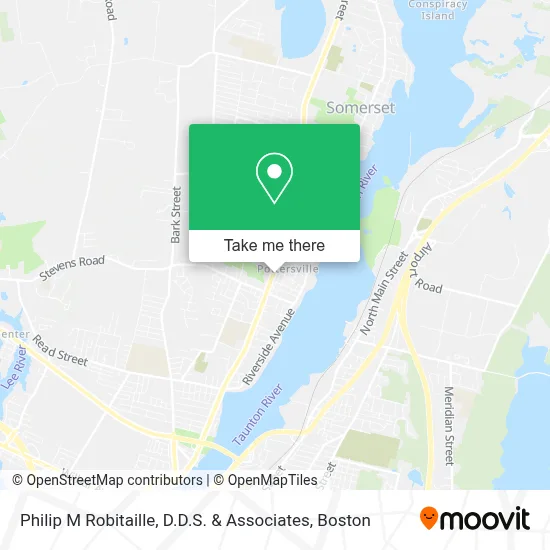
See Philip M Robitaille, D.D.S. & Associates, Somerset, on the map
Public Transit to Philip M Robitaille, D.D.S. & Associates in Somerset
Wondering how to get to Philip M Robitaille, D.D.S. & Associates in Somerset? Moovit helps you find the best way to get to Philip M Robitaille, D.D.S. & Associates with step-by-step directions from the nearest public transit station.
Moovit provides free maps and live directions to help you navigate through your city. View schedules, routes, timetables, and find out how long does it take to get to Philip M Robitaille, D.D.S. & Associates in real time.
Looking for the nearest stop or station to Philip M Robitaille, D.D.S. & Associates? Check out this list of stops closest to your destination: Fall River Depot.
Bus: 114.Train: FALL RIVER/NEW BEDFORD.
Want to see if there’s another route that gets you there at an earlier time? Moovit helps you find alternative routes or times. Get directions from and directions to Philip M Robitaille, D.D.S. & Associates easily from the Moovit App or Website.
We make riding to Philip M Robitaille, D.D.S. & Associates easy, which is why over 1.7 million users, including users in Somerset, trust Moovit as the best app for public transit. You don’t need to download an individual bus app or train app, Moovit is your all-in-one transit app that helps you find the best bus time or train time available.
For information on prices of bus, costs and ride fares to Philip M Robitaille, D.D.S. & Associates, please check the Moovit app.
Use the app to navigate to popular places including to the airport, hospital, stadium, grocery store, mall, coffee shop, school, college, and university.
Philip M Robitaille, D.D.S. & Associates Address: 1188 County St street in Somerset
- Brayton House,
- Bay State Aluminum Center,
- Camara S Cafe,
- Philip M Robitaille DDS,
- Asian Platter,
- Nicole's Hair Design,
- Domino's Pizza,
- George B Lockhart Insurance,
- Mr Carl's,
- Til Lu Inc,
- Hartleys Pork Pies Somerset,
- Cut N Shoppe,
- Lafayette Federal Savings Bank,
- Erick's Son Plumbing & Heating,
- Hair Fashions By Carolyn,
- Waveone Technologies,
- Subway,
- Norwest Automotive Inc,
- Farmland Foods,
- Somerset, Massachusetts
Places Near Philip M Robitaille, D.D.S. & Associates (Somerset)
- Boston Medical Center, Boston,
- Leader Bank Pavilion (Leader Bank Pavillion), Boston,
- House Of Blues, Boston,
- Mgm Music Hall, Boston,
- Museum Of Science, Boston,
- Castle Island, Boston,
- Boston Convention & Exhibition Center, Boston,
- Isabella Stewart Gardner Museum, Boston,
- Td Garden, Boston,
- Wang Theater, Boston,
- Massachusetts General Hospital, Boston,
- Quincy Market, Boston,
- Boston Common, Boston,
- North End, Boston,
- Wilbur Theatre, Boston,
- Seaport District, Boston,
- Cheers, Boston,
- Faneuil Hall, Boston,
- Boston Children's Hospital, Boston,
- Prudential Center, Boston
How to get to popular places in Boston with public transit
Get around Somerset by public transit!
Traveling around Somerset has never been so easy. See step by step directions as you travel to any attraction, street or major public transit station. View bus and train schedules, arrival times, service alerts and detailed routes on a map, so you know exactly how to get to anywhere in Somerset.
When traveling to any destination around Somerset use Moovit's Live Directions with Get Off Notifications to know exactly where and how far to walk, how long to wait for your line, and how many stops are left. Moovit will alert you when it's time to get off — no need to constantly re-check whether yours is the next stop.
Wondering how to use public transit in Somerset or how to pay for public transit in Somerset? Moovit public transit app can help you navigate your way with public transit easily, and at minimum cost. It includes public transit fees, ticket prices, and costs. Looking for a map of Somerset public transit lines? Moovit public transit app shows all public transit maps in Somerset with all Bus, Train, Subway and Ferry routes and stops on an interactive map.
Boston has 4 transit type(s), including: Bus, Train, Subway and Ferry, operated by several transit agencies, including MBTA, Southeastern Regional Transit Authority, MetroWest Regional Transit Authority, Rhode Island Public Transit Authority, WRTA, Lowell Regional Transit Authority, Merrimack Valley Transit, Montachusett Regional Transit Authority, Cape Cod Regional Transit Authority, Brockton Area Transit Authority, Martha's Vineyard Transit Authority, the WAVE - Nantucket Regional Transit Authority, GATRA, Cape Ann Transportation Authority and Massport