Directions to Phillips (Malden) with public transportation
The following transit lines have routes that pass near Phillips
 Bus: 101, 104, 105, 131, 137.
- Train: HAVERHILL, ORANGE LINE, NEWBURYPORT/ROCKPORT.
- Subway: ORANGE LINE.
How to get to Phillips by bus?
Click on the bus route to see step by step directions with maps, line arrival times and updated time schedules.
From Residence Inn by Marriott Boston Back Bay/Fenway, Boston
79 minFrom Nordstrom Rack, Boston
84 minFrom Canopy-Boston, Boston
57 minFrom Regina Pizzeria, Boston
84 minFrom Harvard Museum Of Natural History, Cambridge
58 minFrom Boston University Track and Tennis Center, Boston
82 minFrom SoWa Open Market, Boston
93 minFrom Long Wharf Station, Boston
63 minFrom Aloft-Boston Seaport Dist, Boston
80 minFrom Harvard Vanguard - Kenmore, Boston
76 min
How to get to Phillips by train?
Click on the train route to see step by step directions with maps, line arrival times and updated time schedules.
How to get to Phillips by subway?
Click on the subway route to see step by step directions with maps, line arrival times and updated time schedules.
From Residence Inn by Marriott Boston Back Bay/Fenway, Boston
60 minFrom Nordstrom Rack, Boston
42 minFrom Canopy-Boston, Boston
31 minFrom Regina Pizzeria, Boston
73 minFrom Harvard Museum Of Natural History, Cambridge
56 minFrom Boston University Track and Tennis Center, Boston
70 minFrom SoWa Open Market, Boston
45 minFrom Long Wharf Station, Boston
37 minFrom Aloft-Boston Seaport Dist, Boston
56 minFrom Harvard Vanguard - Kenmore, Boston
59 min
Bus stops near Phillips in Malden
Bus lines to Phillips in Malden
What are the closest stations to Phillips?
The closest stations to Phillips are:
- Main St @ Clifton St is 48 yards away, 1 min walk.
- Main St @ Salem St is 448 yards away, 6 min walk.
- Washington St @ Clifton St is 464 yards away, 6 min walk.
- Oak Grove is 717 yards away, 9 min walk.
- Chelsea is 749 yards away, 12 min walk.
Which bus lines stop near Phillips?
These bus lines stop near Phillips: 101, 104, 105, 131, 137.
Which train line stops near Phillips?
HAVERHILL (#229 | Haverhill)
Which subway line stops near Phillips?
ORANGE LINE (Oak Grove)
What’s the nearest train station to Phillips in Malden?
The nearest train station to Phillips in Malden is Oak Grove. It’s a 9 min walk away.
What’s the nearest bus station to Phillips in Malden?
The nearest bus station to Phillips in Malden is Main St @ Clifton St. It’s a 1 min walk away.
What time is the first subway to Phillips in Malden?
The ORANGE LINE is the first subway that goes to Phillips in Malden. It stops nearby at 5:15 AM.
What time is the last subway to Phillips in Malden?
The ORANGE LINE is the last subway that goes to Phillips in Malden. It stops nearby at 1:59 AM.
What time is the first train to Phillips in Malden?
The HAVERHILL is the first train that goes to Phillips in Malden. It stops nearby at 5:35 AM.
What time is the last train to Phillips in Malden?
The NEWBURYPORT/ROCKPORT is the last train that goes to Phillips in Malden. It stops nearby at 12:06 AM.
What time is the first bus to Phillips in Malden?
The 137 is the first bus that goes to Phillips in Malden. It stops nearby at 4:52 AM.
What time is the last bus to Phillips in Malden?
The 99 is the last bus that goes to Phillips in Malden. It stops nearby at 1:36 AM.
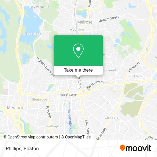
See Phillips, Malden, on the map
Public Transit to Phillips in Malden
Wondering how to get to Phillips in Malden? Moovit helps you find the best way to get to Phillips with step-by-step directions from the nearest public transit station.
Moovit provides free maps and live directions to help you navigate through your city. View schedules, routes, timetables, and find out how long does it take to get to Phillips in real time.
Looking for the nearest stop or station to Phillips? Check out this list of stops closest to your destination: Main St @ Clifton St; Main St @ Salem St; Washington St @ Clifton St; Oak Grove; Chelsea.
Bus: 101, 104, 105, 131, 137, 99, 132.Train: HAVERHILL, ORANGE LINE, NEWBURYPORT/ROCKPORT.Subway: ORANGE LINE.
Want to see if there’s another route that gets you there at an earlier time? Moovit helps you find alternative routes or times. Get directions from and directions to Phillips easily from the Moovit App or Website.
We make riding to Phillips easy, which is why over 1.7 million users, including users in Malden, trust Moovit as the best app for public transit. You don’t need to download an individual bus app or train app, Moovit is your all-in-one transit app that helps you find the best bus time or train time available.
For information on prices of bus, subway and train, costs and ride fares to Phillips, please check the Moovit app.
Use the app to navigate to popular places including to the airport, hospital, stadium, grocery store, mall, coffee shop, school, college, and university.
Phillips Address: 728 Main St street in Malden
- Pawsture Perfect K9,
- Malden Housing Authority,
- Massachusetts Bar Association,
- Lord's Authority Christian Ministries,
- Malden Ymca,
- Dance Center of Ashburn,
- Coytemore Lea,
- Whole Health and Wellness Office,
- Head Start,
- JC Brothers,
- Enjet Aero,
- Intentional Wellness Medspa,
- Wellness Institute of Boston,
- Solla Aesthetics,
- Pidgeon Co,
- House of Dietrich,
- Blots,
- Unique Tile,
- Mind Healing Clinic,
- Grace and Mercy
Places Near Phillips (Malden)
- Mgm Music Hall, Boston,
- Quincy Market, Boston,
- Boston Common, Boston,
- Boston Medical Center, Boston,
- North End, Boston,
- Td Garden, Boston,
- Seaport District, Boston,
- Isabella Stewart Gardner Museum, Boston,
- Cheers, Boston,
- Boston Children's Hospital, Boston,
- Prudential Center, Boston,
- Massachusetts General Hospital, Boston,
- Leader Bank Pavilion (Leader Bank Pavillion), Boston,
- Museum Of Science, Boston,
- House Of Blues, Boston,
- Wilbur Theatre, Boston,
- Wang Theater, Boston,
- Boston Convention & Exhibition Center, Boston,
- Castle Island, Boston,
- Faneuil Hall, Boston
How to get to popular places in Boston with public transit
Get around Malden by public transit!
Traveling around Malden has never been so easy. See step by step directions as you travel to any attraction, street or major public transit station. View bus and train schedules, arrival times, service alerts and detailed routes on a map, so you know exactly how to get to anywhere in Malden.
When traveling to any destination around Malden use Moovit's Live Directions with Get Off Notifications to know exactly where and how far to walk, how long to wait for your line, and how many stops are left. Moovit will alert you when it's time to get off — no need to constantly re-check whether yours is the next stop.
Wondering how to use public transit in Malden or how to pay for public transit in Malden? Moovit public transit app can help you navigate your way with public transit easily, and at minimum cost. It includes public transit fees, ticket prices, and costs. Looking for a map of Malden public transit lines? Moovit public transit app shows all public transit maps in Malden with all Bus, Train, Subway and Ferry routes and stops on an interactive map.
Boston has 4 transit type(s), including: Bus, Train, Subway and Ferry, operated by several transit agencies, including MBTA, Southeastern Regional Transit Authority, MetroWest Regional Transit Authority, Rhode Island Public Transit Authority, WRTA, Lowell Regional Transit Authority, Merrimack Valley Transit, Montachusett Regional Transit Authority, Cape Cod Regional Transit Authority, Brockton Area Transit Authority, Martha's Vineyard Transit Authority, the WAVE - Nantucket Regional Transit Authority, GATRA, Cape Ann Transportation Authority and Massport