Directions to Pho Express (Boston) with public transportation
The following transit lines have routes that pass near Pho Express
 Bus: 501, 57, GREEN LINE B SHUTTLE, GREEN LINE B SHUTTLE, GREEN LINE B SHUTTLE.
- Train: FRAMINGHAM/WORCESTER.
- Subway: GREEN LINE B.
How to get to Pho Express by bus?
Click on the bus route to see step by step directions with maps, line arrival times and updated time schedules.
From Charlestown, Boston
51 minFrom Haymarket Square, Boston
51 minFrom Newton Wellesley Hospital Green Building, Newton
85 minFrom Hilton Garden Inn Boston Logan Airport, Boston
81 minFrom Boston Children's Hospital at Waltham, Waltham
59 minFrom Lasell College, Newton
55 minFrom Constitution Beach, Boston
91 minFrom Showa Boston Institute, Boston
57 minFrom Newton-Wellesley Hospital, Newton
85 minFrom Piers Park, Boston
56 min
How to get to Pho Express by train?
Click on the train route to see step by step directions with maps, line arrival times and updated time schedules.
How to get to Pho Express by subway?
Click on the subway route to see step by step directions with maps, line arrival times and updated time schedules.
From Charlestown, Boston
55 minFrom Haymarket Square, Boston
33 minFrom Newton Wellesley Hospital Green Building, Newton
52 minFrom Hilton Garden Inn Boston Logan Airport, Boston
56 minFrom Lasell College, Newton
64 minFrom Constitution Beach, Boston
55 minFrom Newton-Wellesley Hospital, Newton
52 minFrom Piers Park, Boston
50 min
Bus stops near Pho Express in Boston
Subway station near Pho Express in Boston
- Babcock Street, 5 min walk,VIEW
Bus lines to Pho Express in Boston
- GREEN LINE B SHUTTLE, Boston College - Blandford Street,VIEW
- GREEN LINE B SHUTTLE, Boston College - Back Bay (Shuttle),VIEW
- GREEN LINE B SHUTTLE, Washington Street - Kenmore,VIEW
- GREEN LINE B SHUTTLE, Washington Street - Blandford Street,VIEW
- GREEN LINE B SHUTTLE, Boston College - Babcock Street,VIEW
- GREEN LINE B SHUTTLE, Boston College - Packard's Corner,VIEW
- SHUTTLE, Boston College - Kenmore (Shuttle),VIEW
- 66, Nubian Via Allston,VIEW
- 57, Kenmore - Watertown Yard,VIEW
- GREEN LINE B SHUTTLE, Babcock Street - Blandford Street,VIEW
- GREEN LINE B SHUTTLE, Babcock Street - Copley,VIEW
- GREEN LINE B SHUTTLE, Babcock Street - Kenmore,VIEW
- GREEN LINE B SHUTTLE, Babcock Street - Back Bay via Copley (Shuttle),VIEW
- GREEN LINE B SHUTTLE, Babcock Street - Back Bay,VIEW
What are the closest stations to Pho Express?
The closest stations to Pho Express are:
- Harvard Avenue - Commonwealth Ave @ Harvard Ave is 10 yards away, 1 min walk.
- Harvard Ave @ Commonwealth Ave is 51 yards away, 1 min walk.
- Commonwealth Ave @ Babcock St is 342 yards away, 5 min walk.
- Babcock Street is 352 yards away, 5 min walk.
Which bus lines stop near Pho Express?
These bus lines stop near Pho Express: 501, 57.
Which train line stops near Pho Express?
FRAMINGHAM/WORCESTER (#525 | Worcester)
Which subway line stops near Pho Express?
GREEN LINE B (Boston College)
What’s the nearest subway station to Pho Express in Boston?
The nearest subway station to Pho Express in Boston is Babcock Street. It’s a 5 min walk away.
What’s the nearest bus station to Pho Express in Boston?
The nearest bus stations to Pho Express in Boston are Harvard Avenue - Commonwealth Ave @ Harvard Ave and Harvard Ave @ Commonwealth Ave. The closest one is a 1 min walk away.
What time is the first subway to Pho Express in Boston?
The GREEN LINE B is the first subway that goes to Pho Express in Boston. It stops nearby at 5:14 AM.
What time is the last subway to Pho Express in Boston?
The GREEN LINE B is the last subway that goes to Pho Express in Boston. It stops nearby at 2:26 AM.
What time is the first bus to Pho Express in Boston?
The 57 is the first bus that goes to Pho Express in Boston. It stops nearby at 4:40 AM.
What time is the last bus to Pho Express in Boston?
The 66 is the last bus that goes to Pho Express in Boston. It stops nearby at 2:22 AM.
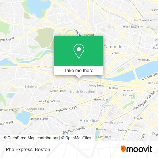
See Pho Express, Boston, on the map
Public Transit to Pho Express in Boston
Wondering how to get to Pho Express in Boston? Moovit helps you find the best way to get to Pho Express with step-by-step directions from the nearest public transit station.
Moovit provides free maps and live directions to help you navigate through your city. View schedules, routes, timetables, and find out how long does it take to get to Pho Express in real time.
Looking for the nearest stop or station to Pho Express? Check out this list of stops closest to your destination: Harvard Avenue - Commonwealth Ave @ Harvard Ave; Harvard Ave @ Commonwealth Ave; Commonwealth Ave @ Babcock St; Babcock Street.
Bus: 501, 57, GREEN LINE B SHUTTLE, GREEN LINE B SHUTTLE, GREEN LINE B SHUTTLE, GREEN LINE B SHUTTLE, GREEN LINE B SHUTTLE, 66, GREEN LINE B SHUTTLE, GREEN LINE B SHUTTLE, GREEN LINE B SHUTTLE, GREEN LINE B SHUTTLE.Train: FRAMINGHAM/WORCESTER.Subway: GREEN LINE B.
Want to see if there’s another route that gets you there at an earlier time? Moovit helps you find alternative routes or times. Get directions from and directions to Pho Express easily from the Moovit App or Website.
We make riding to Pho Express easy, which is why over 1.7 million users, including users in Boston, trust Moovit as the best app for public transit. You don’t need to download an individual bus app or train app, Moovit is your all-in-one transit app that helps you find the best bus time or train time available.
For information on prices of bus, subway and train, costs and ride fares to Pho Express, please check the Moovit app.
Use the app to navigate to popular places including to the airport, hospital, stadium, grocery store, mall, coffee shop, school, college, and university.
Pho Express Address: 1 Brighton Ave street in Boston
- ismaili jamatkhana center,
- Isshindo,
- Hong Kong Supermarket,
- Hydro Therapy Bath Spa Showroom (Hydro Therapy Supply Co.),
- A+ Program,
- Packards Corner Station,
- Limered Teahouse,
- Planned Parenthood - Greater Boston Health Center,
- Planned Parenthood,
- Planned Parenthood League Of Massachusetts,
- Dollar Tree,
- FILENE'S BASEMENT,
- Treehouse,
- Boston University Track and Tennis Center,
- Bu Track & Tennis Center,
- Fordham Rd,
- MBTA Bus Route 57,
- Lorna McKenzie-Pollock, Licsw,
- Clear Flour Bread (Clear Flour Bakery),
- Clear Flour Bakery
Places Near Pho Express (Boston)
- Leader Bank Pavilion (Leader Bank Pavillion), Boston,
- Prudential Center, Boston,
- Faneuil Hall, Boston,
- Quincy Market, Boston,
- Td Garden, Boston,
- Cheers, Boston,
- Mgm Music Hall, Boston,
- Wang Theater, Boston,
- Boston Convention & Exhibition Center, Boston,
- Massachusetts General Hospital, Boston,
- Isabella Stewart Gardner Museum, Boston,
- Boston Children's Hospital, Boston,
- Wilbur Theatre, Boston,
- North End, Boston,
- House Of Blues, Boston,
- Museum Of Science, Boston,
- Boston Medical Center, Boston,
- Boston Common, Boston,
- Castle Island, Boston,
- Seaport District, Boston
How to get to popular places in Boston with public transit
Get around Boston by public transit!
Traveling around Boston has never been so easy. See step by step directions as you travel to any attraction, street or major public transit station. View bus and train schedules, arrival times, service alerts and detailed routes on a map, so you know exactly how to get to anywhere in Boston.
When traveling to any destination around Boston use Moovit's Live Directions with Get Off Notifications to know exactly where and how far to walk, how long to wait for your line, and how many stops are left. Moovit will alert you when it's time to get off — no need to constantly re-check whether yours is the next stop.
Wondering how to use public transit in Boston or how to pay for public transit in Boston? Moovit public transit app can help you navigate your way with public transit easily, and at minimum cost. It includes public transit fees, ticket prices, and costs. Looking for a map of Boston public transit lines? Moovit public transit app shows all public transit maps in Boston with all Bus, Train, Subway and Ferry routes and stops on an interactive map.
Boston has 4 transit type(s), including: Bus, Train, Subway and Ferry, operated by several transit agencies, including MBTA, Southeastern Regional Transit Authority, MetroWest Regional Transit Authority, Rhode Island Public Transit Authority, WRTA, Lowell Regional Transit Authority, Merrimack Valley Transit, Montachusett Regional Transit Authority, Cape Cod Regional Transit Authority, Brockton Area Transit Authority, Martha's Vineyard Transit Authority, the WAVE - Nantucket Regional Transit Authority, GATRA, Cape Ann Transportation Authority and Massport