Directions to Phoenix Challenge Coins (Oxford) with public transportation
The following transit lines have routes that pass near Phoenix Challenge Coins
 Bus: 42.
How to get to Phoenix Challenge Coins by bus?
Click on the bus route to see step by step directions with maps, line arrival times and updated time schedules.
From Polar Park, Worcester
59 minFrom Dcu Center, Worcester
66 minFrom Worcester, MA, Worcester
58 minFrom St Vincent Hospital TH Medical, Worcester
60 minFrom Walmart Supercenter, Worcester
95 minFrom Saint Vincent Hospital at Worcester Medical Center, Worcester
79 minFrom South High Community School, Worcester
99 minFrom Palladium, Worcester
65 minFrom Registry Of Motor Vehicles (Rmv) Branch Office, Worcester
60 min
Bus stop near Phoenix Challenge Coins in Oxford
- Main St at Holbrook Rd, 3 min walk,VIEW
Bus lines to Phoenix Challenge Coins in Oxford
- 42, Central Hub,VIEW
What are the closest stations to Phoenix Challenge Coins?
The closest stations to Phoenix Challenge Coins are:
- Main St at Holbrook Rd is 195 yards away, 3 min walk.
Which bus line stops near Phoenix Challenge Coins?
42 (Central Hub→Davis And Main Webster)
What’s the nearest bus station to Phoenix Challenge Coins in Oxford?
The nearest bus station to Phoenix Challenge Coins in Oxford is Main St at Holbrook Rd. It’s a 3 min walk away.
What time is the first bus to Phoenix Challenge Coins in Oxford?
The 42 is the first bus that goes to Phoenix Challenge Coins in Oxford. It stops nearby at 5:55 AM.
What time is the last bus to Phoenix Challenge Coins in Oxford?
The 42 is the last bus that goes to Phoenix Challenge Coins in Oxford. It stops nearby at 8:34 PM.
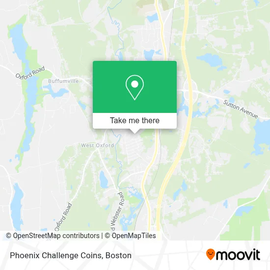
See Phoenix Challenge Coins, Oxford, on the map
Public Transit to Phoenix Challenge Coins in Oxford
Wondering how to get to Phoenix Challenge Coins in Oxford? Moovit helps you find the best way to get to Phoenix Challenge Coins with step-by-step directions from the nearest public transit station.
Moovit provides free maps and live directions to help you navigate through your city. View schedules, routes, timetables, and find out how long does it take to get to Phoenix Challenge Coins in real time.
Looking for the nearest stop or station to Phoenix Challenge Coins? Check out this list of stops closest to your destination: Main St at Holbrook Rd.
Bus: 42.
Want to see if there’s another route that gets you there at an earlier time? Moovit helps you find alternative routes or times. Get directions from and directions to Phoenix Challenge Coins easily from the Moovit App or Website.
We make riding to Phoenix Challenge Coins easy, which is why over 1.7 million users, including users in Oxford, trust Moovit as the best app for public transit. You don’t need to download an individual bus app or train app, Moovit is your all-in-one transit app that helps you find the best bus time or train time available.
For information on prices of bus, costs and ride fares to Phoenix Challenge Coins, please check the Moovit app.
Use the app to navigate to popular places including to the airport, hospital, stadium, grocery store, mall, coffee shop, school, college, and university.
Phoenix Challenge Coins Address: 50 Locust St street in Oxford
- Ruel Field,
- Steve Lapomardo,
- Atm,
- Autocare Tire & Replacement Auto Repair,
- Your Connections Church,
- McGarry Electric,
- Gail Bergeron,
- Rox's,
- Jojos Wildwood Crafts, Books and Spirits,
- Main St + Sunset Ave,
- Dejordy Contracting,
- Solustrance Holist,
- Central Mass Scuba,
- Deja do Salon,
- Wemoov,
- St Vincent Physician Services,
- Nasinnyk George MD,
- Silverman David E,
- 13 Gables,
- 508 Automotive Detailing
Places Near Phoenix Challenge Coins (Oxford)
- Boston Common, Boston,
- Massachusetts General Hospital, Boston,
- Seaport District, Boston,
- Boston Children's Hospital, Boston,
- Wilbur Theatre, Boston,
- Museum Of Science, Boston,
- Prudential Center, Boston,
- Isabella Stewart Gardner Museum, Boston,
- Td Garden, Boston,
- Wang Theater, Boston,
- House Of Blues, Boston,
- Faneuil Hall, Boston,
- Boston Medical Center, Boston,
- Castle Island, Boston,
- Cheers, Boston,
- Mgm Music Hall, Boston,
- North End, Boston,
- Quincy Market, Boston,
- Leader Bank Pavilion (Leader Bank Pavillion), Boston,
- Boston Convention & Exhibition Center, Boston
How to get to popular places in Boston with public transit
Get around Oxford by public transit!
Traveling around Oxford has never been so easy. See step by step directions as you travel to any attraction, street or major public transit station. View bus and train schedules, arrival times, service alerts and detailed routes on a map, so you know exactly how to get to anywhere in Oxford.
When traveling to any destination around Oxford use Moovit's Live Directions with Get Off Notifications to know exactly where and how far to walk, how long to wait for your line, and how many stops are left. Moovit will alert you when it's time to get off — no need to constantly re-check whether yours is the next stop.
Wondering how to use public transit in Oxford or how to pay for public transit in Oxford? Moovit public transit app can help you navigate your way with public transit easily, and at minimum cost. It includes public transit fees, ticket prices, and costs. Looking for a map of Oxford public transit lines? Moovit public transit app shows all public transit maps in Oxford with all Bus, Train, Subway and Ferry routes and stops on an interactive map.
Boston has 4 transit type(s), including: Bus, Train, Subway and Ferry, operated by several transit agencies, including MBTA, Southeastern Regional Transit Authority, MetroWest Regional Transit Authority, Rhode Island Public Transit Authority, WRTA, Lowell Regional Transit Authority, Merrimack Valley Transit, Montachusett Regional Transit Authority, Cape Cod Regional Transit Authority, Brockton Area Transit Authority, Martha's Vineyard Transit Authority, the WAVE - Nantucket Regional Transit Authority, GATRA, Cape Ann Transportation Authority and Massport