Directions to Phoenix Fruit (Orleans) with public transportation
The following transit lines have routes that pass near Phoenix Fruit
 Bus: H2O HYANNIS-ORLEANS, PETER PAN, FLEX, PATRIOT LTD.
How to get to Phoenix Fruit by bus?
Click on the bus route to see step by step directions with maps, line arrival times and updated time schedules.
Bus stops near Phoenix Fruit in Orleans
Bus lines to Phoenix Fruit in Orleans
What are the closest stations to Phoenix Fruit?
The closest stations to Phoenix Fruit are:
- Main Street/Cvs/Mobil, Orleans is 68 yards away, 1 min walk.
- Main Street And Route 6a - Cvs Orleans is 86 yards away, 2 min walk.
- Main Street/Land Ho, Orleans is 406 yards away, 5 min walk.
- Stop & Shop, Orleans is 1766 yards away, 21 min walk.
Which bus lines stop near Phoenix Fruit?
These bus lines stop near Phoenix Fruit: H2O HYANNIS-ORLEANS, PETER PAN.
What’s the nearest bus station to Phoenix Fruit in Orleans?
The nearest bus station to Phoenix Fruit in Orleans is Main Street/Cvs/Mobil, Orleans. It’s a 1 min walk away.
What time is the first bus to Phoenix Fruit in Orleans?
The FLEX is the first bus that goes to Phoenix Fruit in Orleans. It stops nearby at 4:30 AM.
What time is the last bus to Phoenix Fruit in Orleans?
The PATRIOT LTD is the last bus that goes to Phoenix Fruit in Orleans. It stops nearby at 10:01 PM.
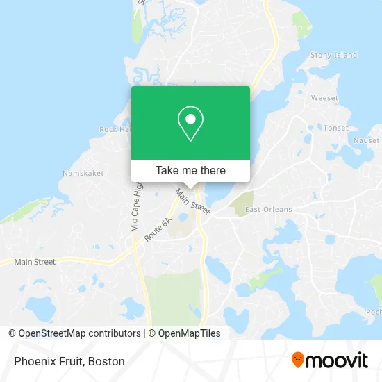
See Phoenix Fruit, Orleans, on the map
Public Transit to Phoenix Fruit in Orleans
Wondering how to get to Phoenix Fruit in Orleans? Moovit helps you find the best way to get to Phoenix Fruit with step-by-step directions from the nearest public transit station.
Moovit provides free maps and live directions to help you navigate through your city. View schedules, routes, timetables, and find out how long does it take to get to Phoenix Fruit in real time.
Looking for the nearest stop or station to Phoenix Fruit? Check out this list of stops closest to your destination: Main Street/Cvs/Mobil; Main Street And Route 6a - Cvs Orleans; Main Street/Land Ho; Stop & Shop.
Bus: H2O HYANNIS-ORLEANS, PETER PAN, FLEX, PATRIOT LTD.
Want to see if there’s another route that gets you there at an earlier time? Moovit helps you find alternative routes or times. Get directions from and directions to Phoenix Fruit easily from the Moovit App or Website.
We make riding to Phoenix Fruit easy, which is why over 1.7 million users, including users in Orleans, trust Moovit as the best app for public transit. You don’t need to download an individual bus app or train app, Moovit is your all-in-one transit app that helps you find the best bus time or train time available.
For information on prices of bus, costs and ride fares to Phoenix Fruit, please check the Moovit app.
Use the app to navigate to popular places including to the airport, hospital, stadium, grocery store, mall, coffee shop, school, college, and university.
Location: Orleans, Boston
- Red Barn,
- Salt Cave Builder,
- Cape Cod Lanterns,
- Rippedit Vintage,
- Orleans, Massachusetts,
- Trek Bicycle Store,
- Nauset Vintage,
- Arts & Crafts Children's Books,
- United Healthcare,
- Northeast Health Services,
- CCRT Mile 13 Marker,
- Harlow & MacGregor,
- Chessboard at Artist Cottages,
- Cape Cod Rail Trail,
- Innseason Resorts Captains Quarters,
- Leonard E Enos III Attorney at Law,
- Comforcare Home Care (Cape Cod, Ma),
- Salvation Army,
- Eastham Food Pantry,
- Brooks S Thayer Attorney
Places Near Phoenix Fruit (Orleans)
- Wang Theater, Boston,
- Boston Children's Hospital, Boston,
- Seaport District, Boston,
- Faneuil Hall, Boston,
- Cheers, Boston,
- Massachusetts General Hospital, Boston,
- Td Garden, Boston,
- Boston Common, Boston,
- Museum Of Science, Boston,
- Isabella Stewart Gardner Museum, Boston,
- North End, Boston,
- Mgm Music Hall, Boston,
- Wilbur Theatre, Boston,
- House Of Blues, Boston,
- Boston Convention & Exhibition Center, Boston,
- Boston Medical Center, Boston,
- Castle Island, Boston,
- Quincy Market, Boston,
- Prudential Center, Boston,
- Leader Bank Pavilion (Leader Bank Pavillion), Boston
How to get to popular places in Boston with public transit
Get around Orleans by public transit!
Traveling around Orleans has never been so easy. See step by step directions as you travel to any attraction, street or major public transit station. View bus and train schedules, arrival times, service alerts and detailed routes on a map, so you know exactly how to get to anywhere in Orleans.
When traveling to any destination around Orleans use Moovit's Live Directions with Get Off Notifications to know exactly where and how far to walk, how long to wait for your line, and how many stops are left. Moovit will alert you when it's time to get off — no need to constantly re-check whether yours is the next stop.
Wondering how to use public transit in Orleans or how to pay for public transit in Orleans? Moovit public transit app can help you navigate your way with public transit easily, and at minimum cost. It includes public transit fees, ticket prices, and costs. Looking for a map of Orleans public transit lines? Moovit public transit app shows all public transit maps in Orleans with all Bus, Train, Subway and Ferry routes and stops on an interactive map.
Boston has 4 transit type(s), including: Bus, Train, Subway and Ferry, operated by several transit agencies, including MBTA, Southeastern Regional Transit Authority, MetroWest Regional Transit Authority, Rhode Island Public Transit Authority, WRTA, Lowell Regional Transit Authority, Merrimack Valley Transit, Montachusett Regional Transit Authority, Cape Cod Regional Transit Authority, Brockton Area Transit Authority, Martha's Vineyard Transit Authority, the WAVE - Nantucket Regional Transit Authority, GATRA, Cape Ann Transportation Authority and Massport