Directions to Piazzale Flaminio (Roma) with public transportation
The following transit lines have routes that pass near Piazzale Flaminio
How to get to Piazzale Flaminio by bus?
Click on the bus route to see step by step directions with maps, line arrival times and updated time schedules.
How to get to Piazzale Flaminio by train?
Click on the train route to see step by step directions with maps, line arrival times and updated time schedules.
How to get to Piazzale Flaminio by metro?
Click on the metro route to see step by step directions with maps, line arrival times and updated time schedules.
Bus stations near Piazzale Flaminio in Roma
- Maria Adelaide, 1 min walk,
- P.le Flaminio, 4 min walk,
- P.za Popolo, 4 min walk,
- P.le Flaminio (Ma), 4 min walk,
- Ministero Marina, 6 min walk,
Train stations near Piazzale Flaminio in Roma
- Piazzale Flaminio, 15 min walk,
Bus lines to Piazzale Flaminio in Roma
- 628, Baronio,
- C3, Staz.ne Tiburtina (Mb),
- N201, P.za Venezia,
- 119, Venezia,
- MA, Cornelia (Ma),
- NMA, Anagnina (Ma),
- 2, Mancini,
- G40, Stazione Grottarossa,
- 89, Clodio,
- 490, Staz.ne Tiburtina (Mb),
- 495, Valle Aurelia/Bonaccorsi,
- 590, Cinecitta' (Ma),
- G04, P.le Flaminio (Ma),
- 61, Villa Borghese/Washington,
- 120F, Recanati,
- 150F, Tonino Bello,
- 160, Montagnola,
- 19BUS, L.go Preneste - P.,za dei Gerani,
- 19NAV, Sostitutivo tram 19 | Valle Giulia - P.za Risorgimento,
What are the closest stations to Piazzale Flaminio?
The closest stations to Piazzale Flaminio are:
- Maria Adelaide is 50 meters away, 1 min walk.
- P.le Flaminio is 234 meters away, 4 min walk.
- P.za Popolo is 256 meters away, 4 min walk.
- P.le Flaminio (Ma) is 282 meters away, 4 min walk.
- Ministero Marina is 396 meters away, 6 min walk.
- Piazzale Flaminio is 1125 meters away, 15 min walk.
Which bus lines stop near Piazzale Flaminio?
These bus lines stop near Piazzale Flaminio: 120F, 150F, 160, 490, 495, 89, MA6.
Which train lines stop near Piazzale Flaminio?
These train lines stop near Piazzale Flaminio: FC3, FL3, FL5.
Which metro lines stop near Piazzale Flaminio?
These metro lines stop near Piazzale Flaminio: A, B.
Which light rail line stops near Piazzale Flaminio?
2
What’s the nearest train station to Piazzale Flaminio in Roma?
The nearest train station to Piazzale Flaminio in Roma is Piazzale Flaminio. It’s a 15 min walk away.
What’s the nearest bus stop to Piazzale Flaminio in Roma?
The nearest bus stop to Piazzale Flaminio in Roma is Maria Adelaide. It’s a 1 min walk away.
What time is the first light rail to Piazzale Flaminio in Roma?
The 2 is the first light rail that goes to Piazzale Flaminio in Roma. It stops nearby at 5:10 AM.
What time is the last light rail to Piazzale Flaminio in Roma?
The 2 is the last light rail that goes to Piazzale Flaminio in Roma. It stops nearby at 12:28 AM.
What time is the first train to Piazzale Flaminio in Roma?
The FC3 is the first train that goes to Piazzale Flaminio in Roma. It stops nearby at 5:50 AM.
What time is the last train to Piazzale Flaminio in Roma?
The FC3 is the last train that goes to Piazzale Flaminio in Roma. It stops nearby at 11:00 PM.
What time is the first bus to Piazzale Flaminio in Roma?
The NMA is the first bus that goes to Piazzale Flaminio in Roma. It stops nearby at 3:02 AM.
What time is the last bus to Piazzale Flaminio in Roma?
The NMA is the last bus that goes to Piazzale Flaminio in Roma. It stops nearby at 3:42 AM.
See Piazzale Flaminio, Roma, on the map
Public Transit to Piazzale Flaminio in Roma
How to get to Piazzale Flaminio in Roma, Italy?
It’s easy with Moovit. Type in your street address and Moovit’s route finder will locate the fastest way to get you there! Not sure where to get off on the street? Download the Moovit App to find live directions (including where to get off on Piazzale Flaminio), see timetables and get the estimated arrival times for your favorite bus, train, metro or light rail lines.
Looking for the nearest stop or station to Piazzale Flaminio? Check out this list of closest stops available to your destination: Maria Adelaide; P.le Flaminio; P.za Popolo; P.le Flaminio (Ma); Ministero Marina; Piazzale Flaminio.
Bus: 120F, 150F, 160, 490, 495, 89, MA6, 628, C3, N201, 119, MA, NMA, 2, G40, G04, 61.Train: FC3, FL3, FL5.Metro: A, B.Light Rail: 2.
Download the Moovit App to see the current schedule and routes available for Roma. No need to install a special bus app to check the bus time or a train app to get train time. Moovit is the only all-in-one transit app that helps you get where you need to go.
We make riding on public transit to Piazzale Flaminio easy, which is why over 1.5 million users, including users in Roma trust Moovit as the best app for public transit.
Use the app to navigate to popular places including to the airport, hospital, stadium, grocery store, mall, coffee shop, school, college, and university.
Location: Roma, Rome and Lazio
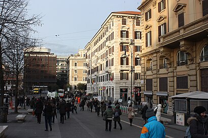
Piazzale Flaminio is a square in Rome (Italy) and the starting point of the Via Flaminia. It divides the Flaminio and the Pinciano quarters.Wiki
Streets near Piazzale Flaminio, Roma
Flaminio (Ma), Roma,Via Alberto Ferrero, Roma,Via Di Villa Ruffo, Roma,Viale Giorgio Washington, Roma,Viale David Lubin, Roma,Via Principessa Clotilde, Roma,Via Francesco Carrara, Roma,Salita Del Pincio, Roma,Via Giambattista Vico, Roma,Piazza Del Popolo, Roma,Via Cesare Beccaria, Roma,Via Maria Cristina, Roma,Piazzale Napoleone Primo, Roma,Via Gian Domenico Romagnosi, Roma,Viale Gabriele D'Annunzio, Roma,Via Matteo Renato Imbriani, Roma,Via Dell'Oca, Roma,Via Luisa Di Savoia, Roma,Via Maria Adelaide, Roma,Vicolo Del Borghetto, RomaGet around Rome and Lazio by public transit!
Traveling around Rome and Lazio has never been so easy. See step by step directions as you travel to any attraction, street or major public transit station. View bus and train schedules, arrival times, service alerts and detailed routes on a map, so you know exactly how to get to anywhere in Rome and Lazio.
When traveling to any destination around Rome and Lazio use Moovit's Live Directions with Get Off Notifications to know exactly where and how far to walk, how long to wait for your line, and how many stops are left. Moovit will alert you when it's time to get off — no need to constantly re-check whether yours is the next stop.
Wondering how to use public transit in Rome and Lazio or how to pay for public transit in Rome and Lazio? Moovit public transit app can help you navigate your way with public transit easily, and at minimum cost. It includes public transit fees, ticket prices, and costs. Looking for a map of Rome and Lazio public transit lines? Moovit public transit app shows all public transit maps in Rome and Lazio with all Bus, Train, Metro, Light Rail, Ferry and Funicular routes and stops on an interactive map.
Rome and Lazio has 6 transit type(s), including: Bus, Train, Metro, Light Rail, Ferry and Funicular, operated by several transit agencies, including ATAC, Cotral, Trenitalia, Roma TPL, Autoservizi Troiani, Navette, Seatour, Autolinee Troiani, CSC Mobilità, BIS, Terravision, ATRAL, TAM S.r.l., Servizi Turistici, Sitbus