Directions to Pico (Somerville) with public transportation
The following transit lines have routes that pass near Pico
 Bus: 69, 83, 85, 109.
- Train: FITCHBURG.
- Subway: GREEN LINE D, RED LINE, GREEN LINE B, GREEN LINE C, GREEN LINE E.
How to get to Pico by bus?
Click on the bus route to see step by step directions with maps, line arrival times and updated time schedules.
From Davio's Seaport, Boston
55 minFrom Roslindale, Boston
82 minFrom World Trade Center MBTA Station - Silver Line, Boston
55 minFrom Ramada Boston, Boston
91 minFrom 1010 MASS AVE, Boston
58 minFrom Ramada by Wyndham Boston, Boston
91 minFrom Regent Theatre, Arlington
39 minFrom Waltham, MA, Waltham
65 min
How to get to Pico by train?
Click on the train route to see step by step directions with maps, line arrival times and updated time schedules.
How to get to Pico by subway?
Click on the subway route to see step by step directions with maps, line arrival times and updated time schedules.
Bus stops near Pico in Somerville
Subway stations near Pico in Somerville
Bus lines to Pico in Somerville
What are the closest stations to Pico?
The closest stations to Pico are:
- 45 Beacon St is 3 yards away, 1 min walk.
- Cambridge St @ Springfield St is 240 yards away, 4 min walk.
- Washington St @ Dane St is 510 yards away, 6 min walk.
- Central is 839 yards away, 10 min walk.
- East Somerville Station is 1048 yards away, 13 min walk.
- Union Square is 1625 yards away, 20 min walk.
Which bus lines stop near Pico?
These bus lines stop near Pico: 69, 83, 85.
Which train line stops near Pico?
FITCHBURG (#410 | North Station)
Which subway lines stop near Pico?
These subway lines stop near Pico: GREEN LINE D, RED LINE.
What’s the nearest subway station to Pico in Somerville?
The nearest subway station to Pico in Somerville is Central. It’s a 10 min walk away.
What’s the nearest bus station to Pico in Somerville?
The nearest bus station to Pico in Somerville is 45 Beacon St. It’s a 1 min walk away.
What time is the first subway to Pico in Somerville?
The GREEN LINE E is the first subway that goes to Pico in Somerville. It stops nearby at 4:49 AM.
What time is the last subway to Pico in Somerville?
The GREEN LINE E is the last subway that goes to Pico in Somerville. It stops nearby at 2:36 AM.
What time is the first bus to Pico in Somerville?
The 109 is the first bus that goes to Pico in Somerville. It stops nearby at 4:56 AM.
What time is the last bus to Pico in Somerville?
The 109 is the last bus that goes to Pico in Somerville. It stops nearby at 1:31 AM.
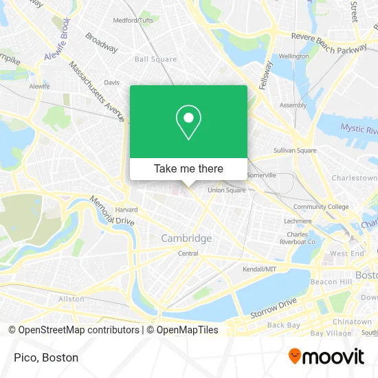
See Pico, Somerville, on the map
Public Transit to Pico in Somerville
Wondering how to get to Pico in Somerville? Moovit helps you find the best way to get to Pico with step-by-step directions from the nearest public transit station.
Moovit provides free maps and live directions to help you navigate through your city. View schedules, routes, timetables, and find out how long does it take to get to Pico in real time.
Looking for the nearest stop or station to Pico? Check out this list of stops closest to your destination: 45 Beacon St; Cambridge St @ Springfield St; Washington St @ Dane St; Central; East Somerville Station; Union Square.
Bus: 69, 83, 85, 109.Train: FITCHBURG.Subway: GREEN LINE D, RED LINE, GREEN LINE B, GREEN LINE C, GREEN LINE E.
Want to see if there’s another route that gets you there at an earlier time? Moovit helps you find alternative routes or times. Get directions from and directions to Pico easily from the Moovit App or Website.
We make riding to Pico easy, which is why over 1.7 million users, including users in Somerville, trust Moovit as the best app for public transit. You don’t need to download an individual bus app or train app, Moovit is your all-in-one transit app that helps you find the best bus time or train time available.
For information on prices of bus, subway and train, costs and ride fares to Pico, please check the Moovit app.
Use the app to navigate to popular places including to the airport, hospital, stadium, grocery store, mall, coffee shop, school, college, and university.
Pico Address: 45 Beacon St street in Somerville
- Amazon Locker-Somerville,
- Amazon Counter at Whole Foods Market,
- Wholefoods Somerville,
- Patalano II, J Vincent M.D.,
- Juniors Plumbing & Heating,
- Greenwood Management Property,
- ATM,
- Thirsty Scholar Pub,
- Cambridge Hospital,
- 1493 Cambridge Street,
- Cambridge Hospital-Er (Cambridge City Emergency Room),
- Kareem, Shakira P,
- Jennifer Wilson, MD,
- Lee, J James MD,
- Dr. Anatoly P. Shalnov, MD (Sophia P Hill),
- Claire Stampfer, MD (Melissa Claire Bartick),
- 15 Waldo Ave Parking,
- CHA Cambridge Health Alliance CHA Cambridge Hospital-ER,
- Cha Primary Care, Cambridge Hospital,
- Cambridge Health Alliance (CHA)
Places Near Pico (Somerville)
- Boston Convention & Exhibition Center, Boston,
- Wilbur Theatre, Boston,
- Boston Common, Boston,
- Massachusetts General Hospital, Boston,
- Leader Bank Pavilion (Leader Bank Pavillion), Boston,
- Faneuil Hall, Boston,
- Td Garden, Boston,
- Mgm Music Hall, Boston,
- Isabella Stewart Gardner Museum, Boston,
- Quincy Market, Boston,
- Wang Theater, Boston,
- Museum Of Science, Boston,
- North End, Boston,
- Prudential Center, Boston,
- Boston Children's Hospital, Boston,
- Seaport District, Boston,
- Cheers, Boston,
- House Of Blues, Boston,
- Boston Medical Center, Boston,
- Castle Island, Boston
How to get to popular places in Boston with public transit
Get around Somerville by public transit!
Traveling around Somerville has never been so easy. See step by step directions as you travel to any attraction, street or major public transit station. View bus and train schedules, arrival times, service alerts and detailed routes on a map, so you know exactly how to get to anywhere in Somerville.
When traveling to any destination around Somerville use Moovit's Live Directions with Get Off Notifications to know exactly where and how far to walk, how long to wait for your line, and how many stops are left. Moovit will alert you when it's time to get off — no need to constantly re-check whether yours is the next stop.
Wondering how to use public transit in Somerville or how to pay for public transit in Somerville? Moovit public transit app can help you navigate your way with public transit easily, and at minimum cost. It includes public transit fees, ticket prices, and costs. Looking for a map of Somerville public transit lines? Moovit public transit app shows all public transit maps in Somerville with all Bus, Train, Subway and Ferry routes and stops on an interactive map.
Boston has 4 transit type(s), including: Bus, Train, Subway and Ferry, operated by several transit agencies, including MBTA, Southeastern Regional Transit Authority, MetroWest Regional Transit Authority, Rhode Island Public Transit Authority, WRTA, Lowell Regional Transit Authority, Merrimack Valley Transit, Montachusett Regional Transit Authority, Cape Cod Regional Transit Authority, Brockton Area Transit Authority, Martha's Vineyard Transit Authority, the WAVE - Nantucket Regional Transit Authority, GATRA, Cape Ann Transportation Authority and Massport