Directions to Pillo Health (Boston) with public transportation
The following transit lines have routes that pass near Pillo Health
 Bus: 354, 426, 504, 92, SL3.
- Train: FAIRMOUNT, FITCHBURG, FRAMINGHAM/WORCESTER, LOWELL, NEEDHAM.
- Subway: BLUE LINE, GREEN LINE D, ORANGE LINE, RED LINE, GREEN LINE B.
How to get to Pillo Health by bus?
Click on the bus route to see step by step directions with maps, line arrival times and updated time schedules.
From Regent Theatre, Arlington
69 minFrom Revere Beach, Revere
74 minFrom Washington St, Boston
71 minFrom Arlington, MA, Arlington
82 minFrom FOUR POINTS BY SHERATON Boston Newton, Newton
27 minFrom Cambria Hotel Boston Somerville, Somerville
64 minFrom Brattle St / Harvard Sq, Cambridge
57 minFrom Four Points by Sheraton Boston Logan Airport, Revere
67 minFrom The Mall At Chestnut Hill, Newton
69 minFrom Forest Hills Station MBTA, Boston
49 min
How to get to Pillo Health by train?
Click on the train route to see step by step directions with maps, line arrival times and updated time schedules.
How to get to Pillo Health by subway?
Click on the subway route to see step by step directions with maps, line arrival times and updated time schedules.
Bus stops near Pillo Health in Boston
- Federal St @ Matthews St, 1 min walk,VIEW
- Federal St @ Franklin St, 2 min walk,VIEW
- Congress St @ Franklin St, 2 min walk,VIEW
- Washington St @ Essex St, 5 min walk,VIEW
- Downtown Crossing - Franklin St @ Washington St, 5 min walk,VIEW
- Devonshire St @ Milk St, 5 min walk,VIEW
- Milk St @ Devonshire St, 5 min walk,VIEW
- Chauncy St @ Summer St, 6 min walk,VIEW
- Otis St @ Summer St, 7 min walk,VIEW
- South Station Boston, 8 min walk,VIEW
- Essex St @ Atlantic Ave, 8 min walk,VIEW
- Summer St @ Atlantic Ave, 11 min walk,VIEW
Subway stations near Pillo Health in Boston
Train station near Pillo Health in Boston
- South Station, 11 min walk,VIEW
Bus lines to Pillo Health in Boston
- 7, City Point Via East First St,VIEW
- 501, Downtown via Copley (Express) - Brighton via Copley (Express),VIEW
- 504, Downtown via Copley (Express) - Watertown via Copley and Newton Corner (Express),VIEW
- 505, Downtown (Express) - Waltham (Express),VIEW
- RED LINE SHUTTLE, Harvard - JFK/UMass via Congress Street,VIEW
- RED LINE SHUTTLE, Kendall/MIT - JFK/UMass,VIEW
- RED LINE SHUTTLE, Harvard - Broadway,VIEW
- RED LINE SHUTTLE, Kendall/MIT - Broadway via Downtown Crossing,VIEW
- RED LINE SHUTTLE, JFK/UMass - Kendall/MIT (Shuttle),VIEW
- 4, North Station Via South Station,VIEW
- SL5, Nubian,VIEW
- RED LINE SHUTTLE, Ashmont - Park Street via Post Office,VIEW
- RED LINE SHUTTLE, JFK/UMass - Park Street via Post Office,VIEW
- RED LINE SHUTTLE, JFK/UMass - Park Street,VIEW
- 92, Sullivan,VIEW
- 93, Sullivan Via Navy Yard,VIEW
- 15, Haymarket Via Fields Corner & Nubian,VIEW
- 39, Haymarket Via Forest Hills,VIEW
- 57, Haymarket Via Kenmore,VIEW
- 11, City Point,VIEW
What are the closest stations to Pillo Health?
The closest stations to Pillo Health are:
- Federal St @ Matthews St is 72 yards away, 1 min walk.
- Federal St @ Franklin St is 79 yards away, 2 min walk.
- Congress St @ Franklin St is 136 yards away, 2 min walk.
- Washington St @ Essex St is 319 yards away, 5 min walk.
- Downtown Crossing - Franklin St @ Washington St is 343 yards away, 5 min walk.
- Devonshire St @ Milk St is 365 yards away, 5 min walk.
- Milk St @ Devonshire St is 366 yards away, 5 min walk.
- Park Street is 425 yards away, 6 min walk.
- Chauncy St @ Summer St is 431 yards away, 6 min walk.
- Downtown Crossing is 466 yards away, 6 min walk.
- Otis St @ Summer St is 544 yards away, 7 min walk.
- South Station Boston is 610 yards away, 8 min walk.
- Essex St @ Atlantic Ave is 624 yards away, 8 min walk.
- Summer St @ Atlantic Ave is 926 yards away, 11 min walk.
- South Station is 933 yards away, 11 min walk.
Which bus lines stop near Pillo Health?
These bus lines stop near Pillo Health: 354, 426, 504, 92, SL3, SL4, SL5.
Which train lines stop near Pillo Health?
These train lines stop near Pillo Health: FAIRMOUNT, FITCHBURG, FRAMINGHAM/WORCESTER, LOWELL, NEEDHAM.
Which subway lines stop near Pillo Health?
These subway lines stop near Pillo Health: BLUE LINE, GREEN LINE D, ORANGE LINE, RED LINE.
What’s the nearest subway station to Pillo Health in Boston?
The nearest subway stations to Pillo Health in Boston are Park Street and Downtown Crossing. The closest one is a 6 min walk away.
What’s the nearest train station to Pillo Health in Boston?
The nearest train station to Pillo Health in Boston is South Station. It’s a 11 min walk away.
What’s the nearest bus station to Pillo Health in Boston?
The nearest bus station to Pillo Health in Boston is Federal St @ Matthews St. It’s a 1 min walk away.
What time is the first subway to Pillo Health in Boston?
The GREEN LINE E is the first subway that goes to Pillo Health in Boston. It stops nearby at 5:07 AM.
What time is the last subway to Pillo Health in Boston?
The GREEN LINE E is the last subway that goes to Pillo Health in Boston. It stops nearby at 2:18 AM.
What time is the first train to Pillo Health in Boston?
The PROVIDENCE/STOUGHTON is the first train that goes to Pillo Health in Boston. It stops nearby at 4:20 AM.
What time is the last train to Pillo Health in Boston?
The LAKE SHORE LIMITED is the last train that goes to Pillo Health in Boston. It stops nearby at 8:32 PM.
What time is the first bus to Pillo Health in Boston?
The SLW is the first bus that goes to Pillo Health in Boston. It stops nearby at 4:19 AM.
What time is the last bus to Pillo Health in Boston?
The SL1 is the last bus that goes to Pillo Health in Boston. It stops nearby at 1:31 AM.
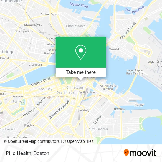
See Pillo Health, Boston, on the map
Public Transit to Pillo Health in Boston
Wondering how to get to Pillo Health in Boston? Moovit helps you find the best way to get to Pillo Health with step-by-step directions from the nearest public transit station.
Moovit provides free maps and live directions to help you navigate through your city. View schedules, routes, timetables, and find out how long does it take to get to Pillo Health in real time.
Looking for the nearest stop or station to Pillo Health? Check out this list of stops closest to your destination: Federal St @ Matthews St; Federal St @ Franklin St; Congress St @ Franklin St; Washington St @ Essex St; Downtown Crossing - Franklin St @ Washington St; Devonshire St @ Milk St; Milk St @ Devonshire St; Park Street; Chauncy St @ Summer St; Downtown Crossing; Otis St @ Summer St; South Station Boston; Essex St @ Atlantic Ave; Summer St @ Atlantic Ave; South Station.
Bus: 354, 426, 504, 92, SL3, SL4, SL5, 7, 501, 505, RED LINE SHUTTLE, RED LINE SHUTTLE, 4.Train: FAIRMOUNT, FITCHBURG, FRAMINGHAM/WORCESTER, LOWELL, NEEDHAM, COMMUTER RAIL SHUTTLE, FAIRMOUNT LINE SHUTTLE, FRANKLIN LINE SHUTTLE, KINGSTON LINE SHUTTLE, SL2.Subway: BLUE LINE, GREEN LINE D, ORANGE LINE, RED LINE, GREEN LINE B, GREEN LINE C, GREEN LINE E.
Want to see if there’s another route that gets you there at an earlier time? Moovit helps you find alternative routes or times. Get directions from and directions to Pillo Health easily from the Moovit App or Website.
We make riding to Pillo Health easy, which is why over 1.7 million users, including users in Boston, trust Moovit as the best app for public transit. You don’t need to download an individual bus app or train app, Moovit is your all-in-one transit app that helps you find the best bus time or train time available.
For information on prices of bus, subway and train, costs and ride fares to Pillo Health, please check the Moovit app.
Use the app to navigate to popular places including to the airport, hospital, stadium, grocery store, mall, coffee shop, school, college, and university.
Pillo Health Address: 71 Summer St street in Boston
- GMA Foundations,
- MBTA Bus Route 554,
- Summer St @ Otis St,
- Yahoo Search Marketing,
- Taipei Economic and Cultural Office,
- Grainmaker,
- JJ Foley's Bar & Grille,
- 99 Summer St.,
- Barry's Bootcamp Boston,
- St. Anthony Shrine,
- Teco,
- Boylston Chess Club,
- Pearson Vue,
- Boston Carmen's Union Local 589 (Amalgamated TRANSIT Union),
- Pearson Vue Test Center,
- Ies,
- PRP Injection MD,
- Wanderu,
- 125 Summer St,
- Downtown
Places Near Pillo Health (Boston)
- Quincy Market, Boston,
- Td Garden, Boston,
- Castle Island, Boston,
- Wilbur Theatre, Boston,
- Boston Children's Hospital, Boston,
- Isabella Stewart Gardner Museum, Boston,
- Wang Theater, Boston,
- North End, Boston,
- Boston Convention & Exhibition Center, Boston,
- Prudential Center, Boston,
- Boston Medical Center, Boston,
- Faneuil Hall, Boston,
- Boston Common, Boston,
- Seaport District, Boston,
- Massachusetts General Hospital, Boston,
- Leader Bank Pavilion (Leader Bank Pavillion), Boston,
- House Of Blues, Boston,
- Mgm Music Hall, Boston,
- Cheers, Boston,
- Museum Of Science, Boston
How to get to popular places in Boston with public transit
Get around Boston by public transit!
Traveling around Boston has never been so easy. See step by step directions as you travel to any attraction, street or major public transit station. View bus and train schedules, arrival times, service alerts and detailed routes on a map, so you know exactly how to get to anywhere in Boston.
When traveling to any destination around Boston use Moovit's Live Directions with Get Off Notifications to know exactly where and how far to walk, how long to wait for your line, and how many stops are left. Moovit will alert you when it's time to get off — no need to constantly re-check whether yours is the next stop.
Wondering how to use public transit in Boston or how to pay for public transit in Boston? Moovit public transit app can help you navigate your way with public transit easily, and at minimum cost. It includes public transit fees, ticket prices, and costs. Looking for a map of Boston public transit lines? Moovit public transit app shows all public transit maps in Boston with all Bus, Train, Subway and Ferry routes and stops on an interactive map.
Boston has 4 transit type(s), including: Bus, Train, Subway and Ferry, operated by several transit agencies, including MBTA, Southeastern Regional Transit Authority, MetroWest Regional Transit Authority, Rhode Island Public Transit Authority, WRTA, Lowell Regional Transit Authority, Merrimack Valley Transit, Montachusett Regional Transit Authority, Cape Cod Regional Transit Authority, Brockton Area Transit Authority, Martha's Vineyard Transit Authority, the WAVE - Nantucket Regional Transit Authority, GATRA, Cape Ann Transportation Authority and Massport