Directions to Pillpack, Inc. (Somerville) with public transportation
The following transit lines have routes that pass near Pillpack, Inc.
 Bus: 87, 88, 90, 96, 89.
- Train: FITCHBURG, RED LINE.
- Subway: RED LINE, GREEN LINE B, GREEN LINE C, GREEN LINE E.
How to get to Pillpack, Inc. by bus?
Click on the bus route to see step by step directions with maps, line arrival times and updated time schedules.
From The Banshee Bar, Boston
75 minFrom 110 Francis Street Garage, Boston
53 minFrom Uphams Corner, Boston
77 minFrom Colonial Theatre, Boston
56 minFrom MBTA Suffolk Downs Station, Boston
82 minFrom World Trade Center, Boston
62 minFrom Park Street MBTA Station - Green & Red Line, Boston
53 minFrom Lexington, MA, Lexington
47 minFrom Folkman Auditorium, Children's Hospital Boston, Boston
49 minFrom 240 Mount Vernon Street, Boston
79 min
How to get to Pillpack, Inc. by train?
Click on the train route to see step by step directions with maps, line arrival times and updated time schedules.
How to get to Pillpack, Inc. by subway?
Click on the subway route to see step by step directions with maps, line arrival times and updated time schedules.
From The Banshee Bar, Boston
39 minFrom 110 Francis Street Garage, Boston
54 minFrom Uphams Corner, Boston
45 minFrom Colonial Theatre, Boston
28 minFrom MBTA Suffolk Downs Station, Boston
48 minFrom World Trade Center, Boston
47 minFrom Park Street MBTA Station - Green & Red Line, Boston
25 minFrom Folkman Auditorium, Children's Hospital Boston, Boston
52 minFrom 240 Mount Vernon Street, Boston
39 min
Bus stops near Pillpack, Inc. in Somerville
Subway station near Pillpack, Inc. in Somerville
- Ball Square Station, 14 min walk,VIEW
Train station near Pillpack, Inc. in Somerville
- Porter, 26 min walk,VIEW
Bus lines to Pillpack, Inc. in Somerville
- 88, Lechmere,VIEW
- 90, Assembly,VIEW
- 87, Arlington Center,VIEW
- 96, Medford Square,VIEW
- 89, Sullivan,VIEW
- 89/93, Haymarket Via Sullivan,VIEW
- 94, Davis,VIEW
- RED LINE SHUTTLE, Alewife - Park Street,VIEW
- RED LINE SHUTTLE, Alewife - Harvard via Brattle Street,VIEW
- RED LINE SHUTTLE, Alewife - Davis,VIEW
- RED LINE SHUTTLE, Alewife - Harvard via Holyoke Street,VIEW
- RED LINE SHUTTLE, Alewife - Kendall/MIT,VIEW
What are the closest stations to Pillpack, Inc.?
The closest stations to Pillpack, Inc. are:
- Highland Ave @ Willow Ave is 89 yards away, 2 min walk.
- Elm St @ Russell St is 192 yards away, 3 min walk.
- Broadway @ Billingham St is 253 yards away, 3 min walk.
- Grove St @ Highland Ave is 254 yards away, 4 min walk.
- Holland St @ Dover St is 338 yards away, 5 min walk.
- Ball Square Station is 1120 yards away, 14 min walk.
- Porter is 2138 yards away, 26 min walk.
Which bus lines stop near Pillpack, Inc.?
These bus lines stop near Pillpack, Inc.: 87, 88, 90, 96.
Which train line stops near Pillpack, Inc.?
FITCHBURG (#409 | Wachusett)
Which subway line stops near Pillpack, Inc.?
RED LINE (Alewife)
What’s the nearest subway station to Pillpack, Inc. in Somerville?
The nearest subway station to Pillpack, Inc. in Somerville is Ball Square Station. It’s a 14 min walk away.
What’s the nearest train station to Pillpack, Inc. in Somerville?
The nearest train station to Pillpack, Inc. in Somerville is Porter. It’s a 26 min walk away.
What’s the nearest bus station to Pillpack, Inc. in Somerville?
The nearest bus station to Pillpack, Inc. in Somerville is Highland Ave @ Willow Ave. It’s a 2 min walk away.
What time is the first subway to Pillpack, Inc. in Somerville?
The GREEN LINE E is the first subway that goes to Pillpack, Inc. in Somerville. It stops nearby at 4:53 AM.
What time is the last subway to Pillpack, Inc. in Somerville?
The GREEN LINE E is the last subway that goes to Pillpack, Inc. in Somerville. It stops nearby at 2:41 AM.
What time is the first train to Pillpack, Inc. in Somerville?
The FITCHBURG is the first train that goes to Pillpack, Inc. in Somerville. It stops nearby at 5:47 AM.
What time is the last train to Pillpack, Inc. in Somerville?
The FITCHBURG is the last train that goes to Pillpack, Inc. in Somerville. It stops nearby at 12:17 AM.
What time is the first bus to Pillpack, Inc. in Somerville?
The 89/93 is the first bus that goes to Pillpack, Inc. in Somerville. It stops nearby at 4:33 AM.
What time is the last bus to Pillpack, Inc. in Somerville?
The 89 is the last bus that goes to Pillpack, Inc. in Somerville. It stops nearby at 1:39 AM.
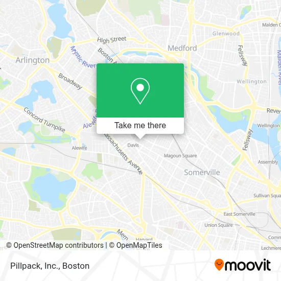
See Pillpack, Inc., Somerville, on the map
Public Transit to Pillpack, Inc. in Somerville
Wondering how to get to Pillpack, Inc. in Somerville? Moovit helps you find the best way to get to Pillpack, Inc. with step-by-step directions from the nearest public transit station.
Moovit provides free maps and live directions to help you navigate through your city. View schedules, routes, timetables, and find out how long does it take to get to Pillpack, Inc. in real time.
Looking for the nearest stop or station to Pillpack, Inc.? Check out this list of stops closest to your destination: Highland Ave @ Willow Ave; Elm St @ Russell St; Broadway @ Billingham St; Grove St @ Highland Ave; Holland St @ Dover St; Ball Square Station; Porter.
Bus: 87, 88, 90, 96, 89, 89/93, 94.Train: FITCHBURG, RED LINE.Subway: RED LINE, GREEN LINE B, GREEN LINE C, GREEN LINE E.
Want to see if there’s another route that gets you there at an earlier time? Moovit helps you find alternative routes or times. Get directions from and directions to Pillpack, Inc. easily from the Moovit App or Website.
We make riding to Pillpack, Inc. easy, which is why over 1.7 million users, including users in Somerville, trust Moovit as the best app for public transit. You don’t need to download an individual bus app or train app, Moovit is your all-in-one transit app that helps you find the best bus time or train time available.
For information on prices of bus, subway and train, costs and ride fares to Pillpack, Inc., please check the Moovit app.
Use the app to navigate to popular places including to the airport, hospital, stadium, grocery store, mall, coffee shop, school, college, and university.
Pillpack, Inc. Address: 120 Beacon St street in Somerville
- Computer Leadership Organization of the Northeast,
- Brightview Somerville Addiction Treatment Center,
- Davis Square Professional Building,
- Santander CONSUMER BANK,
- Epstein Santoyo Law,
- FedEx,
- Comicazi,
- Five Horses Tavern,
- Skin and Body Works I,
- Bricklogix,
- Somerville Community Chorus,
- Muckrock Foundation,
- Cornerstone Reputation,
- Narrative,
- Most Holy Redeemer Rectory,
- Somerville Housing Aut,
- Looking Glass Counseling,
- AC Installation,
- Angela Vang Psychotherapy,
- Gong Cha
Places Near Pillpack, Inc. (Somerville)
- House Of Blues, Boston,
- Boston Medical Center, Boston,
- Wilbur Theatre, Boston,
- Museum Of Science, Boston,
- Wang Theater, Boston,
- Cheers, Boston,
- Td Garden, Boston,
- Faneuil Hall, Boston,
- Castle Island, Boston,
- Mgm Music Hall, Boston,
- North End, Boston,
- Seaport District, Boston,
- Isabella Stewart Gardner Museum, Boston,
- Boston Common, Boston,
- Boston Convention & Exhibition Center, Boston,
- Quincy Market, Boston,
- Leader Bank Pavilion (Leader Bank Pavillion), Boston,
- Massachusetts General Hospital, Boston,
- Prudential Center, Boston,
- Boston Children's Hospital, Boston
How to get to popular places in Boston with public transit
Get around Somerville by public transit!
Traveling around Somerville has never been so easy. See step by step directions as you travel to any attraction, street or major public transit station. View bus and train schedules, arrival times, service alerts and detailed routes on a map, so you know exactly how to get to anywhere in Somerville.
When traveling to any destination around Somerville use Moovit's Live Directions with Get Off Notifications to know exactly where and how far to walk, how long to wait for your line, and how many stops are left. Moovit will alert you when it's time to get off — no need to constantly re-check whether yours is the next stop.
Wondering how to use public transit in Somerville or how to pay for public transit in Somerville? Moovit public transit app can help you navigate your way with public transit easily, and at minimum cost. It includes public transit fees, ticket prices, and costs. Looking for a map of Somerville public transit lines? Moovit public transit app shows all public transit maps in Somerville with all Bus, Train, Subway and Ferry routes and stops on an interactive map.
Boston has 4 transit type(s), including: Bus, Train, Subway and Ferry, operated by several transit agencies, including MBTA, Southeastern Regional Transit Authority, MetroWest Regional Transit Authority, Rhode Island Public Transit Authority, WRTA, Lowell Regional Transit Authority, Merrimack Valley Transit, Montachusett Regional Transit Authority, Cape Cod Regional Transit Authority, Brockton Area Transit Authority, Martha's Vineyard Transit Authority, the WAVE - Nantucket Regional Transit Authority, GATRA, Cape Ann Transportation Authority and Massport