Directions to Pine Banks Fields (Melrose) with public transportation
The following transit lines have routes that pass near Pine Banks Fields
 Bus: 131, 137, 132.
- Train: HAVERHILL, ORANGE LINE.
- Subway: ORANGE LINE.
How to get to Pine Banks Fields by bus?
Click on the bus route to see step by step directions with maps, line arrival times and updated time schedules.
From Boston Opera House (Citizens Bank Opera House), Boston
77 minFrom Boston Public Garden, Boston
83 minFrom Choi's Health Spa, Saugus
90 minFrom Haymarket Square, Boston
71 minFrom sanofi aventis, Cambridge
76 minFrom Canopy by Hilton Boston Downtown, Boston
71 minFrom Market Basket, Somerville
79 minFrom Boston Opera House, Boston
77 minFrom Charles River, Boston
85 minFrom The Swan Boats, Boston
83 min
How to get to Pine Banks Fields by train?
Click on the train route to see step by step directions with maps, line arrival times and updated time schedules.
From Boston Opera House (Citizens Bank Opera House), Boston
57 minFrom Boston Public Garden, Boston
58 minFrom Haymarket Square, Boston
42 minFrom Canopy by Hilton Boston Downtown, Boston
45 minFrom Market Basket, Somerville
117 minFrom Boston Opera House, Boston
56 minFrom Charles River, Boston
56 minFrom The Swan Boats, Boston
58 min
How to get to Pine Banks Fields by subway?
Click on the subway route to see step by step directions with maps, line arrival times and updated time schedules.
From Boston Opera House (Citizens Bank Opera House), Boston
39 minFrom Boston Public Garden, Boston
47 minFrom Haymarket Square, Boston
32 minFrom sanofi aventis, Cambridge
64 minFrom Canopy by Hilton Boston Downtown, Boston
37 minFrom Market Basket, Somerville
58 minFrom Boston Opera House, Boston
40 minFrom Charles River, Boston
49 minFrom The Swan Boats, Boston
46 min
Bus stops near Pine Banks Fields in Melrose
Train station near Pine Banks Fields in Melrose
- Oak Grove, 25 min walk,VIEW
Bus lines to Pine Banks Fields in Melrose
What are the closest stations to Pine Banks Fields?
The closest stations to Pine Banks Fields are:
- Main St @ Sylvan St is 182 yards away, 3 min walk.
- Pleasant St @ Converse Ln is 1590 yards away, 19 min walk.
- Oak Grove is 2078 yards away, 25 min walk.
Which bus lines stop near Pine Banks Fields?
These bus lines stop near Pine Banks Fields: 131, 137.
Which train line stops near Pine Banks Fields?
HAVERHILL (#229 | Haverhill)
Which subway line stops near Pine Banks Fields?
ORANGE LINE (Oak Grove)
What’s the nearest train station to Pine Banks Fields in Melrose?
The nearest train station to Pine Banks Fields in Melrose is Oak Grove. It’s a 25 min walk away.
What’s the nearest bus station to Pine Banks Fields in Melrose?
The nearest bus station to Pine Banks Fields in Melrose is Main St @ Sylvan St. It’s a 3 min walk away.
What time is the first subway to Pine Banks Fields in Melrose?
The ORANGE LINE is the first subway that goes to Pine Banks Fields in Melrose. It stops nearby at 5:15 AM.
What time is the last subway to Pine Banks Fields in Melrose?
The ORANGE LINE is the last subway that goes to Pine Banks Fields in Melrose. It stops nearby at 1:59 AM.
What time is the first train to Pine Banks Fields in Melrose?
The HAVERHILL is the first train that goes to Pine Banks Fields in Melrose. It stops nearby at 5:35 AM.
What time is the last train to Pine Banks Fields in Melrose?
The HAVERHILL is the last train that goes to Pine Banks Fields in Melrose. It stops nearby at 11:53 PM.
What time is the first bus to Pine Banks Fields in Melrose?
The 137 is the first bus that goes to Pine Banks Fields in Melrose. It stops nearby at 4:54 AM.
What time is the last bus to Pine Banks Fields in Melrose?
The 132 is the last bus that goes to Pine Banks Fields in Melrose. It stops nearby at 11:38 PM.
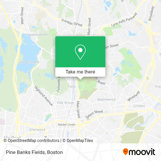
See Pine Banks Fields, Melrose, on the map
Public Transit to Pine Banks Fields in Melrose
Wondering how to get to Pine Banks Fields in Melrose? Moovit helps you find the best way to get to Pine Banks Fields with step-by-step directions from the nearest public transit station.
Moovit provides free maps and live directions to help you navigate through your city. View schedules, routes, timetables, and find out how long does it take to get to Pine Banks Fields in real time.
Looking for the nearest stop or station to Pine Banks Fields? Check out this list of stops closest to your destination: Main St @ Sylvan St; Pleasant St @ Converse Ln; Oak Grove.
Bus: 131, 137, 132.Train: HAVERHILL, ORANGE LINE.Subway: ORANGE LINE.
Want to see if there’s another route that gets you there at an earlier time? Moovit helps you find alternative routes or times. Get directions from and directions to Pine Banks Fields easily from the Moovit App or Website.
We make riding to Pine Banks Fields easy, which is why over 1.7 million users, including users in Melrose, trust Moovit as the best app for public transit. You don’t need to download an individual bus app or train app, Moovit is your all-in-one transit app that helps you find the best bus time or train time available.
For information on prices of bus, subway and train, costs and ride fares to Pine Banks Fields, please check the Moovit app.
Use the app to navigate to popular places including to the airport, hospital, stadium, grocery store, mall, coffee shop, school, college, and university.
Pine Banks Fields Address: 1 Main St street in Melrose
- Simple Fitness,
- Melrose Chiropractor,
- New Horizon Locksmith,
- 1-182nd Infantry Regiment,
- Hinge Fitness,
- ChargePoint,
- Housing Oakwood,
- Windsor at Oak Grove Apartments,
- Steve Gyurina Photography,
- Towne Estates,
- Little Sprouts,
- New England Painting and Contracting,
- Oak Grove - East,
- Mando Fitness Gym,
- Cimetrics,
- Stephen's Towing & Auto Repair,
- Oak Grove Station,
- mbta bus 132,
- Melrose Wakefield Hospital,
- Hurd School Elementary
Places Near Pine Banks Fields (Melrose)
- Boston Common, Boston,
- Quincy Market, Boston,
- Seaport District, Boston,
- Wang Theater, Boston,
- North End, Boston,
- House Of Blues, Boston,
- Boston Children's Hospital, Boston,
- Prudential Center, Boston,
- Boston Medical Center, Boston,
- Museum Of Science, Boston,
- Boston Convention & Exhibition Center, Boston,
- Wilbur Theatre, Boston,
- Td Garden, Boston,
- Cheers, Boston,
- Massachusetts General Hospital, Boston,
- Mgm Music Hall, Boston,
- Faneuil Hall, Boston,
- Leader Bank Pavilion (Leader Bank Pavillion), Boston,
- Isabella Stewart Gardner Museum, Boston,
- Castle Island, Boston
How to get to popular places in Boston with public transit
Get around Melrose by public transit!
Traveling around Melrose has never been so easy. See step by step directions as you travel to any attraction, street or major public transit station. View bus and train schedules, arrival times, service alerts and detailed routes on a map, so you know exactly how to get to anywhere in Melrose.
When traveling to any destination around Melrose use Moovit's Live Directions with Get Off Notifications to know exactly where and how far to walk, how long to wait for your line, and how many stops are left. Moovit will alert you when it's time to get off — no need to constantly re-check whether yours is the next stop.
Wondering how to use public transit in Melrose or how to pay for public transit in Melrose? Moovit public transit app can help you navigate your way with public transit easily, and at minimum cost. It includes public transit fees, ticket prices, and costs. Looking for a map of Melrose public transit lines? Moovit public transit app shows all public transit maps in Melrose with all Bus, Train, Subway and Ferry routes and stops on an interactive map.
Boston has 4 transit type(s), including: Bus, Train, Subway and Ferry, operated by several transit agencies, including MBTA, Southeastern Regional Transit Authority, MetroWest Regional Transit Authority, Rhode Island Public Transit Authority, WRTA, Lowell Regional Transit Authority, Merrimack Valley Transit, Montachusett Regional Transit Authority, Cape Cod Regional Transit Authority, Brockton Area Transit Authority, Martha's Vineyard Transit Authority, the WAVE - Nantucket Regional Transit Authority, GATRA, Cape Ann Transportation Authority and Massport