Directions to Pinkham House (Quincy) with public transportation
The following transit lines have routes that pass near Pinkham House
 Bus: 210, 215, 245, 211, RED LINE SHUTTLE.
- Train: FALL RIVER/NEW BEDFORD, GREENBUSH.
- Subway: RED LINE.
How to get to Pinkham House by bus?
Click on the bus route to see step by step directions with maps, line arrival times and updated time schedules.
From Franklin Park Zoo, Boston
62 minFrom Georgetown, Massachusetts, Boston
73 minFrom Hebrew Rehab Center, Boston
80 minFrom Encore, Boston
77 minFrom Amazon Boston, Boston
109 minFrom Dudley Station, Boston
58 minFrom Jamaica Pond, Boston
68 minFrom Samuel Adams Brewery, Boston
77 minFrom Boston Medical Center / Shapiro Center, Boston
72 minFrom Best Buy, Boston
62 min
How to get to Pinkham House by train?
Click on the train route to see step by step directions with maps, line arrival times and updated time schedules.
From Franklin Park Zoo, Boston
103 minFrom Georgetown, Massachusetts, Boston
99 minFrom Hebrew Rehab Center, Boston
88 minFrom Encore, Boston
67 minFrom Amazon Boston, Boston
58 minFrom Dudley Station, Boston
74 minFrom Jamaica Pond, Boston
91 minFrom Samuel Adams Brewery, Boston
91 minFrom Boston Medical Center / Shapiro Center, Boston
96 minFrom Best Buy, Boston
89 min
How to get to Pinkham House by subway?
Click on the subway route to see step by step directions with maps, line arrival times and updated time schedules.
From Franklin Park Zoo, Boston
71 minFrom Hebrew Rehab Center, Boston
72 minFrom Encore, Boston
46 minFrom Amazon Boston, Boston
40 minFrom Dudley Station, Boston
53 minFrom Jamaica Pond, Boston
61 minFrom Samuel Adams Brewery, Boston
49 minFrom Boston Medical Center / Shapiro Center, Boston
43 minFrom Best Buy, Boston
33 min
Bus stops near Pinkham House in Quincy
Subway station near Pinkham House in Quincy
- Wollaston, 40 min walk,VIEW
Bus lines to Pinkham House in Quincy
- 211, Squantum - Quincy Center,VIEW
- 245, Mattapan - Quincy Center,VIEW
- RED LINE SHUTTLE, Ashmont - Braintree,VIEW
- RED LINE SHUTTLE, Braintree - Broadway,VIEW
- RED LINE SHUTTLE, Braintree - JFK/UMass (Shuttle),VIEW
- RED LINE SHUTTLE, Braintree - North Quincy (Shuttle),VIEW
- RED LINE SHUTTLE, Quincy Center - Broadway (Shuttle),VIEW
- 217, Bryant Ave & Upton St,VIEW
- 210, Fields Corner,VIEW
What are the closest stations to Pinkham House?
The closest stations to Pinkham House are:
- Newport Ave @ Beale St is 67 yards away, 1 min walk.
- N Central @ Beale St is 155 yards away, 2 min walk.
- Hancock St @ Fenno St is 668 yards away, 8 min walk.
- Wollaston is 3376 yards away, 40 min walk.
Which bus lines stop near Pinkham House?
These bus lines stop near Pinkham House: 210, 215, 245.
Which train lines stop near Pinkham House?
These train lines stop near Pinkham House: FALL RIVER/NEW BEDFORD, GREENBUSH.
Which subway line stops near Pinkham House?
RED LINE (Ashmont/Braintree)
What’s the nearest bus station to Pinkham House in Quincy?
The nearest bus station to Pinkham House in Quincy is Newport Ave @ Beale St. It’s a 1 min walk away.
What time is the first subway to Pinkham House in Quincy?
The RED LINE is the first subway that goes to Pinkham House in Quincy. It stops nearby at 5:18 AM.
What time is the last subway to Pinkham House in Quincy?
The RED LINE is the last subway that goes to Pinkham House in Quincy. It stops nearby at 1:49 AM.
What time is the first bus to Pinkham House in Quincy?
The 210 is the first bus that goes to Pinkham House in Quincy. It stops nearby at 5:02 AM.
What time is the last bus to Pinkham House in Quincy?
The 210 is the last bus that goes to Pinkham House in Quincy. It stops nearby at 1:13 AM.
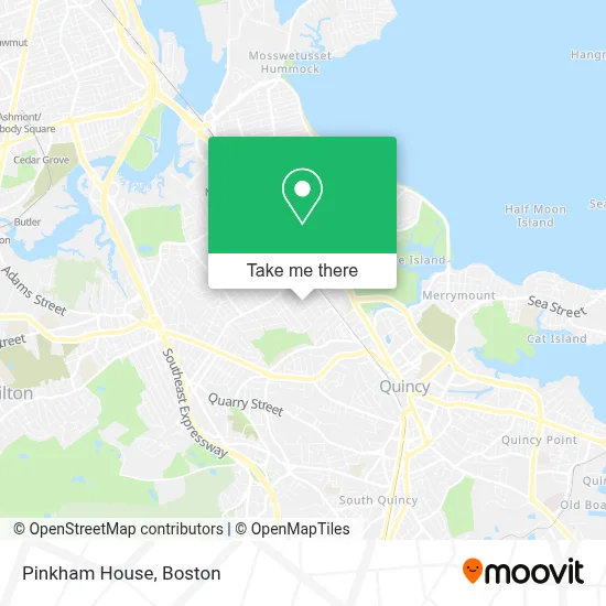
See Pinkham House, Quincy, on the map
Public Transit to Pinkham House in Quincy
Wondering how to get to Pinkham House in Quincy? Moovit helps you find the best way to get to Pinkham House with step-by-step directions from the nearest public transit station.
Moovit provides free maps and live directions to help you navigate through your city. View schedules, routes, timetables, and find out how long does it take to get to Pinkham House in real time.
Looking for the nearest stop or station to Pinkham House? Check out this list of stops closest to your destination: Newport Ave @ Beale St; N Central @ Beale St; Hancock St @ Fenno St; Wollaston.
Bus: 210, 215, 245, 211, RED LINE SHUTTLE, RED LINE SHUTTLE, RED LINE SHUTTLE, 217.Train: FALL RIVER/NEW BEDFORD, GREENBUSH.Subway: RED LINE.
Want to see if there’s another route that gets you there at an earlier time? Moovit helps you find alternative routes or times. Get directions from and directions to Pinkham House easily from the Moovit App or Website.
We make riding to Pinkham House easy, which is why over 1.7 million users, including users in Quincy, trust Moovit as the best app for public transit. You don’t need to download an individual bus app or train app, Moovit is your all-in-one transit app that helps you find the best bus time or train time available.
For information on prices of bus, subway and train, costs and ride fares to Pinkham House, please check the Moovit app.
Use the app to navigate to popular places including to the airport, hospital, stadium, grocery store, mall, coffee shop, school, college, and university.
Pinkham House Address: 79 Winthrop Ave street in Quincy
- Vietnamese Baptist Of Wollaston Church,
- Mel O' Musical Inc,
- House at 94 Grandview Avenue,
- Alfred H. Richards House,
- Beertopia,
- Franklin G Stearns Attorney,
- John M Edwards Attorney,
- Snow Raymond,
- Presidential Point Quincy,
- Integrated Wellness,
- Body Escape Spa,
- Bloom Speech Language & Literacy,
- Venus Hair Salon,
- Gavin Foundation / Gavin Quincy Ats / CSS,
- Tp Sloane Inc,
- Yee's Southern Lions,
- Fellsway Painting,
- Wollaston, Massachusetts,
- Locksmith Shop,
- Gary's Auto Shine
Places Near Pinkham House (Quincy)
- Isabella Stewart Gardner Museum, Boston,
- House Of Blues, Boston,
- Boston Common, Boston,
- Cheers, Boston,
- Leader Bank Pavilion (Leader Bank Pavillion), Boston,
- Wang Theater, Boston,
- Quincy Market, Boston,
- Boston Convention & Exhibition Center, Boston,
- Massachusetts General Hospital, Boston,
- Mgm Music Hall, Boston,
- Seaport District, Boston,
- Wilbur Theatre, Boston,
- Castle Island, Boston,
- Boston Medical Center, Boston,
- Prudential Center, Boston,
- North End, Boston,
- Museum Of Science, Boston,
- Boston Children's Hospital, Boston,
- Td Garden, Boston,
- Faneuil Hall, Boston
How to get to popular places in Boston with public transit
Get around Quincy by public transit!
Traveling around Quincy has never been so easy. See step by step directions as you travel to any attraction, street or major public transit station. View bus and train schedules, arrival times, service alerts and detailed routes on a map, so you know exactly how to get to anywhere in Quincy.
When traveling to any destination around Quincy use Moovit's Live Directions with Get Off Notifications to know exactly where and how far to walk, how long to wait for your line, and how many stops are left. Moovit will alert you when it's time to get off — no need to constantly re-check whether yours is the next stop.
Wondering how to use public transit in Quincy or how to pay for public transit in Quincy? Moovit public transit app can help you navigate your way with public transit easily, and at minimum cost. It includes public transit fees, ticket prices, and costs. Looking for a map of Quincy public transit lines? Moovit public transit app shows all public transit maps in Quincy with all Bus, Train, Subway and Ferry routes and stops on an interactive map.
Boston has 4 transit type(s), including: Bus, Train, Subway and Ferry, operated by several transit agencies, including MBTA, Southeastern Regional Transit Authority, MetroWest Regional Transit Authority, Rhode Island Public Transit Authority, WRTA, Lowell Regional Transit Authority, Merrimack Valley Transit, Montachusett Regional Transit Authority, Cape Cod Regional Transit Authority, Brockton Area Transit Authority, Martha's Vineyard Transit Authority, the WAVE - Nantucket Regional Transit Authority, GATRA, Cape Ann Transportation Authority and Massport