Directions to Pinnacle Assets (Boston) with public transportation
The following transit lines have routes that pass near Pinnacle Assets
 Bus: 38, 39, 51, 35.
- Train: NEEDHAM, FRANKLIN/FOXBORO, ORANGE LINE, PROVIDENCE/STOUGHTON.
- Subway: ORANGE LINE.
How to get to Pinnacle Assets by bus?
Click on the bus route to see step by step directions with maps, line arrival times and updated time schedules.
From Newton-Wellesley Hospital, Newton
124 minFrom South Bay Center, Boston
52 minFrom Bell In Hand Tavern, Boston
79 minFrom WGBH, Boston
35 minFrom Holiday Inn Express & Suites Boston - Cambridge, Cambridge
93 minFrom L.L.Bean, Boston
79 minFrom Westin Copley Place Hotel Boston, Boston
40 minFrom Alumni Stadium, Newton
58 minFrom ICA, Boston
81 minFrom Union Oyster House, Boston
79 min
How to get to Pinnacle Assets by train?
Click on the train route to see step by step directions with maps, line arrival times and updated time schedules.
How to get to Pinnacle Assets by subway?
Click on the subway route to see step by step directions with maps, line arrival times and updated time schedules.
From Newton-Wellesley Hospital, Newton
104 minFrom South Bay Center, Boston
71 minFrom Bell In Hand Tavern, Boston
57 minFrom WGBH, Boston
49 minFrom Holiday Inn Express & Suites Boston - Cambridge, Cambridge
73 minFrom L.L.Bean, Boston
70 minFrom Westin Copley Place Hotel Boston, Boston
52 minFrom Alumni Stadium, Newton
108 minFrom ICA, Boston
72 minFrom Union Oyster House, Boston
57 min
Bus stops near Pinnacle Assets in Boston
Train stations near Pinnacle Assets in Boston
Bus lines to Pinnacle Assets in Boston
What are the closest stations to Pinnacle Assets?
The closest stations to Pinnacle Assets are:
- Centre St Opp Buchanan Rd is 45 yards away, 1 min walk.
- Weld St Opp Wedgewood Rd is 313 yards away, 4 min walk.
- Roslindale Village is 906 yards away, 11 min walk.
- Forest Hills is 2809 yards away, 33 min walk.
Which bus lines stop near Pinnacle Assets?
These bus lines stop near Pinnacle Assets: 38, 39, 51.
Which train line stops near Pinnacle Assets?
NEEDHAM (#625 | Needham Heights)
Which subway line stops near Pinnacle Assets?
ORANGE LINE (Forest Hills)
What’s the nearest train station to Pinnacle Assets in Boston?
The nearest train station to Pinnacle Assets in Boston is Roslindale Village. It’s a 11 min walk away.
What’s the nearest bus station to Pinnacle Assets in Boston?
The nearest bus station to Pinnacle Assets in Boston is Centre St Opp Buchanan Rd. It’s a 1 min walk away.
What time is the first subway to Pinnacle Assets in Boston?
The ORANGE LINE is the first subway that goes to Pinnacle Assets in Boston. It stops nearby at 5:15 AM.
What time is the last subway to Pinnacle Assets in Boston?
The ORANGE LINE is the last subway that goes to Pinnacle Assets in Boston. It stops nearby at 1:58 AM.
What time is the first train to Pinnacle Assets in Boston?
The NEEDHAM is the first train that goes to Pinnacle Assets in Boston. It stops nearby at 7:22 AM.
What time is the last train to Pinnacle Assets in Boston?
The PROVIDENCE/STOUGHTON is the last train that goes to Pinnacle Assets in Boston. It stops nearby at 12:08 AM.
What time is the first bus to Pinnacle Assets in Boston?
The 38 is the first bus that goes to Pinnacle Assets in Boston. It stops nearby at 5:37 AM.
What time is the last bus to Pinnacle Assets in Boston?
The 38 is the last bus that goes to Pinnacle Assets in Boston. It stops nearby at 11:25 PM.
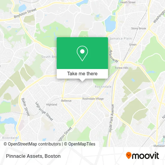
See Pinnacle Assets, Boston, on the map
Public Transit to Pinnacle Assets in Boston
Wondering how to get to Pinnacle Assets in Boston? Moovit helps you find the best way to get to Pinnacle Assets with step-by-step directions from the nearest public transit station.
Moovit provides free maps and live directions to help you navigate through your city. View schedules, routes, timetables, and find out how long does it take to get to Pinnacle Assets in real time.
Looking for the nearest stop or station to Pinnacle Assets? Check out this list of stops closest to your destination: Centre St Opp Buchanan Rd; Weld St Opp Wedgewood Rd; Roslindale Village; Forest Hills.
Bus: 38, 39, 51, 35.Train: NEEDHAM, FRANKLIN/FOXBORO, ORANGE LINE, PROVIDENCE/STOUGHTON.Subway: ORANGE LINE.
Want to see if there’s another route that gets you there at an earlier time? Moovit helps you find alternative routes or times. Get directions from and directions to Pinnacle Assets easily from the Moovit App or Website.
We make riding to Pinnacle Assets easy, which is why over 1.7 million users, including users in Boston, trust Moovit as the best app for public transit. You don’t need to download an individual bus app or train app, Moovit is your all-in-one transit app that helps you find the best bus time or train time available.
For information on prices of bus, subway and train, costs and ride fares to Pinnacle Assets, please check the Moovit app.
Use the app to navigate to popular places including to the airport, hospital, stadium, grocery store, mall, coffee shop, school, college, and university.
Pinnacle Assets Address: 101 Ardale St street in Boston
- Spanish Immersion Rainbow Home Daycare,
- Leigh Alixandre,
- Mary Forde,
- Master Solutions Construction,
- Foreign & Domestic Auto Services,
- Delta Glass Service,
- Arnold Arboretum of Harva,
- Roslindale Wetlands Urban Wild Park,
- Boston for the Dogs,
- Limitless Horizons Ixil,
- Fallon Field,
- Beadcraft Etc,
- Qualter General Contractor,
- Hebrew Rehabilitation Center Volunteer Services,
- Hebrew Rehab Center,
- Spaulding Rehab,
- Fallon Field (Fallon Field, Roslindale),
- Arnold Arboretum-Walter St Gate (Arnold Arboretum-Center Street Gate),
- Arnold Arboretum-Mendum Street Gate,
- Arbri Cafe
Places Near Pinnacle Assets (Boston)
- Td Garden, Boston,
- Mgm Music Hall, Boston,
- Seaport District, Boston,
- Isabella Stewart Gardner Museum, Boston,
- Boston Medical Center, Boston,
- Wilbur Theatre, Boston,
- Prudential Center, Boston,
- Cheers, Boston,
- Quincy Market, Boston,
- House Of Blues, Boston,
- Boston Children's Hospital, Boston,
- Boston Common, Boston,
- Boston Convention & Exhibition Center, Boston,
- Massachusetts General Hospital, Boston,
- Museum Of Science, Boston,
- Wang Theater, Boston,
- Leader Bank Pavilion (Leader Bank Pavillion), Boston,
- North End, Boston,
- Faneuil Hall, Boston,
- Castle Island, Boston
How to get to popular places in Boston with public transit
Get around Boston by public transit!
Traveling around Boston has never been so easy. See step by step directions as you travel to any attraction, street or major public transit station. View bus and train schedules, arrival times, service alerts and detailed routes on a map, so you know exactly how to get to anywhere in Boston.
When traveling to any destination around Boston use Moovit's Live Directions with Get Off Notifications to know exactly where and how far to walk, how long to wait for your line, and how many stops are left. Moovit will alert you when it's time to get off — no need to constantly re-check whether yours is the next stop.
Wondering how to use public transit in Boston or how to pay for public transit in Boston? Moovit public transit app can help you navigate your way with public transit easily, and at minimum cost. It includes public transit fees, ticket prices, and costs. Looking for a map of Boston public transit lines? Moovit public transit app shows all public transit maps in Boston with all Bus, Train, Subway and Ferry routes and stops on an interactive map.
Boston has 4 transit type(s), including: Bus, Train, Subway and Ferry, operated by several transit agencies, including MBTA, Southeastern Regional Transit Authority, MetroWest Regional Transit Authority, Rhode Island Public Transit Authority, WRTA, Lowell Regional Transit Authority, Merrimack Valley Transit, Montachusett Regional Transit Authority, Cape Cod Regional Transit Authority, Brockton Area Transit Authority, Martha's Vineyard Transit Authority, the WAVE - Nantucket Regional Transit Authority, GATRA, Cape Ann Transportation Authority and Massport