How to get to Pinta Comex by bus?
Click on the bus route to see step by step directions with maps, line arrival times and updated time schedules.
From Centro Antirrabico Municipal, Aguascalientes
38 minFrom Pintores Mexicanos, Aguascalientes
44 minFrom Fraccionamiento Camino Real, Aguascalientes
51 minFrom Quintas Miguel Gerónimo, Aguascalientes
55 minFrom Escuela Secundaria Tecnica #37, Aguascalientes
28 minFrom Fraccionamiento Viñedos Del Sur Javer Aguascalientes, Aguascalientes
35 minFrom Tec de Monterrey Campus Ags, Aguascalientes
45 minFrom Fraccionamiento Viña Antigua, Aguascalientes
63 minFrom Chedraui Select, Aguascalientes
41 min
Bus stops near Pinta Comex in Aguascalientes
Bus lines to Pinta Comex in Aguascalientes
- RUTA 28, Jesús María,VIEW
- RUTA 37, Hacienda San Marcos,VIEW
- RUTA 42, Bellavista,VIEW
- RUTA 02, Centro (Jardín Carpio),VIEW
- RUTA 07, Villa Las Palmas,VIEW
- RUTA 40, Terminal Oriente - Terminal Oriente (S),VIEW
- RUTA 40, Terminal Oriente - Terminal Oriente (N),VIEW
- RUTA 18, Lunaria - UAA,VIEW
- RUTA 36, Lunaria - Centro (Mercado Terán),VIEW
What are the closest stations to Pinta Comex?
The closest stations to Pinta Comex are:
- Avenida Héroe De Nacozari, 204 is 162 meters away, 3 min walk.
- Avenida Héroe De Nacozari, Lb is 360 meters away, 5 min walk.
- Avenida Aguascalientes Sur, 908a is 448 meters away, 6 min walk.
- Avenida Aguascalientes Sur, 1100 is 621 meters away, 8 min walk.
Which bus lines stop near Pinta Comex?
These bus lines stop near Pinta Comex: RUTA 02, RUTA 28, RUTA 37, RUTA 40.
What’s the nearest bus station to Pinta Comex in Aguascalientes?
The nearest bus station to Pinta Comex in Aguascalientes is Avenida Héroe De Nacozari, 204. It’s a 3 min walk away.
What time is the first bus to Pinta Comex in Aguascalientes?
The RUTA 40 is the first bus that goes to Pinta Comex in Aguascalientes. It stops nearby at 5:56 AM.
What time is the last bus to Pinta Comex in Aguascalientes?
The RUTA 07 is the last bus that goes to Pinta Comex in Aguascalientes. It stops nearby at 10:56 PM.
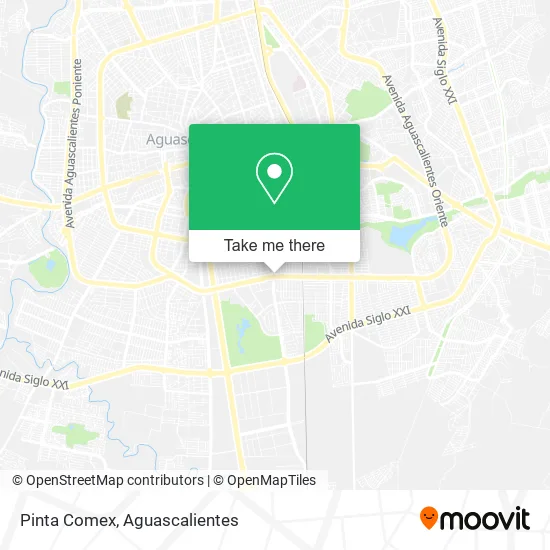
See Pinta Comex, Aguascalientes, on the map
Public Transit to Pinta Comex in Aguascalientes
Wondering how to get to Pinta Comex in Aguascalientes? Moovit helps you find the best way to get to Pinta Comex with step-by-step directions from the nearest public transit station.
Moovit provides free maps and live directions to help you navigate through your city. View schedules, routes, timetables, and find out how long does it take to get to Pinta Comex in real time.
Looking for the nearest stop or station to Pinta Comex? Check out this list of stops closest to your destination: Avenida Héroe De Nacozari; Avenida Héroe De Nacozari; Avenida Aguascalientes Sur; Avenida Aguascalientes Sur.
Bus: RUTA 02, RUTA 28, RUTA 37, RUTA 40, RUTA 42, RUTA 07, RUTA 18, RUTA 36.
Want to see if there’s another route that gets you there at an earlier time? Moovit helps you find alternative routes or times. Get directions from and directions to Pinta Comex easily from the Moovit App or Website.
We make riding to Pinta Comex easy, which is why over 1.5 million users, including users in Aguascalientes, trust Moovit as the best app for public transit. You don’t need to download an individual bus app or train app, Moovit is your all-in-one transit app that helps you find the best bus time or train time available.
For information on prices of bus, costs and ride fares to Pinta Comex, please check the Moovit app.
Use the app to navigate to popular places including to the airport, hospital, stadium, grocery store, mall, coffee shop, school, college, and university.
Pinta Comex Address: Pinta Comex, Avenida Aguascalientes Sur 102, Fraccionamiento México, 20270 Aguascalientes, Aguascal street in Aguascalientes
- BURGER KING,
- Araceli Frausto,
- Cemex Planta Concreto Aguascalientes Sur,
- Avenida Héroe de Nacozari Sur,
- Kiel the Barber,
- Ofitodo,
- Grupo de Danza Folklorica Aztlan Siglo XXI,
- Imprenta Max,
- Rio Pescaderia,
- Prolongación Josefa Ortiz de Domínguez 707,
- Copy Dos,
- Vulcanizadora 24 Horas,
- Electroauto Service,
- Mozzafiato Cafetería,
- Chipitin Boots,
- Llantas y Alineaciones Miguel,
- Patio Sur,
- El Mono,
- Grupo Automotriz Luna,
- Tienda de Abarrotes Hernandez
Places Near Pinta Comex (Aguascalientes)
- Imss Clinica 1, Aguascalientes,
- Nuevo Hospital Hidalgo, Aguascalientes,
- Ciudad industrial, Aguascalientes,
- Jesús María, Aguascalientes,
- Hospital Imss No. 3, Aguascalientes,
- Parque Las Tres Centurias, Aguascalientes,
- Centro Comercial Altaria, Aguascalientes,
- Aeropuerto de Aguascalientes S.A. de C.V., Aguascalientes,
- La Isla San Marcos, Aguascalientes,
- Isla San Marcos, Aguascalientes,
- Central De Autobuses, Aguascalientes,
- Villas de Nuestra Señora de la Asunción, Aguascalientes,
- Villasuncion, Aguascalientes,
- Universidad Autónoma de Aguascalientes, Aguascalientes,
- Agropecuario, Aguascalientes,
- Blvd. Luis Donaldo Colosio, Aguascalientes,
- Centro, Aguascalientes,
- ESPACIOS, Aguascalientes,
- clinica 3 uaa, Aguascalientes,
- Terminal De Combis, Aguascalientes
How to get to popular places in Aguascalientes with public transit
Get around Aguascalientes by public transit!
Traveling around Aguascalientes has never been so easy. See step by step directions as you travel to any attraction, street or major public transit station. View bus and train schedules, arrival times, service alerts and detailed routes on a map, so you know exactly how to get to anywhere in Aguascalientes.
When traveling to any destination around Aguascalientes use Moovit's Live Directions with Get Off Notifications to know exactly where and how far to walk, how long to wait for your line, and how many stops are left. Moovit will alert you when it's time to get off — no need to constantly re-check whether yours is the next stop.
Wondering how to use public transit in Aguascalientes or how to pay for public transit in Aguascalientes? Moovit public transit app can help you navigate your way with public transit easily, and at minimum cost. It includes public transit fees, ticket prices, and costs. Looking for a map of Aguascalientes public transit lines? Moovit public transit app shows all public transit maps in Aguascalientes with all bus routes and stops on an interactive map.
Aguascalientes has 1 transit type(s), including: bus, operated by several transit agencies, including Coordinación General de Movilidad