See Pittsford Green Historic District, Rutland, on the map
Directions to Pittsford Green Historic District (Rutland) with public transportation
The following transit lines have routes that pass near Pittsford Green Historic District
 Bus:
Bus:
How to get to Pittsford Green Historic District by bus?
Click on the bus route to see step by step directions with maps, line arrival times and updated time schedules.
Bus stations near Pittsford Green Historic District in Rutland
- Pittsford Village Green,1 min walk,
- Pittsford Post Office,2 min walk,
Bus lines to Pittsford Green Historic District in Rutland
- RC,Academy Street,
- MIDDLEBURY CONNECTOR,Academy Street Middlebury,
What are the closest stations to Pittsford Green Historic District?
The closest stations to Pittsford Green Historic District are:
- Pittsford Village Green is 10 yards away, 1 min walk.
- Pittsford Post Office is 93 yards away, 2 min walk.
Which bus lines stop near Pittsford Green Historic District?
These bus lines stop near Pittsford Green Historic District: MIDDLEBURY CONNECTOR, RC.
What’s the nearest bus stop to Pittsford Green Historic District in Rutland?
The nearest bus stop to Pittsford Green Historic District in Rutland is Pittsford Village Green. It’s a 1 min walk away.
See Pittsford Green Historic District, Rutland, on the map
Public Transit to Pittsford Green Historic District in Rutland
Wondering how to get to Pittsford Green Historic District in Rutland, United States? Moovit helps you find the best way to get to Pittsford Green Historic District with step-by-step directions from the nearest public transit station.
Moovit provides free maps and live directions to help you navigate through your city. View schedules, routes, timetables, and find out how long does it take to get to Pittsford Green Historic District in real time.
Looking for the nearest stop or station to Pittsford Green Historic District? Check out this list of stops closest to your destination: Pittsford Village Green; Pittsford Post Office.
Bus:
Want to see if there’s another route that gets you there at an earlier time? Moovit helps you find alternative routes or times. Get directions from and directions to Pittsford Green Historic District easily from the Moovit App or Website.
We make riding to Pittsford Green Historic District easy, which is why over 1.5 million users, including users in Rutland, trust Moovit as the best app for public transit. You don’t need to download an individual bus app or train app, Moovit is your all-in-one transit app that helps you find the best bus time or train time available.
For information on prices of bus, costs and ride fares to Pittsford Green Historic District, please check the Moovit app.
Use the app to navigate to popular places including to the airport, hospital, stadium, grocery store, mall, coffee shop, school, college, and university.
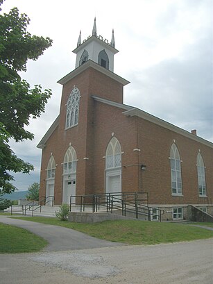
Pittsford Green Historic District Address: Franklin Street street in Rutland
Attractions near Pittsford Green Historic District
Pittsford,Walker Memorial Library,Pittsford Town Hall,Pittsford Post Office,Congregational Burial Yard,Pittsford Congregational Church,Old Cemetery,Vermont Police Academy,Vermont Police Academy Library,Pittsford Fire Department,Evergreen Cemetery,Lothrop School,Saint Alphonsus Cemetery,New England Maple Museum,Pittsford Recreation Area,Vermont Sanatorium,Caverly Preventorium (Historical),Pittsford Fire Department - Fire Service Training,Depot Covered Bridge,GardenHow to get to popular attractions in Rutland with public transit
Brandon, VT, Rutland,Leicester, VT, Addison,The Vermont Country Store Warehouse, Rutland,Killington Ski Resort, Rutland,Richford, VT,Derby Line, VT, Orleans,West Dover, VT, Windham,Rutland Train Station (RUD) - Amtrak, Rutland,UVM Tunnel, Chittenden,Shelburne, VT, Chittenden,St Johnsbury, VT, Caledonia,Montpelier, VT,Ben & Jerry's,I-89 (Exit 18),Fort Ethan Allen, Chittenden,Newport, VT, Orleans,White River Junction Train Station (WRJ) - Amtrak, Windsor,Rt-4 East, Rutland,Lyndonville, VT, Caledonia,CCTA #5: Pine Street, ChittendenGet around Rutland by public transit!
Traveling around Rutland has never been so easy. See step by step directions as you travel to any attraction, street or major public transit station. View bus and train schedules, arrival times, service alerts and detailed routes on a map, so you know exactly how to get to anywhere in Rutland.
When traveling to any destination around Rutland use Moovit's Live Directions with Get Off Notifications to know exactly where and how far to walk, how long to wait for your line, and how many stops are left. Moovit will alert you when it's time to get off — no need to constantly re-check whether yours is the next stop.
Wondering how to use public transit in Rutland or how to pay for public transit in Rutland? Moovit public transit app can help you navigate your way with public transit easily, and at minimum cost. It includes public transit fees, ticket prices, and costs. Looking for a map of Rutland public transit lines? Moovit public transit app shows all public transit maps in Rutland with all bus routes and stops on an interactive map.
Rutland has 1 transit type(s), including: bus, operated by several transit agencies, including Green Mountain Transit, Wilmington MOOver, Advance Transit, Vermont Translines, Rockingham MOOver, The Bus (Marble Valley Regional Transit District), Green Mountain Express, Rural Community Transportation, Addison County Transit Resources, Stagecoach Transportation Services, Amtrak, Greyhound-us and FlixBus-us