Directions to Pizza Bella (Boston) with public transportation
The following transit lines have routes that pass near Pizza Bella
 Bus: EMERSON HOSPITAL SHUTTLE, HARVARD COMMUTER SHUTTLE.
- Train: FITCHBURG.
How to get to Pizza Bella by bus?
Click on the bus route to see step by step directions with maps, line arrival times and updated time schedules.
Bus stop near Pizza Bella in Boston
- Business Plaza at 285 Ayer Rd, 8 min walk,VIEW
Train station near Pizza Bella in Boston
- Ayer, 45 min walk,VIEW
Bus lines to Pizza Bella in Boston
What are the closest stations to Pizza Bella?
The closest stations to Pizza Bella are:
- Business Plaza at 285 Ayer Rd is 561 yards away, 8 min walk.
- Ayer is 3833 yards away, 45 min walk.
Which bus lines stop near Pizza Bella?
These bus lines stop near Pizza Bella: EMERSON HOSPITAL SHUTTLE, HARVARD COMMUTER SHUTTLE.
What’s the nearest bus station to Pizza Bella in Boston?
The nearest bus station to Pizza Bella in Boston is Business Plaza at 285 Ayer Rd. It’s a 8 min walk away.
What time is the first train to Pizza Bella in Boston?
The FITCHBURG is the first train that goes to Pizza Bella in Boston. It stops nearby at 4:53 AM.
What time is the last train to Pizza Bella in Boston?
The FITCHBURG is the last train that goes to Pizza Bella in Boston. It stops nearby at 12:53 AM.
What time is the first bus to Pizza Bella in Boston?
The HARVARD COMMUTER SHUTTLE is the first bus that goes to Pizza Bella in Boston. It stops nearby at 6:25 AM.
What time is the last bus to Pizza Bella in Boston?
The HARVARD COMMUTER SHUTTLE is the last bus that goes to Pizza Bella in Boston. It stops nearby at 6:45 PM.
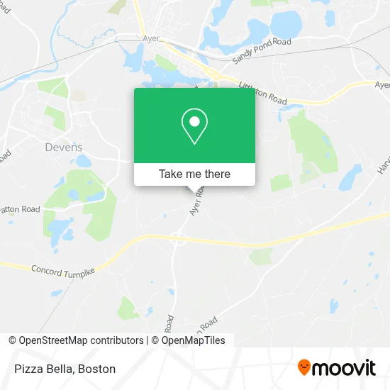
See Pizza Bella, Boston, on the map
Public Transit to Pizza Bella in Boston
Wondering how to get to Pizza Bella in Boston? Moovit helps you find the best way to get to Pizza Bella with step-by-step directions from the nearest public transit station.
Moovit provides free maps and live directions to help you navigate through your city. View schedules, routes, timetables, and find out how long does it take to get to Pizza Bella in real time.
Looking for the nearest stop or station to Pizza Bella? Check out this list of stops closest to your destination: Business Plaza at 285 Ayer Rd; Ayer.
Bus: EMERSON HOSPITAL SHUTTLE, HARVARD COMMUTER SHUTTLE.Train: FITCHBURG.
Want to see if there’s another route that gets you there at an earlier time? Moovit helps you find alternative routes or times. Get directions from and directions to Pizza Bella easily from the Moovit App or Website.
We make riding to Pizza Bella easy, which is why over 1.7 million users, including users in Boston, trust Moovit as the best app for public transit. You don’t need to download an individual bus app or train app, Moovit is your all-in-one transit app that helps you find the best bus time or train time available.
For information on prices of bus and train, costs and ride fares to Pizza Bella, please check the Moovit app.
Use the app to navigate to popular places including to the airport, hospital, stadium, grocery store, mall, coffee shop, school, college, and university.
Pizza Bella Address: 231 Ayer Rd street in Boston
- Watjus Electric,
- Cindy Matchett, Wedding Officiant and Interfaith Minister,
- Craig S Gustafson MD,
- Protime Transportation,
- Millbrook Psychiatric,
- Jeffrey G Resnick DPM,
- Labelle Roofing,
- Harvard Family Medicine,
- George & Company,
- Berwind,
- David E Ross,
- FedEx,
- Winbridge Group,
- Bairesdev,
- Golden Days Social Circle and Health Services,
- Global Devcenter,
- The Authentic Leadership Institute,
- Harvard Post Newspaper,
- Robert F Casey Jr PC,
- Robert Therrien Architects
Places Near Pizza Bella (Boston)
- Quincy Market, Boston,
- Museum Of Science, Boston,
- Td Garden, Boston,
- Wang Theater, Boston,
- Boston Children's Hospital, Boston,
- Castle Island, Boston,
- Wilbur Theatre, Boston,
- Massachusetts General Hospital, Boston,
- Cheers, Boston,
- Prudential Center, Boston,
- Faneuil Hall, Boston,
- Boston Common, Boston,
- Boston Convention & Exhibition Center, Boston,
- Mgm Music Hall, Boston,
- Boston Medical Center, Boston,
- House Of Blues, Boston,
- Isabella Stewart Gardner Museum, Boston,
- North End, Boston,
- Seaport District, Boston,
- Leader Bank Pavilion (Leader Bank Pavillion), Boston
How to get to popular places in Boston with public transit
Get around Boston by public transit!
Traveling around Boston has never been so easy. See step by step directions as you travel to any attraction, street or major public transit station. View bus and train schedules, arrival times, service alerts and detailed routes on a map, so you know exactly how to get to anywhere in Boston.
When traveling to any destination around Boston use Moovit's Live Directions with Get Off Notifications to know exactly where and how far to walk, how long to wait for your line, and how many stops are left. Moovit will alert you when it's time to get off — no need to constantly re-check whether yours is the next stop.
Wondering how to use public transit in Boston or how to pay for public transit in Boston? Moovit public transit app can help you navigate your way with public transit easily, and at minimum cost. It includes public transit fees, ticket prices, and costs. Looking for a map of Boston public transit lines? Moovit public transit app shows all public transit maps in Boston with all Bus, Train, Subway and Ferry routes and stops on an interactive map.
Boston has 4 transit type(s), including: Bus, Train, Subway and Ferry, operated by several transit agencies, including MBTA, Southeastern Regional Transit Authority, MetroWest Regional Transit Authority, Rhode Island Public Transit Authority, WRTA, Lowell Regional Transit Authority, Merrimack Valley Transit, Montachusett Regional Transit Authority, Cape Cod Regional Transit Authority, Brockton Area Transit Authority, Martha's Vineyard Transit Authority, the WAVE - Nantucket Regional Transit Authority, GATRA, Cape Ann Transportation Authority and Massport