See Place Sathonay, Lyon, 1er Arrondissement, on the map
Directions to Place Sathonay (Lyon, 1er Arrondissement) with public transportation
The following transit lines have routes that pass near Place Sathonay
 Bus:
Bus: - Train:
- Metro:
How to get to Place Sathonay by bus?
Click on the bus route to see step by step directions with maps, line arrival times and updated time schedules.
How to get to Place Sathonay by train?
Click on the train route to see step by step directions with maps, line arrival times and updated time schedules.
How to get to Place Sathonay by metro?
Click on the metro route to see step by step directions with maps, line arrival times and updated time schedules.
Bus stations near Place Sathonay in Lyon, 1er Arrondissement
- Jardin Des Plantes,1 min walk,
- Mairie Du 1er,3 min walk,
- Terreaux La Feuillée,6 min walk,
- St-Vincent,6 min walk,
Train stations near Place Sathonay in Lyon, 1er Arrondissement
- Lyon Saint-Paul,6 min walk,
- Lyon-Saint-Paul Quai De Bondy,15 min walk,
Metro stations near Place Sathonay in Lyon, 1er Arrondissement
- Croix-Paquet,25 min walk,
- Hôtel De Ville - Louis Pradel,30 min walk,
Bus lines to Place Sathonay in Lyon, 1er Arrondissement
- S6,Croix-Rousse,
- C13,Montessuy Gutenberg,
- C18,Hôtel De Ville L. Pradel,
- C3,Laurent Bonnevay,
- C14,Les Sources,
- S1,Gare Saint-Paul,
- 31,Cité Edouard Herriot,
- 40,Bellecour Le Viste,
What are the closest stations to Place Sathonay?
The closest stations to Place Sathonay are:
- Jardin Des Plantes is 22 meters away, 1 min walk.
- Mairie Du 1er is 229 meters away, 3 min walk.
- Terreaux La Feuillée is 389 meters away, 6 min walk.
- St-Vincent is 414 meters away, 6 min walk.
- Lyon Saint-Paul is 456 meters away, 6 min walk.
- Lyon-Saint-Paul Quai De Bondy is 1099 meters away, 15 min walk.
- Croix-Paquet is 1886 meters away, 25 min walk.
- Hôtel De Ville - Louis Pradel is 2243 meters away, 30 min walk.
Which bus lines stop near Place Sathonay?
These bus lines stop near Place Sathonay: 40, C13, C14, C3, S1.
Which train lines stop near Place Sathonay?
These train lines stop near Place Sathonay: C12, C19, C24, C9.
Which metro line stops near Place Sathonay?
A
What’s the nearest metro station to Place Sathonay in Lyon, 1er Arrondissement?
The nearest metro station to Place Sathonay in Lyon, 1er Arrondissement is Croix-Paquet. It’s a 25 min walk away.
What’s the nearest train station to Place Sathonay in Lyon, 1er Arrondissement?
The nearest train station to Place Sathonay in Lyon, 1er Arrondissement is Lyon Saint-Paul. It’s a 6 min walk away.
What’s the nearest bus stop to Place Sathonay in Lyon, 1er Arrondissement?
The nearest bus stop to Place Sathonay in Lyon, 1er Arrondissement is Jardin Des Plantes. It’s a 1 min walk away.
What time is the first metro to Place Sathonay in Lyon, 1er Arrondissement?
The A is the first metro that goes to Place Sathonay in Lyon, 1er Arrondissement. It stops nearby at 4:48 AM.
What time is the last metro to Place Sathonay in Lyon, 1er Arrondissement?
The C is the last metro that goes to Place Sathonay in Lyon, 1er Arrondissement. It stops nearby at 12:27 AM.
What time is the first train to Place Sathonay in Lyon, 1er Arrondissement?
The C19 is the first train that goes to Place Sathonay in Lyon, 1er Arrondissement. It stops nearby at 5:42 AM.
What time is the last train to Place Sathonay in Lyon, 1er Arrondissement?
The C19 is the last train that goes to Place Sathonay in Lyon, 1er Arrondissement. It stops nearby at 12:15 AM.
What time is the first bus to Place Sathonay in Lyon, 1er Arrondissement?
The C14 is the first bus that goes to Place Sathonay in Lyon, 1er Arrondissement. It stops nearby at 4:54 AM.
What time is the last bus to Place Sathonay in Lyon, 1er Arrondissement?
The C3 is the last bus that goes to Place Sathonay in Lyon, 1er Arrondissement. It stops nearby at 1:00 AM.
See Place Sathonay, Lyon, 1er Arrondissement, on the map
Public Transit to Place Sathonay in Lyon, 1er Arrondissement
Wondering how to get to Place Sathonay in Lyon, 1er Arrondissement, France? Moovit helps you find the best way to get to Place Sathonay with step-by-step directions from the nearest public transit station.
Moovit provides free maps and live directions to help you navigate through your city. View schedules, routes, timetables, and find out how long does it take to get to Place Sathonay in real time.
Looking for the nearest stop or station to Place Sathonay? Check out this list of stops closest to your destination: Jardin Des Plantes; Mairie Du 1er; Terreaux La Feuillée; St-Vincent; Lyon Saint-Paul; Lyon-Saint-Paul Quai De Bondy; Croix-Paquet; Hôtel De Ville - Louis Pradel.
Bus:Train:Metro:
Want to see if there’s another route that gets you there at an earlier time? Moovit helps you find alternative routes or times. Get directions from and directions to Place Sathonay easily from the Moovit App or Website.
We make riding to Place Sathonay easy, which is why over 1.5 million users, including users in Lyon, 1er Arrondissement, trust Moovit as the best app for public transit. You don’t need to download an individual bus app or train app, Moovit is your all-in-one transit app that helps you find the best bus time or train time available.
For information on prices of bus, train, metro and light rail, costs and ride fares to Place Sathonay, please check the Moovit app.
Use the app to navigate to popular places including to the airport, hospital, stadium, grocery store, mall, coffee shop, school, college, and university.
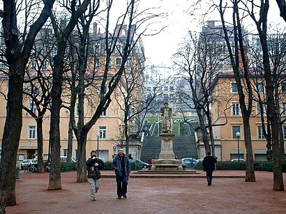
Place Sathonay Address: Place Sathonay street in Lyon, 1er Arrondissement
Attractions near Place Sathonay
Place Sathonay,Space Invader,Arrêt Mairie du 1er,Hopstore,Le Bouchon des Filles,Halles De La Martinière,Le Luxor,14 Rue Sergent Blandan Ancienne Voie du Rhin,Coney Cookies,Chamas Tacos,33 Rue de la Martinière,Bibliothèque Municipale - Croix-Rousse,Lycée La Martinière-Diderot - Site La Centrale,Lycee La Martiniere Terreaux,Claude Macabrey Luthier,Cottereau Mathieu,2 Rue René Leynaud,12 Place Gabriel Rambaud,L 'Agence B4b,Taxi SolbesHow to get to popular attractions in Lyon, 1er Arrondissement with public transit
Astroballe, Villeurbanne,Stade Des Lumières, Décines-Charpieu,Crédit Agricole Centre-Est, Champagne-Au-Mont-D'Or,Hôpital Feyzin Vénissieux, Vénissieux,Sup' de Com Lyon, Lyon, 9e Arrondissement,Hôpital Neurologique Pierre Wertheimer, Bron,Parc Chabrières, Oullins,UFRAPS, Lyon,Cafétéria UPIL, Lyon, 9e Arrondissement,Part-Dieu - Renaudel, Lyon, 3e Arrondissement,Axotel Perrache, Lyon, 2e Arrondissement,Duchère Balmont, Lyon, 9e Arrondissement,IFPASS, Lyon,Hôpital Femme-Mère-Enfant, Bron,Gare SNCF d'Alaï, Tassin-La-Demi-Lune,OFII, Lyon, 2e Arrondissement,ESTRI, Lyon, 2e Arrondissement,Golden Tulip Lyon Milleire, Saint-Priest,Caban'a'cafe, Lyon,Vancia, Rillieux-La-PapeGet around Lyon, 1er Arrondissement by public transit!
Traveling around Lyon, 1er Arrondissement has never been so easy. See step by step directions as you travel to any attraction, street or major public transit station. View bus and train schedules, arrival times, service alerts and detailed routes on a map, so you know exactly how to get to anywhere in Lyon, 1er Arrondissement.
When traveling to any destination around Lyon, 1er Arrondissement use Moovit's Live Directions with Get Off Notifications to know exactly where and how far to walk, how long to wait for your line, and how many stops are left. Moovit will alert you when it's time to get off — no need to constantly re-check whether yours is the next stop.
Wondering how to use public transit in Lyon, 1er Arrondissement or how to pay for public transit in Lyon, 1er Arrondissement? Moovit public transit app can help you navigate your way with public transit easily, and at minimum cost. It includes public transit fees, ticket prices, and costs. Looking for a map of Lyon, 1er Arrondissement public transit lines? Moovit public transit app shows all public transit maps in Lyon, 1er Arrondissement with all bus, train, metro or light rail routes and stops on an interactive map.
Lyon, 1er Arrondissement has 4 transit type(s), including: bus, train, metro or light rail, operated by several transit agencies, including TCL SYTRAL, TCL SYTRAL, TCL SYTRAL, TCL SYTRAL, TCL – Bus service renforcé, TCL – Pleine Lune, SNCF VOYAGEURS, SNCF VOYAGEURS, Conseil Régional Auvergne - Rhône-Alpes, Lignes de Vienne et Agglomération, Rhônexpress and Ruban Porte de l'Isère