Directions to Plan B And C, Inc. (Falmouth) with public transportation
The following transit lines have routes that pass near Plan B And C, Inc.
How to get to Plan B And C, Inc. by bus?
Click on the bus route to see step by step directions with maps, line arrival times and updated time schedules.
Bus stop near Plan B And C, Inc. in Falmouth
- Falmouth Bus Depot, 11 min walk,VIEW
Ferry station near Plan B And C, Inc. in Falmouth
- 227 Clinton St., Falmouth, MA, 45 min walk,VIEW
Bus lines to Plan B And C, Inc. in Falmouth
What are the closest stations to Plan B And C, Inc.?
The closest stations to Plan B And C, Inc. are:
- Falmouth Bus Depot is 899 yards away, 11 min walk.
- 227 Clinton St., Falmouth, MA is 3808 yards away, 45 min walk.
Which bus lines stop near Plan B And C, Inc.?
These bus lines stop near Plan B And C, Inc.: PETER PAN, SEALINE HYANNIS-FALMOUTH/WOODS HOLE, WOODS HOLE TO BOSTON/LOGAN AIRPORT.
Which ferry line stops near Plan B And C, Inc.?
WATER SHUTTLE (Falmouth)
What’s the nearest bus station to Plan B And C, Inc. in Falmouth?
The nearest bus station to Plan B And C, Inc. in Falmouth is Falmouth Bus Depot. It’s a 11 min walk away.
What time is the first bus to Plan B And C, Inc. in Falmouth?
The PETER PAN is the first bus that goes to Plan B And C, Inc. in Falmouth. It stops nearby at 6:00 AM.
What time is the last bus to Plan B And C, Inc. in Falmouth?
The PETER PAN is the last bus that goes to Plan B And C, Inc. in Falmouth. It stops nearby at 8:40 PM.
What time is the first ferry to Plan B And C, Inc. in Falmouth?
The WATER SHUTTLE is the first ferry that goes to Plan B And C, Inc. in Falmouth. It stops nearby at 4:00 AM.
What time is the last ferry to Plan B And C, Inc. in Falmouth?
The WATER SHUTTLE is the last ferry that goes to Plan B And C, Inc. in Falmouth. It stops nearby at 5:20 PM.
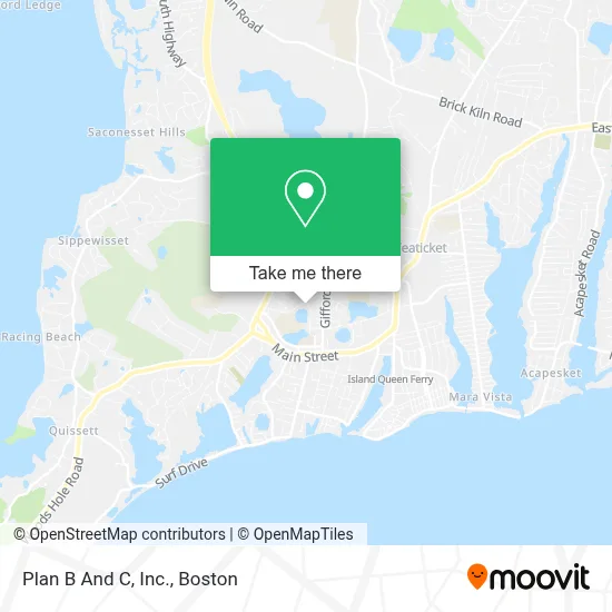
See Plan B And C, Inc., Falmouth, on the map
Public Transit to Plan B And C, Inc. in Falmouth
Wondering how to get to Plan B And C, Inc. in Falmouth? Moovit helps you find the best way to get to Plan B And C, Inc. with step-by-step directions from the nearest public transit station.
Moovit provides free maps and live directions to help you navigate through your city. View schedules, routes, timetables, and find out how long does it take to get to Plan B And C, Inc. in real time.
Looking for the nearest stop or station to Plan B And C, Inc.? Check out this list of stops closest to your destination: Falmouth Bus Depot; 227 Clinton St..
Bus: PETER PAN, SEALINE HYANNIS-FALMOUTH/WOODS HOLE, WOODS HOLE TO BOSTON/LOGAN AIRPORT, CAPEFLYER CONNECTION.Ferry: WATER SHUTTLE.
Want to see if there’s another route that gets you there at an earlier time? Moovit helps you find alternative routes or times. Get directions from and directions to Plan B And C, Inc. easily from the Moovit App or Website.
We make riding to Plan B And C, Inc. easy, which is why over 1.7 million users, including users in Falmouth, trust Moovit as the best app for public transit. You don’t need to download an individual bus app or train app, Moovit is your all-in-one transit app that helps you find the best bus time or train time available.
For information on prices of bus, ferry and train, costs and ride fares to Plan B And C, Inc., please check the Moovit app.
Use the app to navigate to popular places including to the airport, hospital, stadium, grocery store, mall, coffee shop, school, college, and university.
Plan B And C, Inc. Address: 120 Hamlin Ave street in Falmouth
- Nancy Carliss Floral Design/L,
- Cape Start,
- T-Mobile,
- Falmouth Community School,
- Drug Rehab Falmouth,
- Vineyard Tattoo,
- Master Tile & Painting,
- The Blu Pearl Day Spa,
- Falmouth Antiques,
- Planet Fitness,
- Starbucks,
- Jones Tavern,
- Christian Science Churches and Societies,
- AVIS,
- Hotpoint Appliance Repair,
- Health Insurance Brokers Falmouth,
- Falmouth HST'l Society & Museum,
- ADT,
- Kalperis International,
- Cape Structural Consultants
Places Near Plan B And C, Inc. (Falmouth)
- Castle Island, Boston,
- Isabella Stewart Gardner Museum, Boston,
- Td Garden, Boston,
- Wilbur Theatre, Boston,
- Boston Common, Boston,
- Wang Theater, Boston,
- Faneuil Hall, Boston,
- Museum Of Science, Boston,
- Seaport District, Boston,
- Massachusetts General Hospital, Boston,
- Boston Convention & Exhibition Center, Boston,
- Boston Medical Center, Boston,
- Prudential Center, Boston,
- Leader Bank Pavilion (Leader Bank Pavillion), Boston,
- Quincy Market, Boston,
- North End, Boston,
- House Of Blues, Boston,
- Mgm Music Hall, Boston,
- Cheers, Boston,
- Boston Children's Hospital, Boston
How to get to popular places in Boston with public transit
Get around Falmouth by public transit!
Traveling around Falmouth has never been so easy. See step by step directions as you travel to any attraction, street or major public transit station. View bus and train schedules, arrival times, service alerts and detailed routes on a map, so you know exactly how to get to anywhere in Falmouth.
When traveling to any destination around Falmouth use Moovit's Live Directions with Get Off Notifications to know exactly where and how far to walk, how long to wait for your line, and how many stops are left. Moovit will alert you when it's time to get off — no need to constantly re-check whether yours is the next stop.
Wondering how to use public transit in Falmouth or how to pay for public transit in Falmouth? Moovit public transit app can help you navigate your way with public transit easily, and at minimum cost. It includes public transit fees, ticket prices, and costs. Looking for a map of Falmouth public transit lines? Moovit public transit app shows all public transit maps in Falmouth with all Bus, Train, Subway and Ferry routes and stops on an interactive map.
Boston has 4 transit type(s), including: Bus, Train, Subway and Ferry, operated by several transit agencies, including MBTA, Southeastern Regional Transit Authority, MetroWest Regional Transit Authority, Rhode Island Public Transit Authority, WRTA, Lowell Regional Transit Authority, Merrimack Valley Transit, Montachusett Regional Transit Authority, Cape Cod Regional Transit Authority, Brockton Area Transit Authority, Martha's Vineyard Transit Authority, the WAVE - Nantucket Regional Transit Authority, GATRA, Cape Ann Transportation Authority and Massport
Public transit lines with stations closest to Plan B And C, Inc. in Falmouth
Bus lines with stations closest to Plan B And C, Inc. in Falmouth
Falmouth Bus Depot
 CAPEFLYER CONNECTIONCapeFLYER Connection
- SEALINE HYANNIS-FALMOUTH/WOODS HOLESealine Hyannis-Falmouth/Woods Hole
- PETER PANBOSTON LOGAN AIRPORT - BOSTON - FALMOUTH - WOODS HOLE
- PETER PANWOODS HOLE - FALMOUTH - BOSTON - BOSTON LOGAN AIRPORT
- WOODS HOLE TO BOSTON/LOGAN AIRPORTWoods Hole to Boston/Logan Airport