Directions to Platinum Studio (Waltham) with public transportation
The following transit lines have routes that pass near Platinum Studio
 Bus: 505, 553, 554, 558, 556.
- Train: FITCHBURG, FRAMINGHAM/WORCESTER.
- Subway: GREEN LINE D.
How to get to Platinum Studio by bus?
Click on the bus route to see step by step directions with maps, line arrival times and updated time schedules.
From Prometric Testing Center, Boston
45 minFrom Skating Club Of Boston, Boston
43 minFrom Harvard University, Cambridge
55 minFrom Boston University Track and Tennis Center, Boston
46 minFrom the mall at rockingham park mall, Boston
44 minFrom Mass Ave, Cambridge
64 minFrom DoubleTree Suites by Hilton Hotel Boston - Cambridge, Boston
53 minFrom Agganis Arena, Boston
45 minFrom Sheraton-Needham Hotel (Sheraton Boston Needham Hotel), Needham
54 minFrom VFW Parkway, Boston
53 min
How to get to Platinum Studio by train?
Click on the train route to see step by step directions with maps, line arrival times and updated time schedules.
From Prometric Testing Center, Boston
67 minFrom Skating Club Of Boston, Boston
54 minFrom Harvard University, Cambridge
54 minFrom Boston University Track and Tennis Center, Boston
63 minFrom Mass Ave, Cambridge
56 minFrom DoubleTree Suites by Hilton Hotel Boston - Cambridge, Boston
122 minFrom Agganis Arena, Boston
119 minFrom VFW Parkway, Boston
162 min
How to get to Platinum Studio by subway?
Click on the subway route to see step by step directions with maps, line arrival times and updated time schedules.
From Prometric Testing Center, Boston
104 minFrom Harvard University, Cambridge
111 minFrom Boston University Track and Tennis Center, Boston
109 minFrom the mall at rockingham park mall, Boston
75 minFrom Mass Ave, Cambridge
112 minFrom DoubleTree Suites by Hilton Hotel Boston - Cambridge, Boston
125 minFrom Agganis Arena, Boston
103 min
Bus stops near Platinum Studio in Waltham
Train stations near Platinum Studio in Waltham
Bus lines to Platinum Studio in Waltham
What are the closest stations to Platinum Studio?
The closest stations to Platinum Studio are:
- Crescent St @ Woerd Ave is 282 yards away, 4 min walk.
- High St @ Hall St is 387 yards away, 5 min walk.
- Moody St @ Robbins St is 559 yards away, 7 min walk.
- Newtonville is 2147 yards away, 26 min walk.
- Brandeis/Roberts is 3034 yards away, 36 min walk.
Which bus lines stop near Platinum Studio?
These bus lines stop near Platinum Studio: 505, 553, 554.
Which train lines stop near Platinum Studio?
These train lines stop near Platinum Studio: FITCHBURG, FRAMINGHAM/WORCESTER.
Which subway line stops near Platinum Studio?
GREEN LINE D (Riverside)
What’s the nearest train station to Platinum Studio in Waltham?
The nearest train station to Platinum Studio in Waltham is Newtonville. It’s a 26 min walk away.
What’s the nearest bus station to Platinum Studio in Waltham?
The nearest bus station to Platinum Studio in Waltham is Crescent St @ Woerd Ave. It’s a 4 min walk away.
What time is the first train to Platinum Studio in Waltham?
The FRAMINGHAM/WORCESTER is the first train that goes to Platinum Studio in Waltham. It stops nearby at 5:19 AM.
What time is the last train to Platinum Studio in Waltham?
The FRAMINGHAM/WORCESTER is the last train that goes to Platinum Studio in Waltham. It stops nearby at 12:22 AM.
What time is the first bus to Platinum Studio in Waltham?
The 505 is the first bus that goes to Platinum Studio in Waltham. It stops nearby at 5:56 AM.
What time is the last bus to Platinum Studio in Waltham?
The 553 is the last bus that goes to Platinum Studio in Waltham. It stops nearby at 8:56 PM.
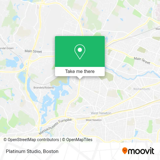
See Platinum Studio, Waltham, on the map
Public Transit to Platinum Studio in Waltham
Wondering how to get to Platinum Studio in Waltham? Moovit helps you find the best way to get to Platinum Studio with step-by-step directions from the nearest public transit station.
Moovit provides free maps and live directions to help you navigate through your city. View schedules, routes, timetables, and find out how long does it take to get to Platinum Studio in real time.
Looking for the nearest stop or station to Platinum Studio? Check out this list of stops closest to your destination: Crescent St @ Woerd Ave; High St @ Hall St; Moody St @ Robbins St; Newtonville; Brandeis/Roberts.
Bus: 505, 553, 554, 558, 556.Train: FITCHBURG, FRAMINGHAM/WORCESTER.Subway: GREEN LINE D.
Want to see if there’s another route that gets you there at an earlier time? Moovit helps you find alternative routes or times. Get directions from and directions to Platinum Studio easily from the Moovit App or Website.
We make riding to Platinum Studio easy, which is why over 1.7 million users, including users in Waltham, trust Moovit as the best app for public transit. You don’t need to download an individual bus app or train app, Moovit is your all-in-one transit app that helps you find the best bus time or train time available.
For information on prices of bus, subway and train, costs and ride fares to Platinum Studio, please check the Moovit app.
Use the app to navigate to popular places including to the airport, hospital, stadium, grocery store, mall, coffee shop, school, college, and university.
Platinum Studio Address: 728 Moody St street in Waltham
- Kelly's Property Services,
- Michelle Densmore Fitness,
- ATM,
- 591 Moody St Parking,
- UPS Drop Box,
- Level Up Fitness Waltham,
- Koko Dental Care,
- Dale Lawrence at Guaranteed Rate Affinity ,
- Jen Pintos at Guaranteed Rate Affinity (NMLS #1596923),
- New England Insurance Group,
- Namirembe Church,
- Iglesia Evangelica Pentecostal,
- N.A. Tran,
- Panco Group,
- Waltham Dual Language School,
- Wakuwaku Ramen Waltham,
- Amuleto,
- Julio Perez Landscaping,
- Keyword Advisors,
- Eci Software Innovations
Places Near Platinum Studio (Waltham)
- Boston Children's Hospital, Boston,
- Boston Convention & Exhibition Center, Boston,
- Massachusetts General Hospital, Boston,
- Prudential Center, Boston,
- Leader Bank Pavilion (Leader Bank Pavillion), Boston,
- Boston Medical Center, Boston,
- Faneuil Hall, Boston,
- Mgm Music Hall, Boston,
- Cheers, Boston,
- Wang Theater, Boston,
- Boston Common, Boston,
- Td Garden, Boston,
- North End, Boston,
- Castle Island, Boston,
- Wilbur Theatre, Boston,
- Quincy Market, Boston,
- Isabella Stewart Gardner Museum, Boston,
- Museum Of Science, Boston,
- House Of Blues, Boston,
- Seaport District, Boston
How to get to popular places in Boston with public transit
Get around Waltham by public transit!
Traveling around Waltham has never been so easy. See step by step directions as you travel to any attraction, street or major public transit station. View bus and train schedules, arrival times, service alerts and detailed routes on a map, so you know exactly how to get to anywhere in Waltham.
When traveling to any destination around Waltham use Moovit's Live Directions with Get Off Notifications to know exactly where and how far to walk, how long to wait for your line, and how many stops are left. Moovit will alert you when it's time to get off — no need to constantly re-check whether yours is the next stop.
Wondering how to use public transit in Waltham or how to pay for public transit in Waltham? Moovit public transit app can help you navigate your way with public transit easily, and at minimum cost. It includes public transit fees, ticket prices, and costs. Looking for a map of Waltham public transit lines? Moovit public transit app shows all public transit maps in Waltham with all Bus, Train, Subway and Ferry routes and stops on an interactive map.
Boston has 4 transit type(s), including: Bus, Train, Subway and Ferry, operated by several transit agencies, including MBTA, Southeastern Regional Transit Authority, MetroWest Regional Transit Authority, Rhode Island Public Transit Authority, WRTA, Lowell Regional Transit Authority, Merrimack Valley Transit, Montachusett Regional Transit Authority, Cape Cod Regional Transit Authority, Brockton Area Transit Authority, Martha's Vineyard Transit Authority, the WAVE - Nantucket Regional Transit Authority, GATRA, Cape Ann Transportation Authority and Massport