Directions to Playstead Field at Franklin Park (Boston) with public transportation
The following transit lines have routes that pass near Playstead Field at Franklin Park
 Bus: 16, 22, 44, 29, 32.
- Train: FAIRMOUNT, FRANKLIN/FOXBORO, NEEDHAM, PROVIDENCE/STOUGHTON.
- Subway: ORANGE LINE.
How to get to Playstead Field at Franklin Park by bus?
Click on the bus route to see step by step directions with maps, line arrival times and updated time schedules.
From The Burren, Somerville
94 minFrom The Liberty Hotel, Boston
58 minFrom Sarma, Somerville
96 minFrom Encore Boston Harbor, Everett
93 minFrom Chelsea District Court, Chelsea
80 minFrom Costco Wholesale, Everett
105 minFrom Harvard Business School, Boston
68 minFrom the mall at rockingham park mall, Boston
58 minFrom Apple Cinemas, Cambridge
100 minFrom Leader Bank Pavilion (Leader Bank Pavillion), Boston
64 min
How to get to Playstead Field at Franklin Park by train?
Click on the train route to see step by step directions with maps, line arrival times and updated time schedules.
How to get to Playstead Field at Franklin Park by subway?
Click on the subway route to see step by step directions with maps, line arrival times and updated time schedules.
From The Burren, Somerville
57 minFrom The Liberty Hotel, Boston
44 minFrom Sarma, Somerville
61 minFrom Encore Boston Harbor, Everett
67 minFrom Costco Wholesale, Everett
66 minFrom Harvard Business School, Boston
64 minFrom the mall at rockingham park mall, Boston
72 minFrom Apple Cinemas, Cambridge
66 minFrom Leader Bank Pavilion (Leader Bank Pavillion), Boston
67 min
Bus stops near Playstead Field at Franklin Park in Boston
Subway station near Playstead Field at Franklin Park in Boston
- Green Street, 7 min walk,VIEW
Train stations near Playstead Field at Franklin Park in Boston
Bus lines to Playstead Field at Franklin Park in Boston
What are the closest stations to Playstead Field at Franklin Park?
The closest stations to Playstead Field at Franklin Park are:
- Seaver St @ Blue Hill Ave is 142 yards away, 2 min walk.
- Seaver St Opp Maple St is 357 yards away, 5 min walk.
- Seaver St Opp Harold St is 401 yards away, 5 min walk.
- Circuit Dr @ Glen Ln is 443 yards away, 6 min walk.
- Green Street is 546 yards away, 7 min walk.
- Forest Hills is 1552 yards away, 19 min walk.
- Four Corners/Geneva is 1728 yards away, 21 min walk.
Which bus lines stop near Playstead Field at Franklin Park?
These bus lines stop near Playstead Field at Franklin Park: 16, 22, 44.
Which train line stops near Playstead Field at Franklin Park?
FAIRMOUNT (#1619 | Fairmount)
Which subway line stops near Playstead Field at Franklin Park?
ORANGE LINE (Forest Hills)
What’s the nearest subway station to Playstead Field at Franklin Park in Boston?
The nearest subway station to Playstead Field at Franklin Park in Boston is Green Street. It’s a 7 min walk away.
What’s the nearest train station to Playstead Field at Franklin Park in Boston?
The nearest train station to Playstead Field at Franklin Park in Boston is Forest Hills. It’s a 19 min walk away.
What’s the nearest bus station to Playstead Field at Franklin Park in Boston?
The nearest bus station to Playstead Field at Franklin Park in Boston is Seaver St @ Blue Hill Ave. It’s a 2 min walk away.
What time is the first subway to Playstead Field at Franklin Park in Boston?
The ORANGE LINE is the first subway that goes to Playstead Field at Franklin Park in Boston. It stops nearby at 5:15 AM.
What time is the last subway to Playstead Field at Franklin Park in Boston?
The ORANGE LINE is the last subway that goes to Playstead Field at Franklin Park in Boston. It stops nearby at 1:58 AM.
What time is the first train to Playstead Field at Franklin Park in Boston?
The FAIRMOUNT is the first train that goes to Playstead Field at Franklin Park in Boston. It stops nearby at 6:30 AM.
What time is the last train to Playstead Field at Franklin Park in Boston?
The PROVIDENCE/STOUGHTON is the last train that goes to Playstead Field at Franklin Park in Boston. It stops nearby at 12:08 AM.
What time is the first bus to Playstead Field at Franklin Park in Boston?
The 16 is the first bus that goes to Playstead Field at Franklin Park in Boston. It stops nearby at 4:33 AM.
What time is the last bus to Playstead Field at Franklin Park in Boston?
The 22 is the last bus that goes to Playstead Field at Franklin Park in Boston. It stops nearby at 2:07 AM.
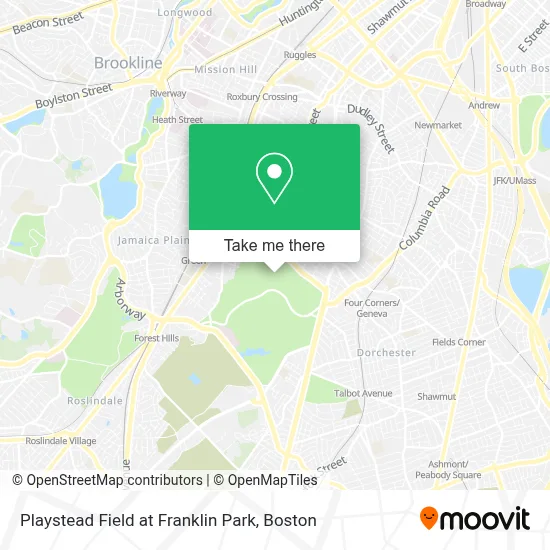
See Playstead Field at Franklin Park, Boston, on the map
Public Transit to Playstead Field at Franklin Park in Boston
Wondering how to get to Playstead Field at Franklin Park in Boston? Moovit helps you find the best way to get to Playstead Field at Franklin Park with step-by-step directions from the nearest public transit station.
Moovit provides free maps and live directions to help you navigate through your city. View schedules, routes, timetables, and find out how long does it take to get to Playstead Field at Franklin Park in real time.
Looking for the nearest stop or station to Playstead Field at Franklin Park? Check out this list of stops closest to your destination: Seaver St @ Blue Hill Ave; Seaver St Opp Maple St; Seaver St Opp Harold St; Circuit Dr @ Glen Ln; Green Street; Forest Hills; Four Corners/Geneva.
Bus: 16, 22, 44, 29, 32, 34, 36, 38.Train: FAIRMOUNT, FRANKLIN/FOXBORO, NEEDHAM, PROVIDENCE/STOUGHTON.Subway: ORANGE LINE.
Want to see if there’s another route that gets you there at an earlier time? Moovit helps you find alternative routes or times. Get directions from and directions to Playstead Field at Franklin Park easily from the Moovit App or Website.
We make riding to Playstead Field at Franklin Park easy, which is why over 1.7 million users, including users in Boston, trust Moovit as the best app for public transit. You don’t need to download an individual bus app or train app, Moovit is your all-in-one transit app that helps you find the best bus time or train time available.
For information on prices of bus, subway and train, costs and ride fares to Playstead Field at Franklin Park, please check the Moovit app.
Use the app to navigate to popular places including to the airport, hospital, stadium, grocery store, mall, coffee shop, school, college, and university.
Playstead Field at Franklin Park Address: Playstead Rd street in Boston
- Zoorassic Park @ Franklin Park Zoo,
- Franklin Park - Overlook Ruins,
- Franklin Park Zoo @ Birds,
- h block,
- USPS Collection Box - Blue Box,
- United House Of Prayer,
- Franklin Park Zoo,
- Franklin Park,
- Lilyp African Hair Braiding,
- Robinhoodmarketplacebo,
- A-Plus Welders 4 Hire,
- LTK Engineering Services,
- William H Darling CPA,
- Sunny Hill Garden Suites,
- Boston Lights: A Lantern Experience,
- St Katharine Drexel,
- Cambridge Historic Fou,
- William J Devine Franklin Park Golf Course,
- Fun with Science Programs,
- Walaikum's Burger
Places Near Playstead Field at Franklin Park (Boston)
- Leader Bank Pavilion (Leader Bank Pavillion), Boston,
- Quincy Market, Boston,
- House Of Blues, Boston,
- Boston Medical Center, Boston,
- Cheers, Boston,
- Castle Island, Boston,
- Prudential Center, Boston,
- Boston Convention & Exhibition Center, Boston,
- North End, Boston,
- Isabella Stewart Gardner Museum, Boston,
- Massachusetts General Hospital, Boston,
- Wang Theater, Boston,
- Wilbur Theatre, Boston,
- Faneuil Hall, Boston,
- Seaport District, Boston,
- Mgm Music Hall, Boston,
- Td Garden, Boston,
- Boston Children's Hospital, Boston,
- Museum Of Science, Boston,
- Boston Common, Boston
How to get to popular places in Boston with public transit
Get around Boston by public transit!
Traveling around Boston has never been so easy. See step by step directions as you travel to any attraction, street or major public transit station. View bus and train schedules, arrival times, service alerts and detailed routes on a map, so you know exactly how to get to anywhere in Boston.
When traveling to any destination around Boston use Moovit's Live Directions with Get Off Notifications to know exactly where and how far to walk, how long to wait for your line, and how many stops are left. Moovit will alert you when it's time to get off — no need to constantly re-check whether yours is the next stop.
Wondering how to use public transit in Boston or how to pay for public transit in Boston? Moovit public transit app can help you navigate your way with public transit easily, and at minimum cost. It includes public transit fees, ticket prices, and costs. Looking for a map of Boston public transit lines? Moovit public transit app shows all public transit maps in Boston with all Bus, Train, Subway and Ferry routes and stops on an interactive map.
Boston has 4 transit type(s), including: Bus, Train, Subway and Ferry, operated by several transit agencies, including MBTA, Southeastern Regional Transit Authority, MetroWest Regional Transit Authority, Rhode Island Public Transit Authority, WRTA, Lowell Regional Transit Authority, Merrimack Valley Transit, Montachusett Regional Transit Authority, Cape Cod Regional Transit Authority, Brockton Area Transit Authority, Martha's Vineyard Transit Authority, the WAVE - Nantucket Regional Transit Authority, GATRA, Cape Ann Transportation Authority and Massport