Directions to Plaza de La Liberación station (Guadalajara) with public transit
The following transit lines have routes that pass near Plaza de La Liberación
How to get to Plaza de La Liberación station by bus?
Click on the bus route to see step by step directions with maps, line arrival times and updated time schedules.
How to get to Plaza de La Liberación station by train?
Click on the train route to see step by step directions with maps, line arrival times and updated time schedules.
Bus stops near Plaza de La Liberación in Guadalajara
- Degollado, 2 min walk,
- Independencia, 3 min walk,
- Poder Judicial, 3 min walk,
- Juan Manuel, 4 min walk,
- Venustiano Carranza, 4 min walk,
- San Felipe, 4 min walk,
- Belén, 5 min walk,
- Juárez, 6 min walk,
Train stations near Plaza de La Liberación in Guadalajara
- Guadalajara Centro, 5 min walk,
- Plaza Universidad, 7 min walk,
Bus lines to Plaza de La Liberación station in Guadalajara
- LM-V2, San Juan de Dios,
- LÍNEA 3, Felipe Ángeles,
- T14-B/C02, Colonia Indígena,
- C07, Mercado Corona,
- C123 - CENTRO SUR, San Miguel de Huentitán,
- C123 - SANTA ANA, Santa Ana Tepetitlán,
- T15 - HOSPITAL CIVIL, Panorámica I,
- T15/C06 (231-C) - HOSPITAL CIVIL, Mesa de los Ocotes,
- C08, San Miguel de Huentitán,
- T06/C18, Camino a Colimilla,
- T14-B/C119 - JESÚS GARCÍA, Ladrón de Guevara,
- C01, San Juan de Ocotán,
- C16 - 🟦 CENTRO 🟦, Clínica 110,
- C21 - 🟥 CBTIS 🟥, Clínica 110,
- C107 (110-A), Huentitán El Bajo,
- T07/C04, Colonia Arroyo Las Flores,
- T14-B/C119 - SAN FELIPE, Heliodoro Hernández Loza,
- C139, Miramar,
- C140 (710), Fraccionamiento Amaranto,
What are the closest stations to Plaza de La Liberación?
The closest stations to Plaza de La Liberación are:
- Degollado is 68 meters away, 2 min walk.
- Independencia is 191 meters away, 3 min walk.
- Poder Judicial is 191 meters away, 3 min walk.
- Juan Manuel is 219 meters away, 4 min walk.
- Venustiano Carranza is 247 meters away, 4 min walk.
- San Felipe is 260 meters away, 4 min walk.
- Belén is 276 meters away, 5 min walk.
- Guadalajara Centro is 349 meters away, 5 min walk.
- Juárez is 385 meters away, 6 min walk.
- Plaza Universidad is 502 meters away, 7 min walk.
Which bus lines stop near Plaza de La Liberación?
These bus lines stop near Plaza de La Liberación: C01, C123 - CENTRO SUR, C123 - SANTA ANA, C124, PARADOR, T15 - DOS TEMPLOS, T15 - HOSPITAL CIVIL, T16-B/C04 - PARQUES.
Which train lines stop near Plaza de La Liberación?
These train lines stop near Plaza de La Liberación: TL-2, TL-3.
What’s the nearest train station to Plaza de La Liberación in Guadalajara?
The nearest train station to Plaza de La Liberación in Guadalajara is Guadalajara Centro. It’s a 5 min walk away.
What’s the nearest bus stop to Plaza de La Liberación in Guadalajara?
The nearest bus stop to Plaza de La Liberación in Guadalajara is Degollado. It’s a 2 min walk away.
What time is the first train to Plaza de La Liberación in Guadalajara?
The TL-2 is the first train that goes to Plaza de La Liberación in Guadalajara. It stops nearby at 5:01 AM.
What time is the last train to Plaza de La Liberación in Guadalajara?
The TL-2 is the last train that goes to Plaza de La Liberación in Guadalajara. It stops nearby at 11:02 PM.
What time is the first bus to Plaza de La Liberación in Guadalajara?
The T15/C06 (231-C) - HOSPITAL CIVIL is the first bus that goes to Plaza de La Liberación in Guadalajara. It stops nearby at 4:51 AM.
What time is the last bus to Plaza de La Liberación in Guadalajara?
The LM-V2 is the last bus that goes to Plaza de La Liberación in Guadalajara. It stops nearby at 11:59 PM.
See Plaza de La Liberación, Guadalajara, on the map
Public Transit to Plaza de La Liberación in Guadalajara
Wondering how to get to Plaza de La Liberación in Guadalajara, México? Moovit helps you find the best way to get to Plaza de La Liberación with step-by-step directions from the nearest public transit station.
Moovit provides free maps and live directions to help you navigate through your city. View schedules, routes, timetables, and find out how long does it take to get to Plaza de La Liberación in real time.
Looking for the nearest stop or station to Plaza de La Liberación? Check out this list of stops closest to your destination: Degollado; Independencia; Poder Judicial; Juan Manuel; Venustiano Carranza; San Felipe; Belén; Guadalajara Centro; Juárez; Plaza Universidad.
Bus: C01, C123 - CENTRO SUR, C123 - SANTA ANA, C124, PARADOR, T15 - DOS TEMPLOS, T15 - HOSPITAL CIVIL, T16-B/C04 - PARQUES, LM-V2, LÍNEA 3, T14-B/C02, C07, T15/C06 (231-C) - HOSPITAL CIVIL.Train: TL-2, TL-3.
Want to see if there’s another route that gets you there at an earlier time? Moovit helps you find alternative routes or times. Get directions from and directions to Plaza de La Liberación easily from the Moovit App or Website.
We make riding to Plaza de La Liberación easy, which is why over 1.5 million users, including users in Guadalajara, trust Moovit as the best app for public transit. You don’t need to download an individual bus app or train app, Moovit is your all-in-one transit app that helps you find the best bus time or train time available.
For information on prices of bus and train, costs and ride fares to Plaza de La Liberación, please check the Moovit app.
Use the app to navigate to popular places including to the airport, hospital, stadium, grocery store, mall, coffee shop, school, college, and university.
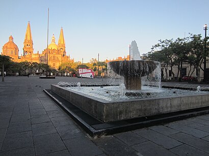
Plaza de La Liberación Address: Hidalgo street in Guadalajara
Plaza de la Liberación is an urban square in Centro, Guadalajara, in the Mexican state of Jalisco.A statue of Miguel Hidalgo y Costilla is installed in the plaza.Wiki
Directions to Plaza de La Liberación station (Guadalajara) with public transit
How to get to popular places in Guadalajara with public transit
Get around Guadalajara by public transit!
Traveling around Guadalajara has never been so easy. See step by step directions as you travel to any attraction, street or major public transit station. View bus and train schedules, arrival times, service alerts and detailed routes on a map, so you know exactly how to get to anywhere in Guadalajara.
When traveling to any destination around Guadalajara use Moovit's Live Directions with Get Off Notifications to know exactly where and how far to walk, how long to wait for your line, and how many stops are left. Moovit will alert you when it's time to get off — no need to constantly re-check whether yours is the next stop.
Wondering how to use public transit in Guadalajara or how to pay for public transit in Guadalajara? Moovit public transit app can help you navigate your way with public transit easily, and at minimum cost. It includes public transit fees, ticket prices, and costs. Looking for a map of Guadalajara public transit lines? Moovit public transit app shows all public transit maps in Guadalajara with all Bus and Train routes and stops on an interactive map.
Guadalajara has 2 transit type(s), including: Bus and Train, operated by several transit agencies, including SITEUR, Mi Macro Calzada - Alimentadoras, SyT, TransBus El Salto, Mi Transporte Eléctrico - Complementarias, Mi Transporte - Características Especiales, Mi Macro - Troncales, SITREN, Transportes Chapala, Mi Macro Calzada - Complementarias, Ruta López Mateos, RIVER, Mi Transporte - Complementarias de Troncales, Mi Macro Periférico - Alimentadoras and Mi Transporte - Troncales