See Pleasant Park Station, Ottawa, on the map
Directions to Pleasant Park Station (Ottawa) with public transportation
The following transit lines have routes that pass near Pleasant Park Station
 Bus:
Bus:
How to get to Pleasant Park Station by bus?
Click on the bus route to see step by step directions with maps, line arrival times and updated time schedules.
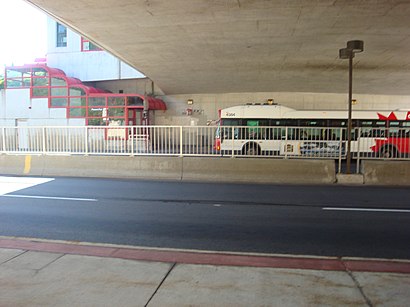
Bus stations near Pleasant Park Station in Ottawa
- Pleasant Park,1 min walk,
- Alta Vista / Pleasant Park,7 min walk,
Light Rail stations near Pleasant Park Station in Ottawa
- Hurdman Station,25 min walk,
Bus lines to Pleasant Park Station in Ottawa
- 10,Lyon,
- 48,Elmvale,
- 49,Elmvale,
- 88,Terry Fox,
- 90,Greenboro,
- 92,Greenboro,
- 93,Leitrim,
- 96,Merivale / 96b Hunt Club,
- 97,Airport ~ Aéroport,
- 98,Hawthorne,
- 99,Barrhaven Centre,
- 190,Mooney's Bay,
- 199,Leikin,
- 290,Mccarthy,
- 291,Herongate,
- 294,Findlay Creek,
- 299,Manotick,
- 451,Lansdowne,
- 44,Billings Bridge,
What are the closest stations to Pleasant Park Station?
The closest stations to Pleasant Park Station are:
- Pleasant Park is 15 meters away, 1 min walk.
- Alta Vista / Pleasant Park is 540 meters away, 7 min walk.
- Hurdman Station is 1887 meters away, 25 min walk.
Which bus lines stop near Pleasant Park Station?
These bus lines stop near Pleasant Park Station: 10, 88, 93, 97.
What’s the nearest light rail station to Pleasant Park Station in Ottawa?
The nearest light rail station to Pleasant Park Station in Ottawa is Hurdman Station. It’s a 25 min walk away.
What’s the nearest bus stop to Pleasant Park Station in Ottawa?
The nearest bus stop to Pleasant Park Station in Ottawa is Pleasant Park. It’s a 1 min walk away.
What time is the first light rail to Pleasant Park Station in Ottawa?
The 1 is the first light rail that goes to Pleasant Park Station in Ottawa. It stops nearby at 5:00 AM.
What time is the last light rail to Pleasant Park Station in Ottawa?
The 1 is the last light rail that goes to Pleasant Park Station in Ottawa. It stops nearby at 1:21 AM.
What time is the first bus to Pleasant Park Station in Ottawa?
The 97 is the first bus that goes to Pleasant Park Station in Ottawa. It stops nearby at 3:06 AM.
What time is the last bus to Pleasant Park Station in Ottawa?
The 97 is the last bus that goes to Pleasant Park Station in Ottawa. It stops nearby at 3:03 AM.
How much is the bus fare to Pleasant Park Station?
The bus fare to Pleasant Park Station costs about $4.00.
See Pleasant Park Station, Ottawa, on the map
Public Transit to Pleasant Park Station in Ottawa
Wondering how to get to Pleasant Park Station in Ottawa, Canada? Moovit helps you find the best way to get to Pleasant Park Station with step-by-step directions from the nearest public transit station.
Moovit provides free maps and live directions to help you navigate through your city. View schedules, routes, timetables, and find out how long does it take to get to Pleasant Park Station in real time.
Looking for the nearest stop or station to Pleasant Park Station? Check out this list of stops closest to your destination: Pleasant Park; Alta Vista / Pleasant Park; Hurdman Station.
Bus:
Want to see if there’s another route that gets you there at an earlier time? Moovit helps you find alternative routes or times. Get directions from and directions to Pleasant Park Station easily from the Moovit App or Website.
We make riding to Pleasant Park Station easy, which is why over 1.5 million users, including users in Ottawa, trust Moovit as the best app for public transit. You don’t need to download an individual bus app or train app, Moovit is your all-in-one transit app that helps you find the best bus time or train time available.
For information on prices of bus, costs and ride fares to Pleasant Park Station, please check the Moovit app.
Use the app to navigate to popular places including to the airport, hospital, stadium, grocery store, mall, coffee shop, school, college, and university.
Pleasant Park Station Address: Plesant Park Road (Transitway) street in Ottawa
Attractions near Pleasant Park Station
M&M Interior Contracting,Billings Bridge Plaza Shopping Centre,The Ottawa Hospital - Riverside Campus,1967 Riverside Drive,Jindal Kidney Care Centre,Riverside Transitway Station,Billings Estate Tea-on-the-Lawn,City of Ottawa,Riverside 2a,411-1919 Riverside Drive,Celine Paris M.PS,Dr. Ernest Couture Child Care Centre,Hannia's Aesthetics and Médical Spa,Badminton Canada,Coinamatic,Imarketing Solutions Group,Dominion Lending,ChargePoint,1355 Bank Street,K1H 8K7How to get to popular attractions in Ottawa with public transit
Ridgemont High School, Ottawa,National Gallery Of Canada, Ottawa,Canadian Tire, Ottawa,Rockcliffe Airport, Ottawa,Jock Turcot University Centre, Ottawa,Canada Aviation And Space Museum, Ottawa,Tanger Outlets, Ottawa,Commissioners Park, Ottawa,Brookstreet Hotel, Ottawa,Hazeldean Mall, Ottawa,National Arts Centre (Stage Door), Ottawa,Ultra Electronics Telemus, Ottawa,Elmvale Acres, Ottawa,TD Place Stadium, Ottawa,Édifice Jean Talon Building, Ottawa,22 Eddy, Hull,Global Affairs Canada / Affaires mondiales Canada, Hull,Parc-O-Bus Freeman, Hull,Cégep De L'Outaouais Campus Gabrielle-Roy, Hull,Roger-Guindon Hall, OttawaGet around Ottawa by public transit!
Traveling around Ottawa has never been so easy. See step by step directions as you travel to any attraction, street or major public transit station. View bus and train schedules, arrival times, service alerts and detailed routes on a map, so you know exactly how to get to anywhere in Ottawa.
When traveling to any destination around Ottawa use Moovit's Live Directions with Get Off Notifications to know exactly where and how far to walk, how long to wait for your line, and how many stops are left. Moovit will alert you when it's time to get off — no need to constantly re-check whether yours is the next stop.
Wondering how to use public transit in Ottawa or how to pay for public transit in Ottawa? Moovit public transit app can help you navigate your way with public transit easily, and at minimum cost. It includes public transit fees, ticket prices, and costs. Looking for a map of Ottawa public transit lines? Moovit public transit app shows all public transit maps in Ottawa with all bus routes and stops on an interactive map.
Ottawa has 1 transit type(s), including: bus, operated by several transit agencies, including OC Transpo, OC Transpo, STO, Transcollines and Megabus Canada