Directions to Pluck (Newton) with public transportation
The following transit lines have routes that pass near Pluck
 Bus: 553, 554, 556, 59.
- Train: FRAMINGHAM/WORCESTER.
- Subway: GREEN LINE D.
How to get to Pluck by bus?
Click on the bus route to see step by step directions with maps, line arrival times and updated time schedules.
From Newbury Comics, Boston
39 minFrom Brandy Melville, Boston
40 minFrom MGM Music Hall at Fenway, Boston
52 minFrom Arlington, MA, Arlington
84 minFrom The Monument, Boston
60 minFrom Beth Israel Deaconess Medical Center (Shapiro Garage), Boston
58 minFrom Ruggles Station, Boston
46 minFrom Trident Booksellers & Cafe, Boston
40 minFrom Beth Israel Hospital, Boston
46 minFrom YMCA of Greater Boston, Boston
40 min
How to get to Pluck by train?
Click on the train route to see step by step directions with maps, line arrival times and updated time schedules.
From Newbury Comics, Boston
35 minFrom Brandy Melville, Boston
35 minFrom MGM Music Hall at Fenway, Boston
25 minFrom The Monument, Boston
125 minFrom Beth Israel Deaconess Medical Center (Shapiro Garage), Boston
35 minFrom Ruggles Station, Boston
106 minFrom Trident Booksellers & Cafe, Boston
35 minFrom Beth Israel Hospital, Boston
33 minFrom YMCA of Greater Boston, Boston
113 min
How to get to Pluck by subway?
Click on the subway route to see step by step directions with maps, line arrival times and updated time schedules.
From Newbury Comics, Boston
73 minFrom Brandy Melville, Boston
72 minFrom MGM Music Hall at Fenway, Boston
78 minFrom The Monument, Boston
108 minFrom Beth Israel Deaconess Medical Center (Shapiro Garage), Boston
71 minFrom Ruggles Station, Boston
91 minFrom Trident Booksellers & Cafe, Boston
73 minFrom Beth Israel Hospital, Boston
70 minFrom YMCA of Greater Boston, Boston
83 min
Subway station near Pluck in Newton
- Newton Centre, 1 min walk,VIEW
Bus stops near Pluck in Newton
Train station near Pluck in Newton
- West Newton, 30 min walk,VIEW
Bus lines to Pluck in Newton
What are the closest stations to Pluck?
The closest stations to Pluck are:
- Newton Centre is 56 yards away, 1 min walk.
- Walnut St @ Watertown St is 66 yards away, 1 min walk.
- Washington St @ Walnut St is 215 yards away, 3 min walk.
- West Newton is 2538 yards away, 30 min walk.
Which bus lines stop near Pluck?
These bus lines stop near Pluck: 553, 554, 556, 59.
Which train line stops near Pluck?
FRAMINGHAM/WORCESTER (#521 | Worcester)
Which subway line stops near Pluck?
GREEN LINE D (Riverside)
What’s the nearest subway station to Pluck in Newton?
The nearest subway station to Pluck in Newton is Newton Centre. It’s a 1 min walk away.
What’s the nearest train station to Pluck in Newton?
The nearest train station to Pluck in Newton is West Newton. It’s a 30 min walk away.
What’s the nearest bus station to Pluck in Newton?
The nearest bus station to Pluck in Newton is Walnut St @ Watertown St. It’s a 1 min walk away.
What time is the first subway to Pluck in Newton?
The GREEN LINE D is the first subway that goes to Pluck in Newton. It stops nearby at 4:48 AM.
What time is the last subway to Pluck in Newton?
The GREEN LINE D is the last subway that goes to Pluck in Newton. It stops nearby at 2:44 AM.
What time is the first train to Pluck in Newton?
The FRAMINGHAM/WORCESTER is the first train that goes to Pluck in Newton. It stops nearby at 5:22 AM.
What time is the last train to Pluck in Newton?
The FRAMINGHAM/WORCESTER is the last train that goes to Pluck in Newton. It stops nearby at 12:20 AM.
What time is the first bus to Pluck in Newton?
The 554 is the first bus that goes to Pluck in Newton. It stops nearby at 6:03 AM.
What time is the last bus to Pluck in Newton?
The 553 is the last bus that goes to Pluck in Newton. It stops nearby at 9:06 PM.
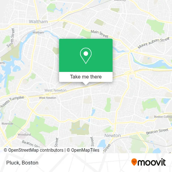
See Pluck, Newton, on the map
Public Transit to Pluck in Newton
Wondering how to get to Pluck in Newton? Moovit helps you find the best way to get to Pluck with step-by-step directions from the nearest public transit station.
Moovit provides free maps and live directions to help you navigate through your city. View schedules, routes, timetables, and find out how long does it take to get to Pluck in real time.
Looking for the nearest stop or station to Pluck? Check out this list of stops closest to your destination: Newton Centre; Walnut St @ Watertown St; Washington St @ Walnut St; West Newton.
Bus: 553, 554, 556, 59.Train: FRAMINGHAM/WORCESTER.Subway: GREEN LINE D.
Want to see if there’s another route that gets you there at an earlier time? Moovit helps you find alternative routes or times. Get directions from and directions to Pluck easily from the Moovit App or Website.
We make riding to Pluck easy, which is why over 1.7 million users, including users in Newton, trust Moovit as the best app for public transit. You don’t need to download an individual bus app or train app, Moovit is your all-in-one transit app that helps you find the best bus time or train time available.
For information on prices of bus, train and subway, costs and ride fares to Pluck, please check the Moovit app.
Use the app to navigate to popular places including to the airport, hospital, stadium, grocery store, mall, coffee shop, school, college, and university.
Pluck Address: 897 Washington St street in Newton
- V Nails & Spa,
- American Locksmith,
- Mobile Redemption,
- Star Market,
- Newton Emergency Plum,
- Buildright Construction,
- Boston Ballet,
- Boston Ballet School,
- Skin Clique,
- Martika Realty,
- Neb Mortgage - Newton Branch,
- Six Flags New England,
- RGB Surveillance,
- Nei General Contracting,
- Dinosaur Capital Partners,
- Mida - Newton,
- Comella S,
- I-90 W Newton,
- Impress Nail & Spa,
- ATM
Places Near Pluck (Newton)
- Leader Bank Pavilion (Leader Bank Pavillion), Boston,
- Wang Theater, Boston,
- Cheers, Boston,
- Seaport District, Boston,
- Boston Common, Boston,
- North End, Boston,
- House Of Blues, Boston,
- Boston Medical Center, Boston,
- Quincy Market, Boston,
- Boston Children's Hospital, Boston,
- Castle Island, Boston,
- Mgm Music Hall, Boston,
- Museum Of Science, Boston,
- Isabella Stewart Gardner Museum, Boston,
- Prudential Center, Boston,
- Boston Convention & Exhibition Center, Boston,
- Td Garden, Boston,
- Faneuil Hall, Boston,
- Wilbur Theatre, Boston,
- Massachusetts General Hospital, Boston
How to get to popular places in Boston with public transit
Get around Newton by public transit!
Traveling around Newton has never been so easy. See step by step directions as you travel to any attraction, street or major public transit station. View bus and train schedules, arrival times, service alerts and detailed routes on a map, so you know exactly how to get to anywhere in Newton.
When traveling to any destination around Newton use Moovit's Live Directions with Get Off Notifications to know exactly where and how far to walk, how long to wait for your line, and how many stops are left. Moovit will alert you when it's time to get off — no need to constantly re-check whether yours is the next stop.
Wondering how to use public transit in Newton or how to pay for public transit in Newton? Moovit public transit app can help you navigate your way with public transit easily, and at minimum cost. It includes public transit fees, ticket prices, and costs. Looking for a map of Newton public transit lines? Moovit public transit app shows all public transit maps in Newton with all Bus, Train, Subway and Ferry routes and stops on an interactive map.
Boston has 4 transit type(s), including: Bus, Train, Subway and Ferry, operated by several transit agencies, including MBTA, Southeastern Regional Transit Authority, MetroWest Regional Transit Authority, Rhode Island Public Transit Authority, WRTA, Lowell Regional Transit Authority, Merrimack Valley Transit, Montachusett Regional Transit Authority, Cape Cod Regional Transit Authority, Brockton Area Transit Authority, Martha's Vineyard Transit Authority, the WAVE - Nantucket Regional Transit Authority, GATRA, Cape Ann Transportation Authority and Massport