Directions to Pmg Physician Associates (Bourne) with public transportation
The following transit lines have routes that pass near Pmg Physician Associates
 Bus: BOURNE RUN, PETER PAN.
- Train: CAPEFLYER.
How to get to Pmg Physician Associates by bus?
Click on the bus route to see step by step directions with maps, line arrival times and updated time schedules.
Train station near Pmg Physician Associates in Bourne
- Bourne, 25 min walk,VIEW
What are the closest stations to Pmg Physician Associates?
The closest stations to Pmg Physician Associates are:
- Bourne is 2078 yards away, 25 min walk.
Which bus lines stop near Pmg Physician Associates?
These bus lines stop near Pmg Physician Associates: BOURNE RUN, PETER PAN.
What’s the nearest train station to Pmg Physician Associates in Bourne?
The nearest train station to Pmg Physician Associates in Bourne is Bourne. It’s a 25 min walk away.
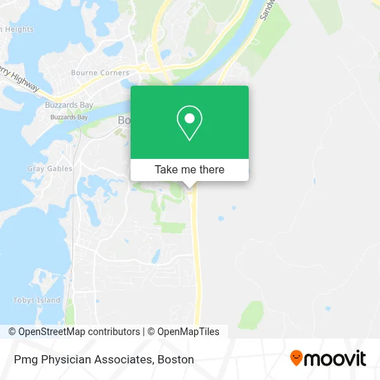
See Pmg Physician Associates, Bourne, on the map
Public Transit to Pmg Physician Associates in Bourne
Wondering how to get to Pmg Physician Associates in Bourne? Moovit helps you find the best way to get to Pmg Physician Associates with step-by-step directions from the nearest public transit station.
Moovit provides free maps and live directions to help you navigate through your city. View schedules, routes, timetables, and find out how long does it take to get to Pmg Physician Associates in real time.
Looking for the nearest stop or station to Pmg Physician Associates? Check out this list of stops closest to your destination: Bourne.
Bus: BOURNE RUN, PETER PAN.Train: CAPEFLYER.
Want to see if there’s another route that gets you there at an earlier time? Moovit helps you find alternative routes or times. Get directions from and directions to Pmg Physician Associates easily from the Moovit App or Website.
We make riding to Pmg Physician Associates easy, which is why over 1.7 million users, including users in Bourne, trust Moovit as the best app for public transit. You don’t need to download an individual bus app or train app, Moovit is your all-in-one transit app that helps you find the best bus time or train time available.
For information on prices of bus, train and ferry, costs and ride fares to Pmg Physician Associates, please check the Moovit app.
Use the app to navigate to popular places including to the airport, hospital, stadium, grocery store, mall, coffee shop, school, college, and university.
Pmg Physician Associates Address: 2 Technology Park Dr street in Bourne
- Mill Pond,
- Offshore Systems,
- Showcase Isuzu,
- Landscaping About US,
- Arcade Alley Cape Cod,
- DUNKIN',
- Bourne, Massachusetts,
- Bourne Station,
- بورن، ماساچوست,
- Harding Sound,
- Pro Finish Construction, Derek,
- Worcester Surf Casting Club,
- BMF Pressure Washing,
- Gray Gables Cemetery,
- Diantonio Distribution Company,
- Grill & More,
- Massachusetts Maritime Academy,
- Connect 55 +,
- Xfinity,
- Cape Cod Charter Guys
Places Near Pmg Physician Associates (Bourne)
- Seaport District, Boston,
- Museum Of Science, Boston,
- Faneuil Hall, Boston,
- Boston Common, Boston,
- Boston Convention & Exhibition Center, Boston,
- Boston Children's Hospital, Boston,
- Leader Bank Pavilion (Leader Bank Pavillion), Boston,
- Td Garden, Boston,
- Wilbur Theatre, Boston,
- House Of Blues, Boston,
- Isabella Stewart Gardner Museum, Boston,
- Wang Theater, Boston,
- Massachusetts General Hospital, Boston,
- Castle Island, Boston,
- Cheers, Boston,
- Boston Medical Center, Boston,
- Prudential Center, Boston,
- Quincy Market, Boston,
- North End, Boston,
- Mgm Music Hall, Boston
How to get to popular places in Boston with public transit
Get around Bourne by public transit!
Traveling around Bourne has never been so easy. See step by step directions as you travel to any attraction, street or major public transit station. View bus and train schedules, arrival times, service alerts and detailed routes on a map, so you know exactly how to get to anywhere in Bourne.
When traveling to any destination around Bourne use Moovit's Live Directions with Get Off Notifications to know exactly where and how far to walk, how long to wait for your line, and how many stops are left. Moovit will alert you when it's time to get off — no need to constantly re-check whether yours is the next stop.
Wondering how to use public transit in Bourne or how to pay for public transit in Bourne? Moovit public transit app can help you navigate your way with public transit easily, and at minimum cost. It includes public transit fees, ticket prices, and costs. Looking for a map of Bourne public transit lines? Moovit public transit app shows all public transit maps in Bourne with all Bus, Train, Subway and Ferry routes and stops on an interactive map.
Boston has 4 transit type(s), including: Bus, Train, Subway and Ferry, operated by several transit agencies, including MBTA, Southeastern Regional Transit Authority, MetroWest Regional Transit Authority, Rhode Island Public Transit Authority, WRTA, Lowell Regional Transit Authority, Merrimack Valley Transit, Montachusett Regional Transit Authority, Cape Cod Regional Transit Authority, Brockton Area Transit Authority, Martha's Vineyard Transit Authority, the WAVE - Nantucket Regional Transit Authority, GATRA, Cape Ann Transportation Authority and Massport