Directions to Pnc Atm (Boston) with public transportation
The following transit lines have routes that pass near Pnc Atm
 Bus: 1, 39, 501, 504, BB.
- Train: NEEDHAM, NEWBURYPORT/ROCKPORT, FOXBORO EVENT SERVICE, FRAMINGHAM/WORCESTER, FRANKLIN/FOXBORO.
- Subway: GREEN LINE B, GREEN LINE C, GREEN LINE D, GREEN LINE E.
How to get to Pnc Atm by bus?
Click on the bus route to see step by step directions with maps, line arrival times and updated time schedules.
From Four Points by Sheraton Boston Logan Airport, Revere
76 minFrom Qea, Quincy
106 minFrom Milton Academy, Milton
93 minFrom Ramada Boston, Boston
66 minFrom Conte Forum, Boston
58 minFrom Arlington, MA, Arlington
73 minFrom VFW Parkway, Boston
51 minFrom West Roxbury, Boston
50 minFrom TownePlace Suites Boston Logan Airport/Chelsea, Chelsea
46 minFrom Hampton Inn Boston Logan Airport Chelsea, Chelsea
52 min
How to get to Pnc Atm by train?
Click on the train route to see step by step directions with maps, line arrival times and updated time schedules.
How to get to Pnc Atm by subway?
Click on the subway route to see step by step directions with maps, line arrival times and updated time schedules.
Bus stops near Pnc Atm in Boston
- Announcement #4 - Back Bay To Airport, 2 min walk,VIEW
- Boylston St @ Prudential Center, 3 min walk,VIEW
- Boylston St @ Dartmouth St, 3 min walk,VIEW
- Stuart St @ Dartmouth St, 5 min walk,VIEW
- Copley - Opp 575 Boylston St, 6 min walk,VIEW
- Copley - Saint James Ave @ Trinity Pl, 7 min walk,VIEW
- Copley - Boylston St @ Dartmouth St, 7 min walk,VIEW
- Saint James Ave @ Dartmouth St, 7 min walk,VIEW
Subway station near Pnc Atm in Boston
- Copley, 7 min walk,VIEW
Train station near Pnc Atm in Boston
- Back Bay - South End, 8 min walk,VIEW
Bus lines to Pnc Atm in Boston
- BB, Back Bay,VIEW
- 55, West Fenway,VIEW
- 57, Haymarket Via Kenmore,VIEW
- 9, Copley - City Point,VIEW
- 10, Arlington via South Bay Center - City Point via South Bay Center,VIEW
- 39, Back Bay - Forest Hills,VIEW
- GREEN LINE B SHUTTLE, Boston University East - Back Bay,VIEW
- GREEN LINE C SHUTTLE, Saint Mary's Street - Back Bay,VIEW
- GREEN LINE E SHUTTLE, Heath Street - Park Street,VIEW
- GREEN LINE SHUTTLE, Boston University East - Park Street,VIEW
- ORANGE LINE SHUTTLE, Ruggles - Copley,VIEW
- 501, Downtown via Copley (Express) - Brighton via Copley (Express),VIEW
- 504, Downtown via Copley (Express) - Watertown via Copley and Newton Corner (Express),VIEW
- GREEN LINE B SHUTTLE, Babcock Street - Back Bay,VIEW
- GREEN LINE B SHUTTLE, Boston College - Back Bay (Shuttle),VIEW
- GREEN LINE B SHUTTLE, Kenmore - Back Bay via Copley (Shuttle),VIEW
- GREEN LINE B SHUTTLE, Babcock Street - Back Bay via Copley (Shuttle),VIEW
- GREEN LINE D SHUTTLE, Brookline Hills - Back Bay (Shuttle),VIEW
- GREEN LINE SHUTTLE, Kenmore - Back Bay,VIEW
- GREEN LINE SHUTTLE, Kenmore - Copley,VIEW
What are the closest stations to Pnc Atm?
The closest stations to Pnc Atm are:
- Announcement #4 - Back Bay To Airport is 73 yards away, 2 min walk.
- Boylston St @ Prudential Center is 162 yards away, 3 min walk.
- Boylston St @ Dartmouth St is 173 yards away, 3 min walk.
- Stuart St @ Dartmouth St is 387 yards away, 5 min walk.
- Copley - Opp 575 Boylston St is 436 yards away, 6 min walk.
- Copley - Saint James Ave @ Trinity Pl is 503 yards away, 7 min walk.
- Copley - Boylston St @ Dartmouth St is 505 yards away, 7 min walk.
- Copley is 515 yards away, 7 min walk.
- Saint James Ave @ Dartmouth St is 530 yards away, 7 min walk.
- Back Bay - South End is 642 yards away, 8 min walk.
Which bus lines stop near Pnc Atm?
These bus lines stop near Pnc Atm: 1, 39, 501, 504, BB.
Which train lines stop near Pnc Atm?
These train lines stop near Pnc Atm: NEEDHAM, NEWBURYPORT/ROCKPORT.
Which subway lines stop near Pnc Atm?
These subway lines stop near Pnc Atm: GREEN LINE B, GREEN LINE C, GREEN LINE D.
What’s the nearest subway station to Pnc Atm in Boston?
The nearest subway station to Pnc Atm in Boston is Copley. It’s a 7 min walk away.
What’s the nearest train station to Pnc Atm in Boston?
The nearest train station to Pnc Atm in Boston is Back Bay - South End. It’s a 8 min walk away.
What’s the nearest bus station to Pnc Atm in Boston?
The nearest bus station to Pnc Atm in Boston is Announcement #4 - Back Bay To Airport. It’s a 2 min walk away.
What time is the first subway to Pnc Atm in Boston?
The GREEN LINE D is the first subway that goes to Pnc Atm in Boston. It stops nearby at 5:03 AM.
What time is the last subway to Pnc Atm in Boston?
The GREEN LINE D is the last subway that goes to Pnc Atm in Boston. It stops nearby at 2:15 AM.
What time is the first train to Pnc Atm in Boston?
The PROVIDENCE/STOUGHTON is the first train that goes to Pnc Atm in Boston. It stops nearby at 4:25 AM.
What time is the last train to Pnc Atm in Boston?
The LAKE SHORE LIMITED is the last train that goes to Pnc Atm in Boston. It stops nearby at 8:26 PM.
What time is the first bus to Pnc Atm in Boston?
The 57 is the first bus that goes to Pnc Atm in Boston. It stops nearby at 4:51 AM.
What time is the last bus to Pnc Atm in Boston?
The 10 is the last bus that goes to Pnc Atm in Boston. It stops nearby at 1:16 AM.
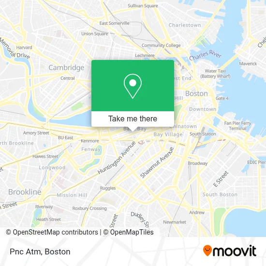
See Pnc Atm, Boston, on the map
Public Transit to Pnc Atm in Boston
Wondering how to get to Pnc Atm in Boston? Moovit helps you find the best way to get to Pnc Atm with step-by-step directions from the nearest public transit station.
Moovit provides free maps and live directions to help you navigate through your city. View schedules, routes, timetables, and find out how long does it take to get to Pnc Atm in real time.
Looking for the nearest stop or station to Pnc Atm? Check out this list of stops closest to your destination: Announcement #4 - Back Bay To Airport; Boylston St @ Prudential Center; Boylston St @ Dartmouth St; Stuart St @ Dartmouth St; Copley - Opp 575 Boylston St; Copley - Saint James Ave @ Trinity Pl; Copley - Boylston St @ Dartmouth St; Copley; Saint James Ave @ Dartmouth St; Back Bay - South End.
Bus: 1, 39, 501, 504, BB, 9, 10, GREEN LINE B SHUTTLE, GREEN LINE C SHUTTLE, 55, 57, GREEN LINE B SHUTTLE, GREEN LINE B SHUTTLE, GREEN LINE B SHUTTLE.Train: NEEDHAM, NEWBURYPORT/ROCKPORT, FOXBORO EVENT SERVICE, FRAMINGHAM/WORCESTER, FRANKLIN/FOXBORO, ORANGE LINE.Subway: GREEN LINE B, GREEN LINE C, GREEN LINE D, GREEN LINE E.
Want to see if there’s another route that gets you there at an earlier time? Moovit helps you find alternative routes or times. Get directions from and directions to Pnc Atm easily from the Moovit App or Website.
We make riding to Pnc Atm easy, which is why over 1.7 million users, including users in Boston, trust Moovit as the best app for public transit. You don’t need to download an individual bus app or train app, Moovit is your all-in-one transit app that helps you find the best bus time or train time available.
For information on prices of bus, subway and train, costs and ride fares to Pnc Atm, please check the Moovit app.
Use the app to navigate to popular places including to the airport, hospital, stadium, grocery store, mall, coffee shop, school, college, and university.
Pnc Atm Address: 729 Boylston St street in Boston
- Uno Pizzeria & Grill - Boston,
- Terrence J. Griffin, DMD (Dr. Terrance Griffin and Associates),
- Lord & Taylor,
- Travelex Currency Services,
- Exclusive Valet (Exclusive Parking),
- 745 Boylston St.,
- Jazz Workshop,
- Bella Bridesmaids Boston,
- Niketown,
- Aluna Salon and Spa (Arthur Harris Salon &Spa),
- Zara,
- Atlantic Fish Co,
- Atlantic Fish Company,
- Exari Systems,
- The Lenox (Lenox Hotel),
- Balloons,
- Piattini,
- First Republic Bank,
- Cochon 555,
- The Lenox Hotel
Places Near Pnc Atm (Boston)
- Boston Children's Hospital, Boston,
- Boston Common, Boston,
- Boston Medical Center, Boston,
- Boston Convention & Exhibition Center, Boston,
- Wilbur Theatre, Boston,
- Castle Island, Boston,
- Museum Of Science, Boston,
- Massachusetts General Hospital, Boston,
- Mgm Music Hall, Boston,
- Quincy Market, Boston,
- North End, Boston,
- Seaport District, Boston,
- Isabella Stewart Gardner Museum, Boston,
- House Of Blues, Boston,
- Cheers, Boston,
- Leader Bank Pavilion (Leader Bank Pavillion), Boston,
- Faneuil Hall, Boston,
- Prudential Center, Boston,
- Td Garden, Boston,
- Wang Theater, Boston
How to get to popular places in Boston with public transit
Get around Boston by public transit!
Traveling around Boston has never been so easy. See step by step directions as you travel to any attraction, street or major public transit station. View bus and train schedules, arrival times, service alerts and detailed routes on a map, so you know exactly how to get to anywhere in Boston.
When traveling to any destination around Boston use Moovit's Live Directions with Get Off Notifications to know exactly where and how far to walk, how long to wait for your line, and how many stops are left. Moovit will alert you when it's time to get off — no need to constantly re-check whether yours is the next stop.
Wondering how to use public transit in Boston or how to pay for public transit in Boston? Moovit public transit app can help you navigate your way with public transit easily, and at minimum cost. It includes public transit fees, ticket prices, and costs. Looking for a map of Boston public transit lines? Moovit public transit app shows all public transit maps in Boston with all Bus, Train, Subway and Ferry routes and stops on an interactive map.
Boston has 4 transit type(s), including: Bus, Train, Subway and Ferry, operated by several transit agencies, including MBTA, Southeastern Regional Transit Authority, MetroWest Regional Transit Authority, Rhode Island Public Transit Authority, WRTA, Lowell Regional Transit Authority, Merrimack Valley Transit, Montachusett Regional Transit Authority, Cape Cod Regional Transit Authority, Brockton Area Transit Authority, Martha's Vineyard Transit Authority, the WAVE - Nantucket Regional Transit Authority, GATRA, Cape Ann Transportation Authority and Massport
Public transit lines with stations closest to Pnc Atm in Boston
Subway lines with stations closest to Pnc Atm in Boston
Train lines with stations closest to Pnc Atm in Boston
Bus lines with stations closest to Pnc Atm in Boston
Stuart St @ Dartmouth St
- 501Downtown via Copley (Express) - Brighton via Copley (Express)
- 504Downtown via Copley (Express) - Watertown via Copley and Newton Corner (Express)
- GREEN LINE B SHUTTLEBabcock Street - Back Bay
- GREEN LINE B SHUTTLEBoston College - Back Bay (Shuttle)
- GREEN LINE B SHUTTLEKenmore - Back Bay via Copley (Shuttle)