Directions to Pointing Robot Studios (Harwich Port) with public transportation
The following transit lines have routes that pass near Pointing Robot Studios
 Bus: FLEX, H2O HYANNIS-ORLEANS.
How to get to Pointing Robot Studios by bus?
Click on the bus route to see step by step directions with maps, line arrival times and updated time schedules.
Which bus lines stop near Pointing Robot Studios?
These bus lines stop near Pointing Robot Studios: FLEX, H2O HYANNIS-ORLEANS.
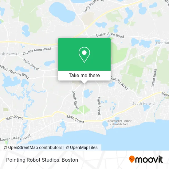
See Pointing Robot Studios, Harwich Port, on the map
Public Transit to Pointing Robot Studios in Harwich Port
Wondering how to get to Pointing Robot Studios in Harwich Port? Moovit helps you find the best way to get to Pointing Robot Studios with step-by-step directions from the nearest public transit station.
Moovit provides free maps and live directions to help you navigate through your city. View schedules, routes, timetables, and find out how long does it take to get to Pointing Robot Studios in real time.
Bus: FLEX, H2O HYANNIS-ORLEANS.
Want to see if there’s another route that gets you there at an earlier time? Moovit helps you find alternative routes or times. Get directions from and directions to Pointing Robot Studios easily from the Moovit App or Website.
We make riding to Pointing Robot Studios easy, which is why over 1.7 million users, including users in Harwich Port, trust Moovit as the best app for public transit. You don’t need to download an individual bus app or train app, Moovit is your all-in-one transit app that helps you find the best bus time or train time available.
For information on prices of bus, costs and ride fares to Pointing Robot Studios, please check the Moovit app.
Use the app to navigate to popular places including to the airport, hospital, stadium, grocery store, mall, coffee shop, school, college, and university.
Pointing Robot Studios Address: 2 Englewood Dr street in Harwich Port
- Harwich, Massachusetts,
- The Westchester Consulting Group,
- Cemetery,
- Monomoy High School - Chatham Harwich,
- Harwich Council on Aging,
- Whitehouse Field,
- Telesmanick Property Management,
- United Plastering and Painting,
- FedEx,
- Mid Cape Pest Control,
- Value Mart,
- Arch 33,
- Sunrise Bait & Tackle,
- Law Office of Brain J Skinner,
- BMO Harris Bank,
- USPS,
- Bray Building & Remodeling,
- 10 Post Office Square Parking,
- Coinstar - Bitcoin ATM,
- Starbucks
Places Near Pointing Robot Studios (Harwich Port)
- Seaport District, Boston,
- Boston Medical Center, Boston,
- Boston Children's Hospital, Boston,
- Quincy Market, Boston,
- Mgm Music Hall, Boston,
- Cheers, Boston,
- House Of Blues, Boston,
- Leader Bank Pavilion (Leader Bank Pavillion), Boston,
- Massachusetts General Hospital, Boston,
- Castle Island, Boston,
- Museum Of Science, Boston,
- Boston Common, Boston,
- Faneuil Hall, Boston,
- North End, Boston,
- Isabella Stewart Gardner Museum, Boston,
- Boston Convention & Exhibition Center, Boston,
- Wang Theater, Boston,
- Prudential Center, Boston,
- Td Garden, Boston,
- Wilbur Theatre, Boston
How to get to popular places in Boston with public transit
Get around Harwich Port by public transit!
Traveling around Harwich Port has never been so easy. See step by step directions as you travel to any attraction, street or major public transit station. View bus and train schedules, arrival times, service alerts and detailed routes on a map, so you know exactly how to get to anywhere in Harwich Port.
When traveling to any destination around Harwich Port use Moovit's Live Directions with Get Off Notifications to know exactly where and how far to walk, how long to wait for your line, and how many stops are left. Moovit will alert you when it's time to get off — no need to constantly re-check whether yours is the next stop.
Wondering how to use public transit in Harwich Port or how to pay for public transit in Harwich Port? Moovit public transit app can help you navigate your way with public transit easily, and at minimum cost. It includes public transit fees, ticket prices, and costs. Looking for a map of Harwich Port public transit lines? Moovit public transit app shows all public transit maps in Harwich Port with all Bus, Train, Subway and Ferry routes and stops on an interactive map.
Boston has 4 transit type(s), including: Bus, Train, Subway and Ferry, operated by several transit agencies, including MBTA, Southeastern Regional Transit Authority, MetroWest Regional Transit Authority, Rhode Island Public Transit Authority, WRTA, Lowell Regional Transit Authority, Merrimack Valley Transit, Montachusett Regional Transit Authority, Cape Cod Regional Transit Authority, Brockton Area Transit Authority, Martha's Vineyard Transit Authority, the WAVE - Nantucket Regional Transit Authority, GATRA, Cape Ann Transportation Authority and Massport