Directions to Poke Poki (Brookline) with public transportation
The following transit lines have routes that pass near Poke Poki
 Bus: 15, 66, GREEN LINE C SHUTTLE, GREEN LINE C SHUTTLE, SHUTTLE.
- Train: FRAMINGHAM/WORCESTER.
- Subway: GREEN LINE C, GREEN LINE B.
How to get to Poke Poki by bus?
Click on the bus route to see step by step directions with maps, line arrival times and updated time schedules.
From City Winery, Boston
50 minFrom Legal Harborside, Boston
52 minFrom New England Law | Boston, Boston
32 minFrom Malden, MA, Malden
91 minFrom Courtyard by Marriott Boston Logan Airport, Boston
76 minFrom Best Western Adams Inn Quincy - Boston, Quincy
92 minFrom Canopy by Hilton Boston Downtown, Boston
48 minFrom Marina Bay, Quincy
152 minFrom Boda Borg, Malden
87 minFrom Orpheum Theatre (Orpheum Theatre Boston), Boston
42 min
How to get to Poke Poki by train?
Click on the train route to see step by step directions with maps, line arrival times and updated time schedules.
How to get to Poke Poki by subway?
Click on the subway route to see step by step directions with maps, line arrival times and updated time schedules.
From City Winery, Boston
40 minFrom Legal Harborside, Boston
60 minFrom New England Law | Boston, Boston
32 minFrom Malden, MA, Malden
64 minFrom Courtyard by Marriott Boston Logan Airport, Boston
59 minFrom Best Western Adams Inn Quincy - Boston, Quincy
66 minFrom Canopy by Hilton Boston Downtown, Boston
39 minFrom Boda Borg, Malden
57 minFrom Orpheum Theatre (Orpheum Theatre Boston), Boston
31 min
Subway stations near Poke Poki in Brookline
Bus stops near Poke Poki in Brookline
Bus lines to Poke Poki in Brookline
- 66, Brighton Center Via Brookline,VIEW
- GREEN LINE C SHUTTLE, Saint Mary's Street (Shuttle),VIEW
- GREEN LINE C SHUTTLE, Coolidge Corner (Shuttle),VIEW
- SHUTTLE, Cleveland Circle (Shuttle),VIEW
- FLIXBUS 2610, New York (Hudson Yards),VIEW
- FLIXBUS N2605, Henrico (Parham Rd Park & Ride),VIEW
- FLIXBUS N2610, Boston (South Station),VIEW
What are the closest stations to Poke Poki?
The closest stations to Poke Poki are:
- Summit Avenue is 201 yards away, 3 min walk.
- Harvard St @ Coolidge St is 205 yards away, 3 min walk.
- Harvard Ave. is 487 yards away, 7 min walk.
- Brookline is 669 yards away, 8 min walk.
Which bus lines stop near Poke Poki?
These bus lines stop near Poke Poki: 15, 66.
Which train line stops near Poke Poki?
FRAMINGHAM/WORCESTER (#525 | Worcester)
Which subway line stops near Poke Poki?
GREEN LINE C (Cleveland Circle)
What’s the nearest subway station to Poke Poki in Brookline?
The nearest subway station to Poke Poki in Brookline is Summit Avenue. It’s a 3 min walk away.
What’s the nearest bus station to Poke Poki in Brookline?
The nearest bus stations to Poke Poki in Brookline are Harvard St @ Coolidge St and Summit Avenue. The closest one is a 3 min walk away.
What time is the first subway to Poke Poki in Brookline?
The GREEN LINE C is the first subway that goes to Poke Poki in Brookline. It stops nearby at 5:07 AM.
What time is the last subway to Poke Poki in Brookline?
The GREEN LINE B is the last subway that goes to Poke Poki in Brookline. It stops nearby at 2:24 AM.
What time is the first bus to Poke Poki in Brookline?
The 66 is the first bus that goes to Poke Poki in Brookline. It stops nearby at 5:00 AM.
What time is the last bus to Poke Poki in Brookline?
The FLIXBUS N2605 is the last bus that goes to Poke Poki in Brookline. It stops nearby at 9:05 AM.
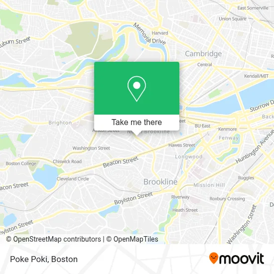
See Poke Poki, Brookline, on the map
Public Transit to Poke Poki in Brookline
Wondering how to get to Poke Poki in Brookline? Moovit helps you find the best way to get to Poke Poki with step-by-step directions from the nearest public transit station.
Moovit provides free maps and live directions to help you navigate through your city. View schedules, routes, timetables, and find out how long does it take to get to Poke Poki in real time.
Looking for the nearest stop or station to Poke Poki? Check out this list of stops closest to your destination: Summit Avenue; Harvard St @ Coolidge St; Harvard Ave.; Brookline.
Bus: 15, 66, GREEN LINE C SHUTTLE, GREEN LINE C SHUTTLE, SHUTTLE, FLIXBUS 2610, FLIXBUS N2605, FLIXBUS N2610.Train: FRAMINGHAM/WORCESTER.Subway: GREEN LINE C, GREEN LINE B.
Want to see if there’s another route that gets you there at an earlier time? Moovit helps you find alternative routes or times. Get directions from and directions to Poke Poki easily from the Moovit App or Website.
We make riding to Poke Poki easy, which is why over 1.7 million users, including users in Brookline, trust Moovit as the best app for public transit. You don’t need to download an individual bus app or train app, Moovit is your all-in-one transit app that helps you find the best bus time or train time available.
For information on prices of bus, subway and train, costs and ride fares to Poke Poki, please check the Moovit app.
Use the app to navigate to popular places including to the airport, hospital, stadium, grocery store, mall, coffee shop, school, college, and university.
Poke Poki Address: 415 Harvard St street in Brookline
- Club Dante,
- Zhangliang Malatang,
- El Peñol 3,
- Kaojiu Restaurant,
- Bonapita,
- Grubhub Holdings Inc.,
- Eileen Park Realtor,
- Dennis Razis, Realtor,
- Elias Papadopoulos Realtor,
- Brookline Locks Change,
- Joel Weingarten,
- Massage Ultra,
- Daniel Rosenbaum MD,
- Morgan Alexander C Phys,
- The Achievement Institute,
- Anna's Taqueria,
- Harvard Street Locksmith,
- Minyan Shaleym,
- New England Yachad,
- 2life
Places Near Poke Poki (Brookline)
- Seaport District, Boston,
- Boston Medical Center, Boston,
- Boston Children's Hospital, Boston,
- Quincy Market, Boston,
- Mgm Music Hall, Boston,
- Cheers, Boston,
- House Of Blues, Boston,
- Leader Bank Pavilion (Leader Bank Pavillion), Boston,
- Massachusetts General Hospital, Boston,
- Castle Island, Boston,
- Museum Of Science, Boston,
- Boston Common, Boston,
- Faneuil Hall, Boston,
- North End, Boston,
- Isabella Stewart Gardner Museum, Boston,
- Boston Convention & Exhibition Center, Boston,
- Wang Theater, Boston,
- Prudential Center, Boston,
- Td Garden, Boston,
- Wilbur Theatre, Boston
How to get to popular places in Boston with public transit
Get around Brookline by public transit!
Traveling around Brookline has never been so easy. See step by step directions as you travel to any attraction, street or major public transit station. View bus and train schedules, arrival times, service alerts and detailed routes on a map, so you know exactly how to get to anywhere in Brookline.
When traveling to any destination around Brookline use Moovit's Live Directions with Get Off Notifications to know exactly where and how far to walk, how long to wait for your line, and how many stops are left. Moovit will alert you when it's time to get off — no need to constantly re-check whether yours is the next stop.
Wondering how to use public transit in Brookline or how to pay for public transit in Brookline? Moovit public transit app can help you navigate your way with public transit easily, and at minimum cost. It includes public transit fees, ticket prices, and costs. Looking for a map of Brookline public transit lines? Moovit public transit app shows all public transit maps in Brookline with all Bus, Train, Subway and Ferry routes and stops on an interactive map.
Boston has 4 transit type(s), including: Bus, Train, Subway and Ferry, operated by several transit agencies, including MBTA, Southeastern Regional Transit Authority, MetroWest Regional Transit Authority, Rhode Island Public Transit Authority, WRTA, Lowell Regional Transit Authority, Merrimack Valley Transit, Montachusett Regional Transit Authority, Cape Cod Regional Transit Authority, Brockton Area Transit Authority, Martha's Vineyard Transit Authority, the WAVE - Nantucket Regional Transit Authority, GATRA, Cape Ann Transportation Authority and Massport