Directions to Polished Hair Lounge (Boston) with public transportation
The following transit lines have routes that pass near Polished Hair Lounge
 Bus: 16, 19, 23.
- Train: FAIRMOUNT, FRANKLIN/FOXBORO, FAIRMOUNT LINE SHUTTLE, PROVIDENCE/STOUGHTON.
- Subway: RED LINE.
How to get to Polished Hair Lounge by bus?
Click on the bus route to see step by step directions with maps, line arrival times and updated time schedules.
From Heartbreak Hill, Newton
62 minFrom Assembly Square, Somerville
90 minFrom Dedham District Court, Dedham
56 minFrom Boston Harbor, Boston
68 minFrom Trinity Church, Boston
45 minFrom Chelsea District Court, Chelsea
84 minFrom Goodwill Store, Boston
63 minFrom Newton, MA, Newton
62 minFrom Seaport District, Boston
61 minFrom Renaissance Boston Waterfront Hotel (Renaissance Waterfront Conference Center), Boston
65 min
How to get to Polished Hair Lounge by train?
Click on the train route to see step by step directions with maps, line arrival times and updated time schedules.
How to get to Polished Hair Lounge by subway?
Click on the subway route to see step by step directions with maps, line arrival times and updated time schedules.
Train stations near Polished Hair Lounge in Boston
- Talbot Avenue, 3 min walk,VIEW
Bus stops near Polished Hair Lounge in Boston
Subway station near Polished Hair Lounge in Boston
- Fields Corner, 21 min walk,VIEW
Bus lines to Polished Hair Lounge in Boston
What are the closest stations to Polished Hair Lounge?
The closest stations to Polished Hair Lounge are:
- Talbot Avenue is 175 yards away, 3 min walk.
- Washington Street @ Four Corners / Geneva Station is 210 yards away, 3 min walk.
- Columbia Rd @ Washington St is 227 yards away, 3 min walk.
- Washington St @ Columbia Rd is 250 yards away, 3 min walk.
- Fields Corner is 1740 yards away, 21 min walk.
Which bus lines stop near Polished Hair Lounge?
These bus lines stop near Polished Hair Lounge: 16, 19, 23.
Which train line stops near Polished Hair Lounge?
FAIRMOUNT (#1619 | Fairmount)
Which subway line stops near Polished Hair Lounge?
RED LINE (Ashmont/Braintree)
What’s the nearest subway station to Polished Hair Lounge in Boston?
The nearest subway station to Polished Hair Lounge in Boston is Fields Corner. It’s a 21 min walk away.
What’s the nearest train station to Polished Hair Lounge in Boston?
The nearest train station to Polished Hair Lounge in Boston is Talbot Avenue. It’s a 3 min walk away.
What’s the nearest bus station to Polished Hair Lounge in Boston?
The nearest bus stations to Polished Hair Lounge in Boston are Washington Street @ Four Corners / Geneva Station, Columbia Rd @ Washington St and Washington St @ Columbia Rd. The closest one is a 3 min walk away.
What time is the first subway to Polished Hair Lounge in Boston?
The RED LINE is the first subway that goes to Polished Hair Lounge in Boston. It stops nearby at 5:18 AM.
What time is the last subway to Polished Hair Lounge in Boston?
The RED LINE is the last subway that goes to Polished Hair Lounge in Boston. It stops nearby at 2:01 AM.
What time is the first train to Polished Hair Lounge in Boston?
The FAIRMOUNT is the first train that goes to Polished Hair Lounge in Boston. It stops nearby at 4:41 AM.
What time is the last train to Polished Hair Lounge in Boston?
The FAIRMOUNT is the last train that goes to Polished Hair Lounge in Boston. It stops nearby at 12:03 AM.
What time is the first bus to Polished Hair Lounge in Boston?
The 16 is the first bus that goes to Polished Hair Lounge in Boston. It stops nearby at 4:36 AM.
What time is the last bus to Polished Hair Lounge in Boston?
The 23 is the last bus that goes to Polished Hair Lounge in Boston. It stops nearby at 2:36 AM.
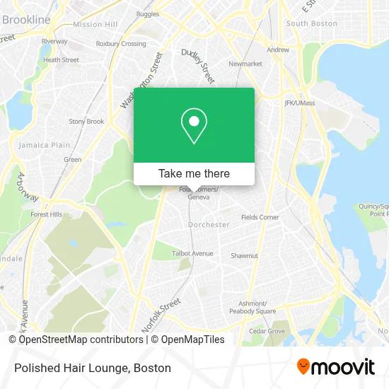
See Polished Hair Lounge, Boston, on the map
Public Transit to Polished Hair Lounge in Boston
Wondering how to get to Polished Hair Lounge in Boston? Moovit helps you find the best way to get to Polished Hair Lounge with step-by-step directions from the nearest public transit station.
Moovit provides free maps and live directions to help you navigate through your city. View schedules, routes, timetables, and find out how long does it take to get to Polished Hair Lounge in real time.
Looking for the nearest stop or station to Polished Hair Lounge? Check out this list of stops closest to your destination: Talbot Avenue; Washington Street @ Four Corners / Geneva Station; Columbia Rd @ Washington St; Washington St @ Columbia Rd; Fields Corner.
Bus: 16, 19, 23.Train: FAIRMOUNT, FRANKLIN/FOXBORO, FAIRMOUNT LINE SHUTTLE, PROVIDENCE/STOUGHTON.Subway: RED LINE.
Want to see if there’s another route that gets you there at an earlier time? Moovit helps you find alternative routes or times. Get directions from and directions to Polished Hair Lounge easily from the Moovit App or Website.
We make riding to Polished Hair Lounge easy, which is why over 1.7 million users, including users in Boston, trust Moovit as the best app for public transit. You don’t need to download an individual bus app or train app, Moovit is your all-in-one transit app that helps you find the best bus time or train time available.
For information on prices of bus, subway and train, costs and ride fares to Polished Hair Lounge, please check the Moovit app.
Use the app to navigate to popular places including to the airport, hospital, stadium, grocery store, mall, coffee shop, school, college, and university.
Polished Hair Lounge Address: 208 Washington St street in Boston
- Bebe's African Hair Braiding Salon,
- Wings and Tingz Caters,
- Kingdom Hall of Jehovah's Witnesses,
- The Guild,
- Elmont St & Vassar St,
- Figueroa Mini Market,
- MBTA Four Corners / Geneva Commuter Rail Station,
- Franklin Park Zoo XD Theatre,
- Radcliffe 24 7 Dorchester Available Locksmith,
- Yawkey Center,
- Lawson's Brothers Hair Salon,
- New Style,
- Debbie Noble Designs,
- PNC Bank,
- Saveourselves Productions,
- Gilded Studio,
- MoneyGram,
- Rambo Lock and Key Service,
- Atlantic Marine Security,
- Black Tie Jewelers II
Places Near Polished Hair Lounge (Boston)
- Boston Children's Hospital, Boston,
- Cheers, Boston,
- Seaport District, Boston,
- Isabella Stewart Gardner Museum, Boston,
- Castle Island, Boston,
- Boston Medical Center, Boston,
- Wilbur Theatre, Boston,
- Leader Bank Pavilion (Leader Bank Pavillion), Boston,
- Quincy Market, Boston,
- North End, Boston,
- Faneuil Hall, Boston,
- Boston Convention & Exhibition Center, Boston,
- House Of Blues, Boston,
- Mgm Music Hall, Boston,
- Prudential Center, Boston,
- Wang Theater, Boston,
- Museum Of Science, Boston,
- Td Garden, Boston,
- Boston Common, Boston,
- Massachusetts General Hospital, Boston
How to get to popular places in Boston with public transit
Get around Boston by public transit!
Traveling around Boston has never been so easy. See step by step directions as you travel to any attraction, street or major public transit station. View bus and train schedules, arrival times, service alerts and detailed routes on a map, so you know exactly how to get to anywhere in Boston.
When traveling to any destination around Boston use Moovit's Live Directions with Get Off Notifications to know exactly where and how far to walk, how long to wait for your line, and how many stops are left. Moovit will alert you when it's time to get off — no need to constantly re-check whether yours is the next stop.
Wondering how to use public transit in Boston or how to pay for public transit in Boston? Moovit public transit app can help you navigate your way with public transit easily, and at minimum cost. It includes public transit fees, ticket prices, and costs. Looking for a map of Boston public transit lines? Moovit public transit app shows all public transit maps in Boston with all Bus, Train, Subway and Ferry routes and stops on an interactive map.
Boston has 4 transit type(s), including: Bus, Train, Subway and Ferry, operated by several transit agencies, including MBTA, Southeastern Regional Transit Authority, MetroWest Regional Transit Authority, Rhode Island Public Transit Authority, WRTA, Lowell Regional Transit Authority, Merrimack Valley Transit, Montachusett Regional Transit Authority, Cape Cod Regional Transit Authority, Brockton Area Transit Authority, Martha's Vineyard Transit Authority, the WAVE - Nantucket Regional Transit Authority, GATRA, Cape Ann Transportation Authority and Massport