Directions to Polk Street (Russian Hill, Sf) with public transportation
The following transit lines have routes that pass near Polk Street
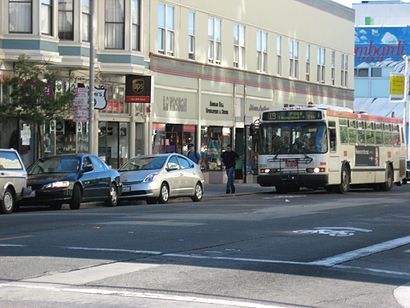
How to get to Polk Street by bus?
Click on the bus route to see step by step directions with maps, line arrival times and updated time schedules.
How to get to Polk Street by BART?
Click on the BART route to see step by step directions with maps, line arrival times and updated time schedules.
Bus stations near Polk Street in Russian Hill, Sf
- Beach St & Polk St, 1 min walk,
Cable Car stations near Polk Street in Russian Hill, Sf
- Hyde St & Beach St, 4 min walk,
Bus lines to Polk Street in Russian Hill, Sf
- 19, Shipyard,
What are the closest stations to Polk Street?
The closest stations to Polk Street are:
- Beach St & Polk St is 55 yards away, 1 min walk.
- Hyde St & Beach St is 319 yards away, 4 min walk.
Which bus lines stop near Polk Street?
These bus lines stop near Polk Street: 19, 28, 30.
Which BART line stops near Polk Street?
RED
What’s the nearest bus stop to Polk Street in Russian Hill, Sf?
The nearest bus stop to Polk Street in Russian Hill, Sf is Beach St & Polk St. It’s a 1 min walk away.
What’s the nearest cable car station to Polk Street in Russian Hill, Sf?
The nearest cable car station to Polk Street in Russian Hill, Sf is Hyde St & Beach St. It’s a 4 min walk away.
See Polk Street, Russian Hill, Sf, on the map
Public Transit to Polk Street in Russian Hill, Sf
Wondering how to get to Polk Street in Russian Hill, Sf, United States? Moovit helps you find the best way to get to Polk Street with step-by-step directions from the nearest public transit station.
Moovit provides free maps and live directions to help you navigate through your city. View schedules, routes, timetables, and find out how long does it take to get to Polk Street in real time.
Looking for the nearest stop or station to Polk Street? Check out this list of stops closest to your destination: Beach St & Polk St; Hyde St & Beach St.
Bus: 19, 28, 30.BART: RED.Cable Car: PH.
Want to see if there’s another route that gets you there at an earlier time? Moovit helps you find alternative routes or times. Get directions from and directions to Polk Street easily from the Moovit App or Website.
We make riding to Polk Street easy, which is why over 1.5 million users, including users in Russian Hill, Sf, trust Moovit as the best app for public transit. You don’t need to download an individual bus app or train app, Moovit is your all-in-one transit app that helps you find the best bus time or train time available.
For information on prices of bus and BART, costs and ride fares to Polk Street, please check the Moovit app.
Use the app to navigate to popular places including to the airport, hospital, stadium, grocery store, mall, coffee shop, school, college, and university.
Polk Street Address: Polk St & Beach St, San Francisco, CA 94109, USA street in Russian Hill, Sf
Attractions near Polk Street
Polk Street & Beach Street,Frog,Seal,National Maritime Museum,Compass - Beach Street,Ana Mandara,Bradley Joe - Compass, The Lurie Group,Jones Group SF of Compass,Frank Castaldini - Compass Real Estate,Compass,984 Beach St,Tower Tours,Beach St. (3031 Larkin St.) - Ghirardelli Square Parking Garage - Spothero,Landmark Builders,3129 Polk St,The Bay Cafè at Williams-Sonoma,Bay Cafe,Laurel's Catering,E204A,Fontana TowersHow to get to popular attractions in Russian Hill, Sf with public transit
Googleplex - 43,AMC Saratoga 14, San Jose,IKEA, East Palo Alto,Century Walnut Creek 14 and XD, Walnut Creek,City of Milpitas, Milpitas,Napa Valley, Yountville,Costco Wholesale, Santa Clara,Microsoft SVC,City of Gilroy, Gilroy,Googleplex - B40 Gym,440 Castro, Castro/Upper Market,City of Cupertino, Cupertino,Google - Quad Campus,Yahoo! Sunnyvale, Sunnyvale,Fremont BART Station, Fremont,City of Los Altos, Los Altos,Whole Foods Market, San Ramon,City of Pinole, Pinole,City of Rohnert Park, Rohnert Park,Sharks Ice at San Jose, San JoseGet around San Francisco - San Jose, CA by public transit!
Traveling around San Francisco - San Jose, CA has never been so easy. See step by step directions as you travel to any attraction, street or major public transit station. View bus and train schedules, arrival times, service alerts and detailed routes on a map, so you know exactly how to get to anywhere in San Francisco - San Jose, CA.
When traveling to any destination around San Francisco - San Jose, CA use Moovit's Live Directions with Get Off Notifications to know exactly where and how far to walk, how long to wait for your line, and how many stops are left. Moovit will alert you when it's time to get off — no need to constantly re-check whether yours is the next stop.
Wondering how to use public transit in San Francisco - San Jose, CA or how to pay for public transit in San Francisco - San Jose, CA? Moovit public transit app can help you navigate your way with public transit easily, and at minimum cost. It includes public transit fees, ticket prices, and costs. Looking for a map of San Francisco - San Jose, CA public transit lines? Moovit public transit app shows all public transit maps in San Francisco - San Jose, CA with all Bus, Train, BART, Light Rail, Ferry and Cable Car routes and stops on an interactive map.
San Francisco - San Jose, CA has 6 transit type(s), including: Bus, Train, BART, Light Rail, Ferry and Cable Car, operated by several transit agencies, including BART, Bay Area Rapid Transit, Muni Metro, Caltrain, VTA, Capitol Corridor, Sonoma Marin Area Rail Transit, MUNI, SF Cable Car, AC Transit, Dumbarton Express, Golden Gate Transit, County Connection, SamTrans, SamTrans / City of Menlo Park