Directions to Pompeii Design Group Cellular (Boston) with public transportation
The following transit lines have routes that pass near Pompeii Design Group Cellular
 Bus: 450, 501, 504, SL4, SL5.
- Train: FITCHBURG, FRAMINGHAM/WORCESTER.
- Subway: GREEN LINE B, GREEN LINE D, GREEN LINE E, ORANGE LINE, RED LINE.
How to get to Pompeii Design Group Cellular by bus?
Click on the bus route to see step by step directions with maps, line arrival times and updated time schedules.
From Hyatt Place Medford, Medford
44 minFrom Milton Academy, Milton
90 minFrom Heartbreak Hill, Newton
41 minFrom Warrior Ice Arena, Boston
61 minFrom Arlington, MA, Arlington
89 minFrom Winthrop, Winthrop Town
86 minFrom Danehy Park, Cambridge
70 minFrom Watertown Mall, Watertown Town
59 minFrom Newton, MA, Newton
41 minFrom Newton, MA, Newton
53 min
How to get to Pompeii Design Group Cellular by train?
Click on the train route to see step by step directions with maps, line arrival times and updated time schedules.
How to get to Pompeii Design Group Cellular by subway?
Click on the subway route to see step by step directions with maps, line arrival times and updated time schedules.
Bus stops near Pompeii Design Group Cellular in Boston
Subway stations near Pompeii Design Group Cellular in Boston
Bus lines to Pompeii Design Group Cellular in Boston
- 39, Forest Hills,VIEW
- 57, Watertown Via Kenmore,VIEW
- 501, Downtown Via Cambridge St And Copley (Express),VIEW
- 504, Downtown Via Copley (Express),VIEW
- 43, Park St & Tremont St,VIEW
- 9, City Point,VIEW
- 15, Mattapan Via Nubian & Fields Corner,VIEW
- GREEN LINE E SHUTTLE, Heath Street (Shuttle),VIEW
- GREEN LINE SHUTTLE, Blandford Street (Shuttle),VIEW
- SL5, Downtown,VIEW
- SL4, South Station,VIEW
- 11, Chauncy & Summer,VIEW
- 10, Arlington Via South Bay Center,VIEW
- 55, Arlington,VIEW
What are the closest stations to Pompeii Design Group Cellular?
The closest stations to Pompeii Design Group Cellular are:
- Stuart St @ Charles St S is 107 yards away, 2 min walk.
- Charles St S @ Park Plaza is 195 yards away, 3 min walk.
- Herald St @ Tremont St is 255 yards away, 4 min walk.
- Tremont St @ Boylston Station is 316 yards away, 4 min walk.
- Washington St @ Tufts Med Ctr is 341 yards away, 5 min walk.
- Chinatown is 342 yards away, 5 min walk.
- Downtown Crossing is 513 yards away, 7 min walk.
- Saint James Ave @ Arlington St is 540 yards away, 7 min walk.
- Arlington is 798 yards away, 10 min walk.
Which bus lines stop near Pompeii Design Group Cellular?
These bus lines stop near Pompeii Design Group Cellular: 450, 501, 504, SL4, SL5.
Which train lines stop near Pompeii Design Group Cellular?
These train lines stop near Pompeii Design Group Cellular: FITCHBURG, FRAMINGHAM/WORCESTER.
Which subway lines stop near Pompeii Design Group Cellular?
These subway lines stop near Pompeii Design Group Cellular: GREEN LINE B, GREEN LINE D, GREEN LINE E, ORANGE LINE, RED LINE.
What’s the nearest subway station to Pompeii Design Group Cellular in Boston?
The nearest subway station to Pompeii Design Group Cellular in Boston is Chinatown. It’s a 5 min walk away.
What’s the nearest bus station to Pompeii Design Group Cellular in Boston?
The nearest bus station to Pompeii Design Group Cellular in Boston is Stuart St @ Charles St S. It’s a 2 min walk away.
What time is the first subway to Pompeii Design Group Cellular in Boston?
The GREEN LINE D is the first subway that goes to Pompeii Design Group Cellular in Boston. It stops nearby at 5:07 AM.
What time is the last subway to Pompeii Design Group Cellular in Boston?
The GREEN LINE E is the last subway that goes to Pompeii Design Group Cellular in Boston. It stops nearby at 2:16 AM.
What time is the first bus to Pompeii Design Group Cellular in Boston?
The 43 is the first bus that goes to Pompeii Design Group Cellular in Boston. It stops nearby at 5:06 AM.
What time is the last bus to Pompeii Design Group Cellular in Boston?
The 10 is the last bus that goes to Pompeii Design Group Cellular in Boston. It stops nearby at 1:19 AM.
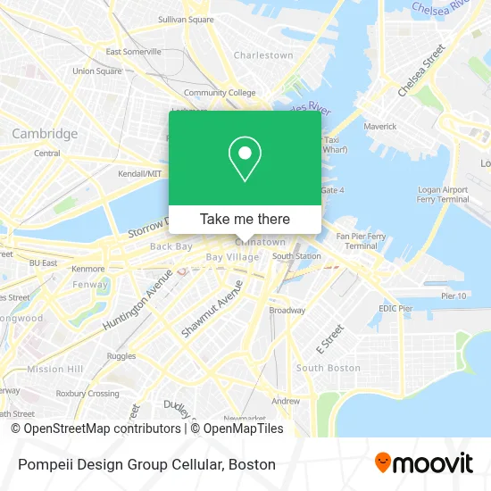
See Pompeii Design Group Cellular, Boston, on the map
Public Transit to Pompeii Design Group Cellular in Boston
Wondering how to get to Pompeii Design Group Cellular in Boston? Moovit helps you find the best way to get to Pompeii Design Group Cellular with step-by-step directions from the nearest public transit station.
Moovit provides free maps and live directions to help you navigate through your city. View schedules, routes, timetables, and find out how long does it take to get to Pompeii Design Group Cellular in real time.
Looking for the nearest stop or station to Pompeii Design Group Cellular? Check out this list of stops closest to your destination: Stuart St @ Charles St S; Charles St S @ Park Plaza; Herald St @ Tremont St; Tremont St @ Boylston Station; Washington St @ Tufts Med Ctr; Chinatown; Downtown Crossing; Saint James Ave @ Arlington St; Arlington.
Bus: 450, 501, 504, SL4, SL5, 39, 57, 43, 9.Train: FITCHBURG, FRAMINGHAM/WORCESTER.Subway: GREEN LINE B, GREEN LINE D, GREEN LINE E, ORANGE LINE, RED LINE, GREEN LINE C.
Want to see if there’s another route that gets you there at an earlier time? Moovit helps you find alternative routes or times. Get directions from and directions to Pompeii Design Group Cellular easily from the Moovit App or Website.
We make riding to Pompeii Design Group Cellular easy, which is why over 1.7 million users, including users in Boston, trust Moovit as the best app for public transit. You don’t need to download an individual bus app or train app, Moovit is your all-in-one transit app that helps you find the best bus time or train time available.
For information on prices of bus, subway and train, costs and ride fares to Pompeii Design Group Cellular, please check the Moovit app.
Use the app to navigate to popular places including to the airport, hospital, stadium, grocery store, mall, coffee shop, school, college, and university.
Pompeii Design Group Cellular Address: 110 Stuart St Unit 17D street in Boston
- W Boston Fit,
- W HOTELS,
- W Boston,
- Bliss Spa at W Boston,
- Rock Bottom Restaurant and Brewery,
- Theatre District,
- The W Hotel Boston,
- Tufts Medical Center - Biewend building,
- Shubert Theater (Citi Performing Arts Center Shubert Theatre),
- Boston Theatre District,
- Shubert Theatre MA USA,
- Genkiya Sushi,
- Rock Bottom,
- Shubert Theatre,
- Moxy Boston Downtown,
- Nick's Comedy Stop,
- Venu,
- Blacklist Boston,
- Nick's Comedy Stop (Nick From Nick's),
- Icon Nightclub
Places Near Pompeii Design Group Cellular (Boston)
- Boston Medical Center, Boston,
- Prudential Center, Boston,
- Castle Island, Boston,
- Wang Theater, Boston,
- Isabella Stewart Gardner Museum, Boston,
- Seaport District, Boston,
- Museum Of Science, Boston,
- Leader Bank Pavilion (Leader Bank Pavillion), Boston,
- Cheers, Boston,
- North End, Boston,
- Wilbur Theatre, Boston,
- Boston Common, Boston,
- Quincy Market, Boston,
- Boston Children's Hospital, Boston,
- House Of Blues, Boston,
- Faneuil Hall, Boston,
- Boston Convention & Exhibition Center, Boston,
- Td Garden, Boston,
- Mgm Music Hall, Boston,
- Massachusetts General Hospital, Boston
How to get to popular places in Boston with public transit
Get around Boston by public transit!
Traveling around Boston has never been so easy. See step by step directions as you travel to any attraction, street or major public transit station. View bus and train schedules, arrival times, service alerts and detailed routes on a map, so you know exactly how to get to anywhere in Boston.
When traveling to any destination around Boston use Moovit's Live Directions with Get Off Notifications to know exactly where and how far to walk, how long to wait for your line, and how many stops are left. Moovit will alert you when it's time to get off — no need to constantly re-check whether yours is the next stop.
Wondering how to use public transit in Boston or how to pay for public transit in Boston? Moovit public transit app can help you navigate your way with public transit easily, and at minimum cost. It includes public transit fees, ticket prices, and costs. Looking for a map of Boston public transit lines? Moovit public transit app shows all public transit maps in Boston with all Bus, Train, Subway and Ferry routes and stops on an interactive map.
Boston has 4 transit type(s), including: Bus, Train, Subway and Ferry, operated by several transit agencies, including MBTA, Southeastern Regional Transit Authority, MetroWest Regional Transit Authority, Rhode Island Public Transit Authority, WRTA, Lowell Regional Transit Authority, Merrimack Valley Transit, Montachusett Regional Transit Authority, Cape Cod Regional Transit Authority, Brockton Area Transit Authority, Martha's Vineyard Transit Authority, the WAVE - Nantucket Regional Transit Authority, GATRA, Cape Ann Transportation Authority and Massport