See Ponce De Leon Apartment Building, Washington, on the map
Directions to Ponce De Leon Apartment Building (Washington) with public transportation
The following transit lines have routes that pass near Ponce De Leon Apartment Building
 Bus:
Bus: - Metro:
How to get to Ponce De Leon Apartment Building by bus?
Click on the bus route to see step by step directions with maps, line arrival times and updated time schedules.
How to get to Ponce De Leon Apartment Building by metro?
Click on the metro route to see step by step directions with maps, line arrival times and updated time schedules.
Metro stations near Ponce De Leon Apartment Building in Washington
- Friendship Heights,30 min walk,
What are the closest stations to Ponce De Leon Apartment Building?
The closest stations to Ponce De Leon Apartment Building are:
- Friendship Heights is 2507 yards away, 30 min walk.
Which bus lines stop near Ponce De Leon Apartment Building?
These bus lines stop near Ponce De Leon Apartment Building: L2, N2.
Which metro line stops near Ponce De Leon Apartment Building?
METRORAIL RED LINE
What’s the nearest metro station to Ponce De Leon Apartment Building in Washington?
The nearest metro station to Ponce De Leon Apartment Building in Washington is Friendship Heights. It’s a 30 min walk away.
See Ponce De Leon Apartment Building, Washington, on the map
Public Transit to Ponce De Leon Apartment Building in Washington
Wondering how to get to Ponce De Leon Apartment Building in Washington, United States? Moovit helps you find the best way to get to Ponce De Leon Apartment Building with step-by-step directions from the nearest public transit station.
Moovit provides free maps and live directions to help you navigate through your city. View schedules, routes, timetables, and find out how long does it take to get to Ponce De Leon Apartment Building in real time.
Looking for the nearest stop or station to Ponce De Leon Apartment Building? Check out this list of stops closest to your destination: Friendship Heights.
Bus:Metro:
Want to see if there’s another route that gets you there at an earlier time? Moovit helps you find alternative routes or times. Get directions from and directions to Ponce De Leon Apartment Building easily from the Moovit App or Website.
We make riding to Ponce De Leon Apartment Building easy, which is why over 1.5 million users, including users in Washington, trust Moovit as the best app for public transit. You don’t need to download an individual bus app or train app, Moovit is your all-in-one transit app that helps you find the best bus time or train time available.
For information on prices of bus and metro, costs and ride fares to Ponce De Leon Apartment Building, please check the Moovit app.
Use the app to navigate to popular places including to the airport, hospital, stadium, grocery store, mall, coffee shop, school, college, and university.
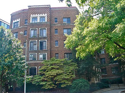
Ponce De Leon Apartment Building Address: Connecticut Avenue Northwest street in Washington
Attractions near Ponce De Leon Apartment Building
Family First Investors,Washington Photo Safari,Schiff Neil P PHD,4545 Connecticut Avenue Northwest,Appleton St NW (connecticut appleton),Connecticut Ave NW Appleton,3504 Appleton St NW ,819,8,81,Deborah A Newmark, Licfw,Deborah A Newmark LCSW,The Albemarle,Claudia Salazar & Associates,The Center for Natural Healing,Stutman Suzanne S,3400 Brandywine St NW ,411,New Amersham,Albemarle St NW (Connecticut Ave NW and albemarle)How to get to popular attractions in Washington with public transit
Baltimore Marriott Inner Harbor at Camden Yards, Baltimore,Toki Underground, Washington,Maryland State Fairgrounds, Baltimore County,Odenton MARC Station, Anne Arundel County,Daniel O'Connell's Irish Restaurant & Bar, Alexandria,Shaw's Tavern, Washington,Manassas, VA, Manassas,Peking Gourmet Inn, Fairfax County,Renaissance Baltimore Harborplace Hotel, Baltimore,Merritt Downtown Athletic Club, Baltimore,Damascus, MD, Montgomery County,I-270, Montgomery County,Little Havana, Baltimore,Penn Quarter Sports Tavern, Washington,Howard Community College, Howard County,Hard Rock Cafe Washington DC, Washington,AMC Owings Mills 17, Baltimore County,District Chophouse & Brewery, Washington,Nando's Peri-Peri, Washington,Owings Mills, Maryland, Baltimore CountyGet around Washington by public transit!
Traveling around Washington has never been so easy. See step by step directions as you travel to any attraction, street or major public transit station. View bus and train schedules, arrival times, service alerts and detailed routes on a map, so you know exactly how to get to anywhere in Washington.
When traveling to any destination around Washington use Moovit's Live Directions with Get Off Notifications to know exactly where and how far to walk, how long to wait for your line, and how many stops are left. Moovit will alert you when it's time to get off — no need to constantly re-check whether yours is the next stop.
Wondering how to use public transit in Washington or how to pay for public transit in Washington? Moovit public transit app can help you navigate your way with public transit easily, and at minimum cost. It includes public transit fees, ticket prices, and costs. Looking for a map of Washington public transit lines? Moovit public transit app shows all public transit maps in Washington with all bus or metro routes and stops on an interactive map.
Washington has 2 transit type(s), including: bus or metro, operated by several transit agencies, including WMATA, WMATA, Montgomery County Ride On, Fairfax Connector, TheBus, DC Circulator, MDOT MTA, Marc, MDOT MTA, MDOT MTA, Virginia Railway Express (VRE), PRTC, DASH - Alexandria, Arlington Transit (ART) and DC Streetcar