How to get to Popcorn Plaza by bus?
Click on the bus route to see step by step directions with maps, line arrival times and updated time schedules.
From Beth Israel Deaconess Hospital-Milton, Milton
56 minFrom 240 Mount Vernon Street, Boston
89 minFrom Children's Hospital, Boston
89 minFrom Best Western Adams Inn Quincy - Boston, Quincy
42 minFrom Marina Bay, Quincy
73 minFrom Washington St, Boston
62 minFrom Randolph, MA, Randolph
73 minFrom Doubletree-Boston Bayside, Boston
90 minFrom Nantasket Beach, Hull
45 minFrom Boston Scientific, Quincy
60 min
How to get to Popcorn Plaza by train?
Click on the train route to see step by step directions with maps, line arrival times and updated time schedules.
How to get to Popcorn Plaza by subway?
Click on the subway route to see step by step directions with maps, line arrival times and updated time schedules.
Bus stops near Popcorn Plaza in Quincy
Subway station near Popcorn Plaza in Quincy
- Wollaston, 38 min walk,VIEW
Train station near Popcorn Plaza in Quincy
- Weymouth Landing/East Braintree, 53 min walk,VIEW
Bus lines to Popcorn Plaza in Quincy
What are the closest stations to Popcorn Plaza?
The closest stations to Popcorn Plaza are:
- South St Opp Main St is 237 yards away, 4 min walk.
- Washington St @ Washington Ct is 279 yards away, 4 min walk.
- Wollaston is 3236 yards away, 38 min walk.
- Weymouth Landing/East Braintree is 4508 yards away, 53 min walk.
Which bus lines stop near Popcorn Plaza?
These bus lines stop near Popcorn Plaza: 220, 222.
Which train lines stop near Popcorn Plaza?
These train lines stop near Popcorn Plaza: FALL RIVER/NEW BEDFORD, GREENBUSH.
Which subway line stops near Popcorn Plaza?
RED LINE (Ashmont/Braintree)
What’s the nearest bus station to Popcorn Plaza in Quincy?
The nearest bus stations to Popcorn Plaza in Quincy are South St Opp Main St and Washington St @ Washington Ct. The closest one is a 4 min walk away.
What time is the first subway to Popcorn Plaza in Quincy?
The RED LINE is the first subway that goes to Popcorn Plaza in Quincy. It stops nearby at 5:18 AM.
What time is the last subway to Popcorn Plaza in Quincy?
The RED LINE is the last subway that goes to Popcorn Plaza in Quincy. It stops nearby at 1:49 AM.
What time is the first train to Popcorn Plaza in Quincy?
The GREENBUSH is the first train that goes to Popcorn Plaza in Quincy. It stops nearby at 5:46 AM.
What time is the last train to Popcorn Plaza in Quincy?
The GREENBUSH is the last train that goes to Popcorn Plaza in Quincy. It stops nearby at 12:14 AM.
What time is the first bus to Popcorn Plaza in Quincy?
The 222 is the first bus that goes to Popcorn Plaza in Quincy. It stops nearby at 4:59 AM.
What time is the last bus to Popcorn Plaza in Quincy?
The 220 is the last bus that goes to Popcorn Plaza in Quincy. It stops nearby at 1:47 AM.
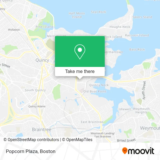
See Popcorn Plaza, Quincy, on the map
Public Transit to Popcorn Plaza in Quincy
Wondering how to get to Popcorn Plaza in Quincy? Moovit helps you find the best way to get to Popcorn Plaza with step-by-step directions from the nearest public transit station.
Moovit provides free maps and live directions to help you navigate through your city. View schedules, routes, timetables, and find out how long does it take to get to Popcorn Plaza in real time.
Looking for the nearest stop or station to Popcorn Plaza? Check out this list of stops closest to your destination: South St Opp Main St; Washington St @ Washington Ct; Wollaston; Weymouth Landing/East Braintree.
Bus: 220, 222, 225.Train: FALL RIVER/NEW BEDFORD, GREENBUSH.Subway: RED LINE.
Want to see if there’s another route that gets you there at an earlier time? Moovit helps you find alternative routes or times. Get directions from and directions to Popcorn Plaza easily from the Moovit App or Website.
We make riding to Popcorn Plaza easy, which is why over 1.7 million users, including users in Quincy, trust Moovit as the best app for public transit. You don’t need to download an individual bus app or train app, Moovit is your all-in-one transit app that helps you find the best bus time or train time available.
For information on prices of bus, subway and train, costs and ride fares to Popcorn Plaza, please check the Moovit app.
Use the app to navigate to popular places including to the airport, hospital, stadium, grocery store, mall, coffee shop, school, college, and university.
Popcorn Plaza Address: 225 West St street in Quincy
- Cricket Locksmith,
- 5star Appliance Repair Company,
- U-Haul,
- USPS Collection Box - Blue Box,
- Faxon Commons,
- Cleverly Court Field,
- Tacos & Pupusas,
- Nour al Sham Market,
- Credit Union 1,
- JCBT Architect,
- The Craic Irish Pub,
- Seven Days Locksmith,
- DUNKIN',
- Sylvia Halbfinger, Licsw,
- Quincy Center, A Program of Arbour Hospital,
- New England Aquarium - Animal Care Center,
- Jiffy Lube,
- Prestige Car Wash,
- Flynn Masonry,
- BB.Q Chicken Quincy
Places Near Popcorn Plaza (Quincy)
- Quincy Market, Boston,
- North End, Boston,
- Boston Children's Hospital, Boston,
- Td Garden, Boston,
- Prudential Center, Boston,
- Museum Of Science, Boston,
- Boston Common, Boston,
- Wang Theater, Boston,
- House Of Blues, Boston,
- Seaport District, Boston,
- Wilbur Theatre, Boston,
- Cheers, Boston,
- Faneuil Hall, Boston,
- Boston Medical Center, Boston,
- Mgm Music Hall, Boston,
- Leader Bank Pavilion (Leader Bank Pavillion), Boston,
- Isabella Stewart Gardner Museum, Boston,
- Massachusetts General Hospital, Boston,
- Boston Convention & Exhibition Center, Boston,
- Castle Island, Boston
How to get to popular places in Boston with public transit
Get around Quincy by public transit!
Traveling around Quincy has never been so easy. See step by step directions as you travel to any attraction, street or major public transit station. View bus and train schedules, arrival times, service alerts and detailed routes on a map, so you know exactly how to get to anywhere in Quincy.
When traveling to any destination around Quincy use Moovit's Live Directions with Get Off Notifications to know exactly where and how far to walk, how long to wait for your line, and how many stops are left. Moovit will alert you when it's time to get off — no need to constantly re-check whether yours is the next stop.
Wondering how to use public transit in Quincy or how to pay for public transit in Quincy? Moovit public transit app can help you navigate your way with public transit easily, and at minimum cost. It includes public transit fees, ticket prices, and costs. Looking for a map of Quincy public transit lines? Moovit public transit app shows all public transit maps in Quincy with all Bus, Train, Subway and Ferry routes and stops on an interactive map.
Boston has 4 transit type(s), including: Bus, Train, Subway and Ferry, operated by several transit agencies, including MBTA, Southeastern Regional Transit Authority, MetroWest Regional Transit Authority, Rhode Island Public Transit Authority, WRTA, Lowell Regional Transit Authority, Merrimack Valley Transit, Montachusett Regional Transit Authority, Cape Cod Regional Transit Authority, Brockton Area Transit Authority, Martha's Vineyard Transit Authority, the WAVE - Nantucket Regional Transit Authority, GATRA, Cape Ann Transportation Authority and Massport