Directions to Poptronics (Baltimore) with public transportation
The following transit lines have routes that pass near Poptronics
 Bus: 51, 73, 94, CITYLINK NAVY, CITYLINK PURPLE.
- Train: MARC.
- Metro: METRO.
- Light Rail: LIGHT RAILLINK.
How to get to Poptronics by bus?
Click on the bus route to see step by step directions with maps, line arrival times and updated time schedules.
From Glen Burnie, MD, Anne Arundel County
65 minFrom Good Samaritan Hospital, Baltimore
60 minFrom Giant Food Stores, Baltimore
37 minFrom NSA Friendship Annex (FANX), Anne Arundel County
72 minFrom Reisterstown Road Plaza, Baltimore
63 minFrom Walmart, Baltimore County
59 minFrom Western High School, Baltimore
49 minFrom I-695 @ Exit 17 (Security Blvd/MD 122), Baltimore County
45 minFrom Loyola University Maryland, Baltimore
43 minFrom Harford Road, Baltimore
36 min
How to get to Poptronics by metro?
Click on the metro route to see step by step directions with maps, line arrival times and updated time schedules.
Bus stops near Poptronics in Baltimore
Light Rail stations near Poptronics in Baltimore
- Convention Center, 9 min walk,VIEW
Train station near Poptronics in Baltimore
- Camden Station Marc, 22 min walk,VIEW
Bus lines to Poptronics in Baltimore
What are the closest stations to Poptronics?
The closest stations to Poptronics are:
- Russell St & Hamburg St FS Nb is 206 yards away, 3 min walk.
- Washington Blvd & Barre St Wb is 556 yards away, 7 min walk.
- Convention Center is 673 yards away, 9 min walk.
- Pratt St & Greene St is 898 yards away, 11 min walk.
- Camden Station Marc is 1854 yards away, 22 min walk.
Which bus lines stop near Poptronics?
These bus lines stop near Poptronics: 51, 73, 94, CITYLINK NAVY, CITYLINK PURPLE, CITYLINK YELLOW.
Which metro line stops near Poptronics?
METRO (Towards John Hopkins)
Which light rail line stops near Poptronics?
LIGHT RAILLINK (Soutbound)
What’s the nearest light rail station to Poptronics in Baltimore?
The nearest light rail station to Poptronics in Baltimore is Convention Center. It’s a 9 min walk away.
What’s the nearest train station to Poptronics in Baltimore?
The nearest train station to Poptronics in Baltimore is Camden Station Marc. It’s a 22 min walk away.
What’s the nearest bus station to Poptronics in Baltimore?
The nearest bus station to Poptronics in Baltimore is Russell St & Hamburg St FS Nb. It’s a 3 min walk away.
What time is the first light rail to Poptronics in Baltimore?
The LIGHT RAILLINK is the first light rail that goes to Poptronics in Baltimore. It stops nearby at 3:59 AM.
What time is the last light rail to Poptronics in Baltimore?
The LIGHT RAILLINK is the last light rail that goes to Poptronics in Baltimore. It stops nearby at 1:17 AM.
What time is the first train to Poptronics in Baltimore?
The MARC is the first train that goes to Poptronics in Baltimore. It stops nearby at 5:00 AM.
What time is the last train to Poptronics in Baltimore?
The MARC is the last train that goes to Poptronics in Baltimore. It stops nearby at 8:55 PM.
What time is the first bus to Poptronics in Baltimore?
The 75 is the first bus that goes to Poptronics in Baltimore. It stops nearby at 3:09 AM.
What time is the last bus to Poptronics in Baltimore?
The CITYLINK YELLOW is the last bus that goes to Poptronics in Baltimore. It stops nearby at 3:18 AM.
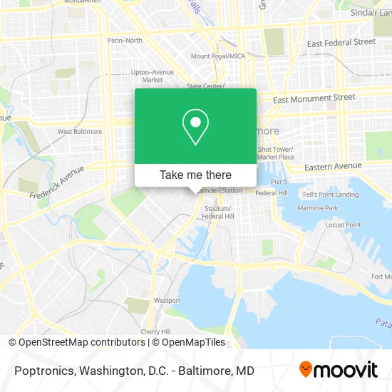
See Poptronics, Baltimore, on the map
Public Transit to Poptronics in Baltimore
Wondering how to get to Poptronics in Baltimore? Moovit helps you find the best way to get to Poptronics with step-by-step directions from the nearest public transit station.
Moovit provides free maps and live directions to help you navigate through your city. View schedules, routes, timetables, and find out how long does it take to get to Poptronics in real time.
Looking for the nearest stop or station to Poptronics? Check out this list of stops closest to your destination: Russell St & Hamburg St FS Nb; Washington Blvd & Barre St Wb; Convention Center; Pratt St & Greene St; Camden Station Marc.
Bus: 51, 73, 94, CITYLINK NAVY, CITYLINK PURPLE, CITYLINK YELLOW, 69, 70, 75, CITYLINK BROWN, 76, 91.Train: MARC.Metro: METRO.Light Rail: LIGHT RAILLINK.
Want to see if there’s another route that gets you there at an earlier time? Moovit helps you find alternative routes or times. Get directions from and directions to Poptronics easily from the Moovit App or Website.
We make riding to Poptronics easy, which is why over 1.5 million users, including users in Baltimore, trust Moovit as the best app for public transit. You don’t need to download an individual bus app or train app, Moovit is your all-in-one transit app that helps you find the best bus time or train time available.
For information on prices of bus, light rail and metro, costs and ride fares to Poptronics, please check the Moovit app.
Use the app to navigate to popular places including to the airport, hospital, stadium, grocery store, mall, coffee shop, school, college, and university.
Poptronics Address: 1004 Russell St Baltimore, MD 21230 street in Baltimore
- Store It All Self Storage,
- Extra Space Storage,
- Catholic Charities Head Start,
- Ravens,
- MZ Bakertinytots Christain Daycare,
- TJS Cleaning Service,
- Ravenswalk,
- Eaton,
- Green Door Properties,
- The Flower Shop,
- Mcnair Enterprise,
- 24 Hours Locksmith In Baltimore,
- MD Lot MD Promo Ravens,
- Ravens Walk @ M&T Bank Stadium,
- 621 Burgundy St Parking,
- Bryan's Furnished Baltimore Rental,
- Hot Properties,
- Lot O - M&T Bank Stadium,
- 1100 Wicomico St,
- Roberto E Baez Ortz Law Office
Places Near Poptronics (Baltimore)
- Georgetown, Washington,
- Marriott Marquis Washington, DC, Washington,
- Basilica of the National Shrine, Washington,
- Sibley Memorial Hospital, Washington,
- Washington National Cathedral, Washington,
- Warner Theatre, Washington,
- National Zoo, Washington,
- PG Mall, Prince George's County,
- Camden Yards, Baltimore,
- The Anthem, Washington,
- Westfield Montgomery Mall, Montgomery County,
- M&T Bank Stadium, Baltimore,
- Museum Of The Bible, Washington,
- National Museum of African American History and Culture, Washington,
- National Mall, Washington,
- Washington DC VA Medical Center, Washington,
- Amazon Hq2, Arlington County,
- Rock Creek Tennis Center, Washington,
- Capital One Arena, Washington,
- Pennsylvania Ave NW (3rd st and pennsylvania), Washington
How to get to popular places in Washington, D.C. - Baltimore, MD with public transit
Get around Baltimore by public transit!
Traveling around Baltimore has never been so easy. See step by step directions as you travel to any attraction, street or major public transit station. View bus and train schedules, arrival times, service alerts and detailed routes on a map, so you know exactly how to get to anywhere in Baltimore.
When traveling to any destination around Baltimore use Moovit's Live Directions with Get Off Notifications to know exactly where and how far to walk, how long to wait for your line, and how many stops are left. Moovit will alert you when it's time to get off — no need to constantly re-check whether yours is the next stop.
Wondering how to use public transit in Baltimore or how to pay for public transit in Baltimore? Moovit public transit app can help you navigate your way with public transit easily, and at minimum cost. It includes public transit fees, ticket prices, and costs. Looking for a map of Baltimore public transit lines? Moovit public transit app shows all public transit maps in Baltimore with all Bus, Train, Metro, Light Rail and Ferry routes and stops on an interactive map.
Washington, D.C. - Baltimore, MD has 5 transit type(s), including: Bus, Train, Metro, Light Rail and Ferry, operated by several transit agencies, including WMATA, Montgomery County Ride On, Fairfax Connector, TheBus, PRTC, DASH - Alexandria, Arlington Transit (ART), RTA of Central Maryland, MDOT MTA, MDOT MTA Light RailLink, MDOT MTA Commuter Bus, MDOT MTA Local Bus, FXBGO!, Virginia Railway Express (VRE) and MARC