Directions to Poquott (Poquott, Ny) with public transportation
The following transit lines have routes that pass near Poquott
How to get to Poquott by bus?
Click on the bus route to see step by step directions with maps, line arrival times and updated time schedules.
How to get to Poquott by train?
Click on the train route to see step by step directions with maps, line arrival times and updated time schedules.
Bus stations near Poquott in Poquott, Ny
- Three Village Shopping Center, 40 min walk,
Train stations near Poquott in Poquott, Ny
- Port Jefferson, 54 min walk,
Bus lines to Poquott in Poquott, Ny
- 51, Patchogue Railroad Via Smith Haven Mall,
What are the closest stations to Poquott?
The closest stations to Poquott are:
- Three Village Shopping Center is 3351 yards away, 40 min walk.
- Port Jefferson is 4487 yards away, 54 min walk.
Which bus lines stop near Poquott?
These bus lines stop near Poquott: S60, S62, S76.
Which train line stops near Poquott?
PORT JEFFERSON
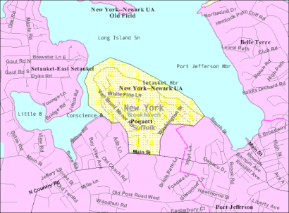
See Poquott, Poquott, Ny, on the map
Public Transit to Poquott in Poquott, Ny
Wondering how to get to Poquott in Poquott, Ny, United States? Moovit helps you find the best way to get to Poquott with step-by-step directions from the nearest public transit station.
Moovit provides free maps and live directions to help you navigate through your city. View schedules, routes, timetables, and find out how long does it take to get to Poquott in real time.
Looking for the nearest stop or station to Poquott? Check out this list of stops closest to your destination: Three Village Shopping Center; Port Jefferson.
Bus: S60, S62, S76, 51.Train: PORT JEFFERSON, PORT JEFFERSON BRANCH.
Want to see if there’s another route that gets you there at an earlier time? Moovit helps you find alternative routes or times. Get directions from and directions to Poquott easily from the Moovit App or Website.
We make riding to Poquott easy, which is why over 1.5 million users, including users in Poquott, Ny, trust Moovit as the best app for public transit. You don’t need to download an individual bus app or train app, Moovit is your all-in-one transit app that helps you find the best bus time or train time available.
For information on prices of bus, train and subway, costs and ride fares to Poquott, please check the Moovit app.
Get to Poquott with public transit and pay for the ride in the Moovit app. In addition to all info you may need for your trip to Poquott, including live directions, real-time arrivals and fare prices, you can also buy public transit passes for your rides. No need for cash or paper tickets to get to Poquott - everything you need is accessible in the app with a click of the button.
Use the app to navigate to popular places including to the airport, hospital, stadium, grocery store, mall, coffee shop, school, college, and university.
Poquott Address: Washington Street street in Poquott, Ny
Attractions near Poquott
Washington St (washington cedar),Emerald Irrigation,1 Walnut Ave,76 New St,PJK Unlimited,60 New St,54 New St,Research Electronics Dev,TDM Consulting Engineer,1 New St,25 New St,49 Chestnut Ave,Elite Long Island Charters,Bayview and Cedar,99 Washington St,Chestnut Ave (chestnut ave walnut),Singingwood Music,Baskin Robbins Seth Goldstein,25 Washington St,94 Shen CtHow to get to popular attractions in Poquott, Ny with public transit
Union Square, Manhattan,BM3/BM4 Express Bus,Jackson Heights Roosevelt Avenue 74th Street Station, Queens,Poconos, Pennsylvania, Bronx,Museum of Modern Art (MoMA), Manhattan,George Washington Bridge Bus Station, Manhattan,Pace University, Manhattan,66 John Street, Manhattan,NJ 440, Jersey City, Nj,Castle Clinton National Monument, Manhattan,Church Street, Manhattan,Prudential Center, Newark, Nj,Pier 36, Manhattan,The Cloisters, Manhattan,Flushing Meadows-Corona Park, Queens,Florham Park, NJ, Florham Park, Nj,MTA - 81st Street - Museum of Natural History, Manhattan,376 Hudson Street, Manhattan,103 Canal St, Manhattan,425 West 59th Street, ManhattanGet around New York - New Jersey by public transit!
Traveling around New York - New Jersey has never been so easy. See step by step directions as you travel to any attraction, street or major public transit station. View bus and train schedules, arrival times, service alerts and detailed routes on a map, so you know exactly how to get to anywhere in New York - New Jersey.
When traveling to any destination around New York - New Jersey use Moovit's Live Directions with Get Off Notifications to know exactly where and how far to walk, how long to wait for your line, and how many stops are left. Moovit will alert you when it's time to get off — no need to constantly re-check whether yours is the next stop.
Wondering how to use public transit in New York - New Jersey or how to pay for public transit in New York - New Jersey? Moovit public transit app can help you navigate your way with public transit easily, and at minimum cost. It includes public transit fees, ticket prices, and costs. Looking for a map of New York - New Jersey public transit lines? Moovit public transit app shows all public transit maps in New York - New Jersey with all Bus, Train, Subway, Light Rail, Ferry and Cable Car routes and stops on an interactive map.
New York - New Jersey has 6 transit type(s), including: Bus, Train, Subway, Light Rail, Ferry and Cable Car, operated by several transit agencies, including MTA Subway, Metro-North Railroad, LIRR, PATH, Shore Line East, MTA Bus Company, MTA New York City Transit - Express routes, MTA Bus, NJ Transit, NYC Ferry, NICE bus, Bee-Line Bus, NJ Transit Rail, Norwalk Transit District, CTTransit - Waterbury-Meriden