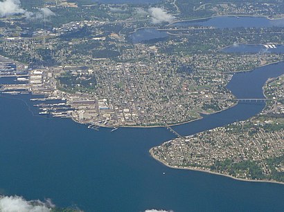
See Port Washington Narrows, Bremerton, on the map
Directions to Port Washington Narrows (Bremerton) with public transportation
The following transit lines have routes that pass near Port Washington Narrows
 Bus:
Bus:
How to get to Port Washington Narrows by bus?
Click on the bus route to see step by step directions with maps, line arrival times and updated time schedules.
Bus stations near Port Washington Narrows in Bremerton
- Lebo Blvd At Elm St,10 min walk,
- Snyder At 25th St.,64 min walk,
Bus lines to Port Washington Narrows in Bremerton
- 225,To Bremerton TC,
- 224,Westside Bremerton,
What are the closest stations to Port Washington Narrows?
The closest stations to Port Washington Narrows are:
- Lebo Blvd At Elm St is 781 yards away, 10 min walk.
- Snyder At 25th St. is 5225 yards away, 64 min walk.
Which bus line stops near Port Washington Narrows?
25
What’s the nearest bus stop to Port Washington Narrows in Bremerton?
The nearest bus stop to Port Washington Narrows in Bremerton is Lebo Blvd At Elm St. It’s a 10 min walk away.
See Port Washington Narrows, Bremerton, on the map
Public Transit to Port Washington Narrows in Bremerton
Wondering how to get to Port Washington Narrows in Bremerton, United States? Moovit helps you find the best way to get to Port Washington Narrows with step-by-step directions from the nearest public transit station.
Moovit provides free maps and live directions to help you navigate through your city. View schedules, routes, timetables, and find out how long does it take to get to Port Washington Narrows in real time.
Looking for the nearest stop or station to Port Washington Narrows? Check out this list of stops closest to your destination: Lebo Blvd At Elm St; Snyder At 25th St..
Bus:
Want to see if there’s another route that gets you there at an earlier time? Moovit helps you find alternative routes or times. Get directions from and directions to Port Washington Narrows easily from the Moovit App or Website.
We make riding to Port Washington Narrows easy, which is why over 1.5 million users, including users in Bremerton, trust Moovit as the best app for public transit. You don’t need to download an individual bus app or train app, Moovit is your all-in-one transit app that helps you find the best bus time or train time available.
For information on prices of bus and ferry, costs and ride fares to Port Washington Narrows, please check the Moovit app.
Use the app to navigate to popular places including to the airport, hospital, stadium, grocery store, mall, coffee shop, school, college, and university.
Location: Bremerton, Seattle - Tacoma, WA
Attractions near Port Washington Narrows
Dr.Caulkins Office,Taft Avenue,Bayview Apartments,City to City Airport Taxi Service,S.P. "Pat" Carey Vista,Pat Carey Vista,geocache-Olympic Sunset,Tracyton Beach Road Northwest,118 Sheridan Rd,Anderson Cove,S/V Chinook,Port Washington Marina - Chinook,The Charleston,Port Washington Marina,OLYRUN,Central Kitsap Fire District,Apple St,Lebo Recreation Area,2834 Hefner St,2834 Hefner AvenueHow to get to popular attractions in Bremerton with public transit
I-5,Sea Airport, Seatac,Northgate Mall, Seattle,Olympia-Lacey Amtrak Station (OLW),Everett, WA, Everett,Lake Stevens, Lake Stevens,Starbucks, Lynnwood,Bellevue Transit Center, Bellevue,Tavolàta, Seattle,City of University Place, University Place,Tulalip Casino Resort,The Landing, Renton,The Boeing Co., Everett,Seattle Central College, Seattle,Renton Highlands, Renton,Tacoma Community College, Tacoma,Marysville, WA,King County Metro Bus Route 255, Bellevue,Camp Murray,I90, BellevueGet around Bremerton by public transit!
Traveling around Bremerton has never been so easy. See step by step directions as you travel to any attraction, street or major public transit station. View bus and train schedules, arrival times, service alerts and detailed routes on a map, so you know exactly how to get to anywhere in Bremerton.
When traveling to any destination around Bremerton use Moovit's Live Directions with Get Off Notifications to know exactly where and how far to walk, how long to wait for your line, and how many stops are left. Moovit will alert you when it's time to get off — no need to constantly re-check whether yours is the next stop.
Wondering how to use public transit in Bremerton or how to pay for public transit in Bremerton? Moovit public transit app can help you navigate your way with public transit easily, and at minimum cost. It includes public transit fees, ticket prices, and costs. Looking for a map of Bremerton public transit lines? Moovit public transit app shows all public transit maps in Bremerton with all bus or ferry routes and stops on an interactive map.
Bremerton has 2 transit type(s), including: bus or ferry, operated by several transit agencies, including Sound Transit, Seattle Streetcar, Sound Transit, Metro Transit, Metro Transit, Sound Transit, Whatcom Transportation Authority, Mason Transit Authority, Snoqualmie Valley Transportation (SVT), Snoqualmie Valley Transportation, Amtrak, Island Transit, Kitsap Transit, Intercity Transit and Everett Transit