Directions to Port of Oakland with public transportation
The following transit lines have routes that pass near Port of Oakland
How to get to Port of Oakland by bus?
Click on the bus route to see step by step directions with maps, line arrival times and updated time schedules.
How to get to Port of Oakland by train?
Click on the train route to see step by step directions with maps, line arrival times and updated time schedules.
How to get to Port of Oakland by BART?
Click on the BART route to see step by step directions with maps, line arrival times and updated time schedules.
Bus stations near Port of Oakland
- West Oakland BART,4 min walk,
- Oakland (West Oakland BART Station),5 min walk,
- 7th St & Mandela Pkwy (West Oakland BART),6 min walk,
Ferry stations near Port of Oakland
- Oakland Jack London Square Water Shuttle Dock,30 min walk,
- Oakland Ferry Terminal,35 min walk,
Bart stations near Port of Oakland
- West Oakland,30 min walk,
Bus lines to Port of Oakland
- 62,West Oakland BART,
- 29,Christie Ave. & 64th St.,
- 14,Fruitvale BART,
- 36,West Oakland BART,
- GREYHOUND US0800,San Francisco - Coalinga - Los Angeles,
- GREYHOUND US0802,San Francisco - Fresno - Los Angeles,
- GREYHOUND US0831,San Francisco - Los Angeles - San Diego,
- GREYHOUND US0870,San Jose - San Francisco - Sacramento - Reno,
- FLIXBUS 2000,Los Angeles - San Francisco,
- FLIXBUS N2002,SF - LA - Palm Springs,
- FLIXBUS N2003,San Francisco - Los Angeles - San Diego,
- FLIXBUS 2005,SF - SLO - Santa Barbara - LA,
- FLIXBUS 2062,Sacramento - San Francisco,
- FLIXBUS 2064,San Francisco - Reno,
- MEGABUS,Anaheim, Ca,
- 800,Richmond BART,
What are the closest stations to Port of Oakland?
The closest stations to Port of Oakland are:
- West Oakland BART is 252 yards away, 4 min walk.
- Oakland (West Oakland BART Station) is 383 yards away, 5 min walk.
- 7th St & Mandela Pkwy (West Oakland BART) is 449 yards away, 6 min walk.
- Oakland Jack London Square Water Shuttle Dock is 2540 yards away, 30 min walk.
- West Oakland is 2561 yards away, 30 min walk.
- Oakland Ferry Terminal is 3000 yards away, 35 min walk.
Which bus lines stop near Port of Oakland?
These bus lines stop near Port of Oakland: 29, 36, GREYHOUND US0800, MEGABUS.
Which train line stops near Port of Oakland?
CC
Which BART lines stop near Port of Oakland?
These BART lines stop near Port of Oakland: BLUE, GREEN, YELLOW.
What’s the nearest BART station to Port of Oakland?
The nearest BART station to Port of Oakland is West Oakland. It’s a 30 min walk away.
What’s the nearest bus stop to Port of Oakland?
The nearest bus stop to Port of Oakland is West Oakland BART. It’s a 4 min walk away.
What’s the nearest ferry station to Port of Oakland?
The nearest ferry station to Port of Oakland is Oakland Jack London Square Water Shuttle Dock. It’s a 30 min walk away.
What time is the first BART to Port of Oakland?
The GREEN is the first BART that goes to Port of Oakland. It stops nearby at 5:06 AM.
What time is the last BART to Port of Oakland?
The YELLOW is the last BART that goes to Port of Oakland. It stops nearby at 1:00 AM.
What time is the first bus to Port of Oakland?
The 800 is the first bus that goes to Port of Oakland. It stops nearby at 3:00 AM.
What time is the last bus to Port of Oakland?
The FLIXBUS N2002 is the last bus that goes to Port of Oakland. It stops nearby at 10:20 AM.
What time is the first ferry to Port of Oakland?
The SOUTH SAN FRANCISCO is the first ferry that goes to Port of Oakland. It stops nearby at 6:20 AM.
What time is the last ferry to Port of Oakland?
The OAKLAND & ALAMEDA is the last ferry that goes to Port of Oakland. It stops nearby at 9:40 PM.
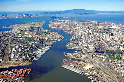
See Port of Oakland on the map
Public Transportation to Port of Oakland
Wondering how to get to Port of Oakland, United States? Moovit helps you find the best way to get to Port of Oakland with step-by-step directions from the nearest public transit station.
Moovit provides free maps and live directions to help you navigate through your city. View schedules, routes, timetables, and find out how long does it take to get to Port of Oakland in real time.
Looking for the nearest stop or station to Port of Oakland? Check out this list of stops closest to your destination: West Oakland BART; Oakland (West Oakland BART Station); 7th St & Mandela Pkwy (West Oakland BART); Oakland Jack London Square Water Shuttle Dock; West Oakland; Oakland Ferry Terminal.
Bus:2936GREYHOUND US0800MEGABUS6214Train:CCBART:BLUEGREENYELLOWREDREDFerry:OAKLAND ALAMEDA WATER SHUTTLE
Want to see if there’s another route that gets you there at an earlier time? Moovit helps you find alternative routes or times. Get directions from and directions to Port of Oakland easily from the Moovit App or Website.
We make riding to Port of Oakland easy, which is why over 1.5 million users, including users in Oakland, trust Moovit as the best app for public transit. You don’t need to download an individual bus app or train app, Moovit is your all-in-one transit app that helps you find the best bus time or train time available.
For information on prices of bus, BART, train, cable car and light rail, costs and ride fares to Port of Oakland, please check the Moovit app.
Get to Port of Oakland with public transit and pay for the ride in the Moovit app. In addition to all info you may need for your trip to Port of Oakland, including live directions, real-time arrivals and fare prices, you can also buy public transit passes for your rides. No need for cash or paper tickets to get to Port of Oakland - everything you need is accessible in the app with a click of the button.
Use the app to navigate to popular places including to the airport, hospital, stadium, grocery store, mall, coffee shop, school, college, and university.
Port of Oakland Address: 530 Water St street in Oakland
Attractions near Port of Oakland
West Oakland BART Station,Megabus West Oakland,Mandela Partners,Oakland Pride,US Post Office,Post Office-Oakland (USPS),Amtrak Train 718,San Francisco,Peralta Street & 10th Street,The Crucible,Entrance I-880 S,10th St,Stanley Brown Services,Drachma,Google Shuttle - West Oakland P&R,West Oakland Park & Ride,St. Patrick's Terra,Lower Bottoms,Brandon Silkscreen,IconHow to get to popular attractions in Oakland with public transit
Boudin Bakery Café SFO, Sfo,Alcatraz Cruises, North Beach, Sf,LinkedIn,Costco Wholesale, Antioch,Concord BART Station, Concord,Lawrence Livermore National Laboratory, Livermore,City of Dublin, Dublin,IKEA, East Palo Alto,Daly City BART, Daly City,San Antonio Caltrain Station,City of Fremont, Fremont,Serramonte Center, Daly City,Campbell, CA, Campbell,440 Castro, Castro/Upper Market,Costco Wholesale, Santa Clara,Safeway, Rohnert Park,Googleplex - Charlie's Cafe,I-680 / US-101 / I-280 Interchange, San Jose,The Home Depot, Concord,Sfo, SfoGet around Oakland by public transit!
Traveling around Oakland has never been so easy. See step by step directions as you travel to any attraction, street or major public transit station. View bus and train schedules, arrival times, service alerts and detailed routes on a map, so you know exactly how to get to anywhere in Oakland.
When traveling to any destination around Oakland use Moovit's Live Directions with Get Off Notifications to know exactly where and how far to walk, how long to wait for your line, and how many stops are left. Moovit will alert you when it's time to get off — no need to constantly re-check whether yours is the next stop.
Wondering how to use public transit in Oakland or how to pay for public transit in Oakland? Moovit public transit app can help you navigate your way with public transit easily, and at minimum cost. It includes public transit fees, ticket prices, and costs. Looking for a map of Oakland public transit lines? Moovit public transit app shows all public transit maps in Oakland with all bus, BART, train, cable car or light rail routes and stops on an interactive map.
Oakland has 5 transit type(s), including: bus, BART, train, cable car or light rail, operated by several transit agencies, including BART, Bay Area Rapid Transit, Muni Metro, Caltrain, VTA, Capitol Corridor, Sonoma Marin Area Rail Transit, MUNI, VTA, SF Cable Car, AC Transit, Dumbarton Express, Golden Gate Transit, County Connection and SamTrans