Directions to Porte D'Orléans (Paris) with public transportation
The following transit lines have routes that pass near Porte D'Orléans
How to get to Porte D'Orléans by bus?
Click on the bus route to see step by step directions with maps, line arrival times and updated time schedules.
How to get to Porte D'Orléans by train?
Click on the train route to see step by step directions with maps, line arrival times and updated time schedules.
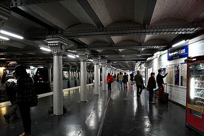
How to get to Porte D'Orléans by metro?
Click on the metro route to see step by step directions with maps, line arrival times and updated time schedules.
Which train line stops near Porte D'Orléans?
N
Which metro line stops near Porte D'Orléans?
4
Which bus lines stop near Porte D'Orléans?
These bus lines stop near Porte D'Orléans: 126, 187, 68.
See Porte D'Orléans, Paris, on the map
Public Transit to Porte D'Orléans in Paris
Wondering how to get to Porte D'Orléans in Paris, France? Moovit helps you find the best way to get to Porte D'Orléans with step-by-step directions from the nearest public transit station.
Moovit provides free maps and live directions to help you navigate through your city. View schedules, routes, timetables, and find out how long does it take to get to Porte D'Orléans in real time.
Train: N.Metro: 4.Bus: 126, 187, 68.
Want to see if there’s another route that gets you there at an earlier time? Moovit helps you find alternative routes or times. Get directions from and directions to Porte D'Orléans easily from the Moovit App or Website.
We make riding to Porte D'Orléans easy, which is why over 1.5 million users, including users in Paris, trust Moovit as the best app for public transit. You don’t need to download an individual bus app or train app, Moovit is your all-in-one transit app that helps you find the best bus time or train time available.
For information on prices of bus, metro, train and RER, costs and ride fares to Porte D'Orléans, please check the Moovit app.
Use the app to navigate to popular places including to the airport, hospital, stadium, grocery store, mall, coffee shop, school, college, and university.
Porte D'Orléans Address: Rue de la Légion Étrangère street in Paris
Attractions near Porte D'Orléans
Arrêt Porte d'Orléans – Métro [125,128,187,188,194,197,295,297,299],Parking Saesme Porte D'Orleans,Place du 25 Juin 1944,La Banque Postale,Porte D'Orléans - Métro,Paris/25 Août 1944/8,Avenue de la Porte d'Orléans & Place du 25 Août 1944,Bona Suzy,10944 Place du 25 Août 1944,boulangerie Thévenin,Porte D'Orléans - Ernest Reyer,La Rotonde,Pharmacie,Mandarin Film,Concept Coiffure,Feel Sport Montrouge,Arrêt Porte d'Orléans - Ernest Reyer [126],Pizza Prima,Statue Du Général Leclerc,RealHow to get to popular attractions in Paris with public transit
Cergy, Cergy,Residence Orangerie, Le Chesnay,McDonald's, Tremblay-En-France,Université Paris Ouest - Nanterre la Défense, Nanterre,Saint-Denis, Saint-Denis,Poissy, Poissy,Pontoise, Pontoise,Wunderman, Boulogne-Billancourt,Pontault-Combault, Pontault-Combault,McCann Paris, Clichy,Malakoff, Malakoff,MRM Paris, Clichy,Tour Pacific, Puteaux,Parc Des Princes G To K, Paris,Starbucks, Paray-Vieille-Poste,Place Coluche, Paris,SmartFocus, Clichy,Théâtre du Rond-Point, Paris,Place Napoléon Bonaparte, Fontainebleau,Starbucks, Velizy-VillacoublayGet around Paris by public transit!
Traveling around Paris has never been so easy. See step by step directions as you travel to any attraction, street or major public transit station. View bus and train schedules, arrival times, service alerts and detailed routes on a map, so you know exactly how to get to anywhere in Paris.
When traveling to any destination around Paris use Moovit's Live Directions with Get Off Notifications to know exactly where and how far to walk, how long to wait for your line, and how many stops are left. Moovit will alert you when it's time to get off — no need to constantly re-check whether yours is the next stop.
Wondering how to use public transit in Paris or how to pay for public transit in Paris? Moovit public transit app can help you navigate your way with public transit easily, and at minimum cost. It includes public transit fees, ticket prices, and costs. Looking for a map of Paris public transit lines? Moovit public transit app shows all public transit maps in Paris with all Bus, Train, Metro, Light Rail, RER and Funicular routes and stops on an interactive map.
Paris has 6 transit type(s), including: Bus, Train, Metro, Light Rail, RER and Funicular, operated by several transit agencies, including RATP, RER, RER Bus de remplacement, Train, Train Bus de remplacement, Tramway Bus de remplacement, TER, Tramway, ADP, Noctilien, Magical Shuttle, Apolo 7, Argenteuil - Boucles de Seine, Autobus du Fort, Autocars Dominique