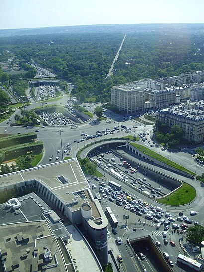
See Porte Maillot, Paris, on the map
Directions to Porte Maillot (Paris) with public transportation
The following transit lines have routes that pass near Porte Maillot
 RER:
RER: - Metro:
- Bus:
How to get to Porte Maillot by bus?
Click on the bus route to see step by step directions with maps, line arrival times and updated time schedules.
How to get to Porte Maillot by metro?
Click on the metro route to see step by step directions with maps, line arrival times and updated time schedules.
Bus stations near Porte Maillot in Paris
- Porte Maillot - Métro - RER,2 min walk,
- Porte Maillot - Neuilly,3 min walk,
- Porte Maillot,4 min walk,
- Porte Maillot - Grande Armée,6 min walk,
- Paris Porte Maillot,6 min walk,
- Marché,7 min walk,
Metro stations near Porte Maillot in Paris
- Porte Dauphine,11 min walk,
Rer stations near Porte Maillot in Paris
- Neuilly Porte Maillot,17 min walk,
Bus lines to Porte Maillot in Paris
- 244,Porte Maillot - Métro - RER,
- 82,Porte Des Ternes - Anny Flore,
- PC,Pont du Garigliano - Hôpital Européen Georges Pompidou,
- N11,Château de Vincennes,
- N24,Charles de Gaulle - Etoile - Grande Armée,
- N151,Paris Saint-Lazare,
- N153,Gare Saint-Lazare,
- A01 PPM,Aéroport Paris Beauvais,
- 73,Charlebourg,
What are the closest stations to Porte Maillot?
The closest stations to Porte Maillot are:
- Porte Maillot - Métro - RER is 134 meters away, 2 min walk.
- Porte Maillot - Neuilly is 218 meters away, 3 min walk.
- Porte Maillot is 226 meters away, 4 min walk.
- Porte Maillot - Grande Armée is 401 meters away, 6 min walk.
- Paris Porte Maillot is 426 meters away, 6 min walk.
- Marché is 476 meters away, 7 min walk.
- Porte Dauphine is 804 meters away, 11 min walk.
- Neuilly Porte Maillot is 1273 meters away, 17 min walk.
Which RER line stops near Porte Maillot?
C
Which metro line stops near Porte Maillot?
1
Which bus lines stop near Porte Maillot?
These bus lines stop near Porte Maillot: 164, 244, 274, 92, PC.
What’s the nearest metro station to Porte Maillot in Paris?
The nearest metro station to Porte Maillot in Paris is Porte Dauphine. It’s a 11 min walk away.
What’s the nearest bus stop to Porte Maillot in Paris?
The nearest bus stop to Porte Maillot in Paris is Porte Maillot - Métro - RER. It’s a 2 min walk away.
What’s the nearest RER station to Porte Maillot in Paris?
The nearest RER station to Porte Maillot in Paris is Neuilly Porte Maillot. It’s a 17 min walk away.
What time is the first light rail to Porte Maillot in Paris?
The T3B is the first light rail that goes to Porte Maillot in Paris. It stops nearby at 5:17 AM.
What time is the last light rail to Porte Maillot in Paris?
The T3B is the last light rail that goes to Porte Maillot in Paris. It stops nearby at 1:01 AM.
What time is the first metro to Porte Maillot in Paris?
The 2 is the first metro that goes to Porte Maillot in Paris. It stops nearby at 5:30 AM.
What time is the last metro to Porte Maillot in Paris?
The 2 is the last metro that goes to Porte Maillot in Paris. It stops nearby at 1:15 AM.
What time is the first bus to Porte Maillot in Paris?
The N11 is the first bus that goes to Porte Maillot in Paris. It stops nearby at 3:00 AM.
What time is the last bus to Porte Maillot in Paris?
The N11 is the last bus that goes to Porte Maillot in Paris. It stops nearby at 3:42 AM.
What time is the first RER to Porte Maillot in Paris?
The C is the first RER that goes to Porte Maillot in Paris. It stops nearby at 5:00 AM.
What time is the last RER to Porte Maillot in Paris?
The C is the last RER that goes to Porte Maillot in Paris. It stops nearby at 12:16 AM.
See Porte Maillot, Paris, on the map
Public Transit to Porte Maillot in Paris
How to get to Porte Maillot in Paris, France?
It’s easy with Moovit. Type in your street address and Moovit’s route finder will locate the fastest way to get you there! Not sure where to get off on the street? Download the Moovit App to find live directions (including where to get off on Porte Maillot), see timetables and get the estimated arrival times for your favorite metro, bus, RER or train lines.
Looking for the nearest stop or station to Porte Maillot? Check out this list of closest stops available to your destination: Porte Maillot - Métro - RER; Porte Maillot - Neuilly; Porte Maillot; Porte Maillot - Grande Armée; Paris Porte Maillot; Marché; Porte Dauphine; Neuilly Porte Maillot.
RER:Metro:Bus:
Download the Moovit App to see the current schedule and routes available for Paris. No need to install a special bus app to check the bus time or a train app to get train time. Moovit is the only all-in-one transit app that helps you get where you need to go.
We make riding on public transit to Porte Maillot easy, which is why over 1.5 million users, including users in Paris trust Moovit as the best app for public transit.
Use the app to navigate to popular places including to the airport, hospital, stadium, grocery store, mall, coffee shop, school, college, and university.
Location: Paris
Streets near Porte Maillot, Paris
Boulevard André Maurois, Paris,Rue Joseph Et Marie Hackin, Paris,Place de la Porte Maillot, Paris,Tunnel Grand-Maillot, Paris,Rue Weber, Paris,Accès Parking Porte Maillot, Paris,Avenue Charles de Gaulle, Paris,Avenue de Neuilly, Paris,Rue Marbeau, Paris,Rue du Général Anselin, Paris,Rue Raoul Nordling, Paris,Boulevard Marbeau, Paris,Impasse de Malakoff, Paris,Boulevard Thierry de Martel, Paris,Rue Lalo, Paris,Boulevard Périphérique Intérieur, Paris,Avenue de Malakoff, Paris,Rue de Dreux, Neuilly-Sur-Seine,Rue du Commandant Marchand, Paris,Boulevard de L'Amiral Bruix, ParisHow to get to popular attractions in Paris with public transit
Stade de France A To J, Saint-Denis,Poissy, Poissy,Stade de France K To Z, Saint-Denis,Avon, Fontainebleau,Musée D'Orsay, Paris,Le Cube, Issy-Les-Moulineaux,La Française des Jeux, Boulogne-Billancourt,Toussus-le-Noble, Toussus-Le-Noble,Servon, Servon,Metropolis, Rungis,Moulin de la Bièvre, Antony,École Spéciale des Travaux Publics, du Bâtiment et de l'Industrie (ESTP Paris), Cachan,Rambouillet, Rambouillet,Talentsoft, Boulogne-Billancourt,Roche SAS, Boulogne-Billancourt,Brioche Dorée, Mauregard,Groupe AFNOR, Saint-Denis,Château de Dourdan, Dourdan,INSEAD, Fontainebleau,Université Paris-Est Marne la Vallée, Champs-Sur-MarneGet around Paris by public transit!
Traveling around Paris has never been so easy. See step by step directions as you travel to any attraction, street or major public transit station. View bus and train schedules, arrival times, service alerts and detailed routes on a map, so you know exactly how to get to anywhere in Paris.
When traveling to any destination around Paris use Moovit's Live Directions with Get Off Notifications to know exactly where and how far to walk, how long to wait for your line, and how many stops are left. Moovit will alert you when it's time to get off — no need to constantly re-check whether yours is the next stop.
Wondering how to use public transit in Paris or how to pay for public transit in Paris? Moovit public transit app can help you navigate your way with public transit easily, and at minimum cost. It includes public transit fees, ticket prices, and costs. Looking for a map of Paris public transit lines? Moovit public transit app shows all public transit maps in Paris with all metro, bus, RER or train routes and stops on an interactive map.
Paris has 4 transit type(s), including: metro, bus, RER or train, operated by several transit agencies, including RATP, RER, RER Bus de remplacement, Train, Train Bus de remplacement, RATP, Tramway Bus de remplacement, TER, RATP, Tramway, ADP, ADP, RATP, Noctilien and Magical Shuttle