Directions to Porte Projetos (Colombo) with public transportation
The following transit lines have routes that pass near Porte Projetos
How to get to Porte Projetos by bus?
Click on the bus route to see step by step directions with maps, line arrival times and updated time schedules.
From UPA 24h - Unidade de Pronto Atendimento Boa Vista, Bacacheri
39 minFrom Avenida Anita Garibaldi, São Lourenço
71 minFrom Terminal Maracanã - 607 - Colombo / CIC (Embarque), Colombo
39 minFrom Rua Nossa Senhora de Nazaré, Boa Vista
57 minFrom Rua Thereza Lopes Skroski, Santa Cândida
53 minFrom Centro Espirita Aprendizes Da Verdade, Boa Vista
67 minFrom Terminal Guaraituba, Colombo
54 minFrom Avenida Monteiro Tourinho, Tingüi
54 minFrom Atuba, Atuba
49 minFrom Terminal Roça Grande, Colombo
21 min
Bus stops near Porte Projetos in Colombo
Bus lines to Porte Projetos in Colombo
- U01 SEDE / MARACANÃ, Terminal Maracanã → Terminal Sede Colombo,VIEW
- U02 PARQUE EMBU / JARDIM FLORENÇA, Parque Embu → Jardim Florença,VIEW
- U05 CAPIVARI, Capivari → Terminal Sede Colombo,VIEW
- U08 GRUTA BACAETAVA, Terminal Sede Colombo → Morro Grande,VIEW
- U11 ITAJACURU / SANTA GEMA (IMBUIAL), Terminal Sede Colombo ↺ Itajacuru / Santa Gema (Circular),VIEW
- S16 GUARACI, Terminal Sede Colombo → Terminal Roça Grande,VIEW
- S19 SEDE / ROÇA GRANDE, Terminal Roça Grande → Terminal Sede Colombo,VIEW
- B72 COLOMBO / GUADALUPE (VIA T. ROÇA GRANDE), Terminal Sede Colombo → Terminal Guadalupe,VIEW
- I91 TAMANDARÉ / COLOMBO, Colombo (Hospital São Rafael de Arcanjo) → Terminal Tamandaré,VIEW
What are the closest stations to Porte Projetos?
The closest stations to Porte Projetos are:
- R. Venâncio Trevisan, 103 is 150 meters away, 2 min walk.
- R. José Leal Fontoura, 226 is 553 meters away, 8 min walk.
Which bus lines stop near Porte Projetos?
These bus lines stop near Porte Projetos: B72 COLOMBO / GUADALUPE (VIA T. ROÇA GRANDE), U01 SEDE / MARACANÃ.
What’s the nearest bus station to Porte Projetos in Colombo?
The nearest bus station to Porte Projetos in Colombo is R. Venâncio Trevisan, 103. It’s a 2 min walk away.
What time is the first bus to Porte Projetos in Colombo?
The B72 COLOMBO / GUADALUPE (VIA T. ROÇA GRANDE) is the first bus that goes to Porte Projetos in Colombo. It stops nearby at 5:04 AM.
What time is the last bus to Porte Projetos in Colombo?
The B72 COLOMBO / GUADALUPE (VIA T. ROÇA GRANDE) is the last bus that goes to Porte Projetos in Colombo. It stops nearby at 1:21 AM.
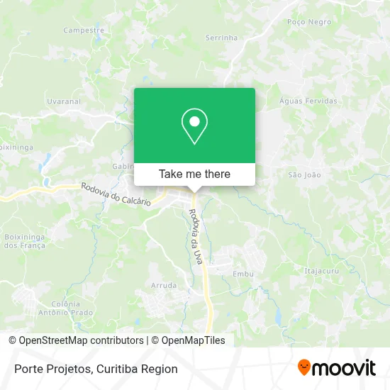
See Porte Projetos, Colombo, on the map
Public Transit to Porte Projetos in Colombo
Wondering how to get to Porte Projetos in Colombo? Moovit helps you find the best way to get to Porte Projetos with step-by-step directions from the nearest public transit station.
Moovit provides free maps and live directions to help you navigate through your city. View schedules, routes, timetables, and find out how long does it take to get to Porte Projetos in real time.
Looking for the nearest stop or station to Porte Projetos? Check out this list of stops closest to your destination: R. Venâncio Trevisan; R. José Leal Fontoura.
Bus: B72 COLOMBO / GUADALUPE (VIA T. ROÇA GRANDE), U01 SEDE / MARACANÃ, U02 PARQUE EMBU / JARDIM FLORENÇA, U05 CAPIVARI, U08 GRUTA BACAETAVA, U11 ITAJACURU / SANTA GEMA (IMBUIAL), I91 TAMANDARÉ / COLOMBO.
Want to see if there’s another route that gets you there at an earlier time? Moovit helps you find alternative routes or times. Get directions from and directions to Porte Projetos easily from the Moovit App or Website.
We make riding to Porte Projetos easy, which is why over 1.5 million users, including users in Colombo, trust Moovit as the best app for public transit. You don’t need to download an individual bus app or train app, Moovit is your all-in-one transit app that helps you find the best bus time or train time available.
For information on prices of bus, costs and ride fares to Porte Projetos, please check the Moovit app.
Use the app to navigate to popular places including to the airport, hospital, stadium, grocery store, mall, coffee shop, school, college, and university.
Porte Projetos Address: Rua Francisco Busato, 8000 Centro Colombo-PR 83414-520 street in Colombo
- Torquato Odontologia Integrada,
- Atacadão de Sorvetes Eskimó - Colombo,
- Vitalize: Pilates, Corpo e Mente Saudáveis,
- Elda Muller - Roupas Importadas,
- Transportadora Leonilda Ltda Me,
- Wanguarda Aruitetura,
- Real Distribuidora de Racoes,
- Camaracolombo,
- Costureira,
- Floricultura Florisbella,
- Câmara Municipal De Colombo,
- Livraria e Papelaria Arco-Iris,
- Posto Puppi,
- Oficina do Jota - Refrigeração e Máquinas,
- Jhonny's Pastelaria e Lanches,
- Agility Estacionamento,
- Klauzer Box,
- Rádio Trike,
- SGODA FITNESS,
- Restaurante Chang Long
Places Near Porte Projetos (Colombo)
- Arena Da Baixada - Curitiba,
- Shopping Palladium, Portão,
- Hospital Nossa Senhora Das Graças, Mercês,
- Hhhhh, Fazendinha,
- Parque Barigui, Mercês,
- Park Shopping Barigüi, Mossunguê,
- Hospital Universitário Evangélico de Curitiba, Bigorrilho,
- Hospital Da Cruz Vermelha, Batel,
- Campo Largo, Campo,
- Jockey Plaza Shopping Center, Tarumã,
- Rua Martim Afonso 558, Mercês,
- Hospital do Rocio, Campo,
- Pontifícia Universidade Católica do Paraná (PUCPR), Prado Velho,
- Shopping Estação, Rebouças,
- Hospital Erasto Gaertner, Jardim Das Américas,
- Hospital de Clínicas (HC - UFPR), Centro,
- Jardim Botânico de Curitiba PR, Centro,
- Hospital Madalena Sofia, Bairro Alto,
- Hospital Angelina Caron, Campina Grande Do Sul,
- Rua General Mário Tourinho, Campina Do Siqueira
How to get to popular places in Curitiba Region with public transit
Get around Colombo by public transit!
Traveling around Colombo has never been so easy. See step by step directions as you travel to any attraction, street or major public transit station. View bus and train schedules, arrival times, service alerts and detailed routes on a map, so you know exactly how to get to anywhere in Colombo.
When traveling to any destination around Colombo use Moovit's Live Directions with Get Off Notifications to know exactly where and how far to walk, how long to wait for your line, and how many stops are left. Moovit will alert you when it's time to get off — no need to constantly re-check whether yours is the next stop.
Wondering how to use public transit in Colombo or how to pay for public transit in Colombo? Moovit public transit app can help you navigate your way with public transit easily, and at minimum cost. It includes public transit fees, ticket prices, and costs. Looking for a map of Colombo public transit lines? Moovit public transit app shows all public transit maps in Colombo with all Bus and Cable Car routes and stops on an interactive map.
Curitiba Region has 2 transit type(s), including: Bus and Cable Car, operated by several transit agencies, including Sistema Integrado de Mobilidade (URBS), Sistema Integrado de Mobilidade (AMEP), URBS (Cartões bancários e Dinheiro), URBS (Cartões bancários / Cartão URBS), AMEP (Cartões bancários / Cartão MetroCard), AMEP (Cartões bancários / Cartão MetroCard / Dinheiro), Viação Colombo (Dinheiro), TRIAR (Cartão TRIAR / Dinheiro), Empresa Curitiba Cerro Azul (Dinheiro), Expresso Nossa Senhora da Penha (Dinheiro), Empresa Campo Alto Tijucas (Dinheiro), Auto Viação São José (Cartão VEM / Dinheiro), BRT S/A (Cartão VEM / Dinheiro), TransPiedade (Cartão Cidadão / Dinheiro) and Oceânica Sul (Cartão Transporte / Dinheiro)