Directions to Potter Estate (Newton) with public transportation
The following transit lines have routes that pass near Potter Estate
 Bus: 504, 553, 556, 558, 57.
- Train: FRAMINGHAM/WORCESTER, FITCHBURG.
- Subway: GREEN LINE D, GREEN LINE B.
How to get to Potter Estate by bus?
Click on the bus route to see step by step directions with maps, line arrival times and updated time schedules.
From Wegmans, Medford
103 minFrom Beth Israel Deaconess Medical Center Is, Boston
45 minFrom Raffles Boston Back Bay Hotel & Residences, Boston
23 minFrom new hampshire!, Boston
47 minFrom Fire & Ice (Fire Ice Restaurant), Boston
22 minFrom Wachusett mountain, Boston
40 minFrom Assembly Square Mall Shopping Center, Somerville
90 minFrom Fire + Ice, Boston
22 minFrom Guitar Center, Boston
51 minFrom Harvard Stadium, Boston
40 min
How to get to Potter Estate by train?
Click on the train route to see step by step directions with maps, line arrival times and updated time schedules.
From Beth Israel Deaconess Medical Center Is, Boston
120 minFrom Raffles Boston Back Bay Hotel & Residences, Boston
40 minFrom new hampshire!, Boston
135 minFrom Fire & Ice (Fire Ice Restaurant), Boston
43 minFrom Fire + Ice, Boston
44 minFrom Guitar Center, Boston
39 minFrom Harvard Stadium, Boston
49 min
How to get to Potter Estate by subway?
Click on the subway route to see step by step directions with maps, line arrival times and updated time schedules.
From Beth Israel Deaconess Medical Center Is, Boston
98 minFrom Raffles Boston Back Bay Hotel & Residences, Boston
85 minFrom Fire & Ice (Fire Ice Restaurant), Boston
85 minFrom Assembly Square Mall Shopping Center, Somerville
115 minFrom Fire + Ice, Boston
85 minFrom Guitar Center, Boston
82 minFrom Harvard Stadium, Boston
119 min
Bus stops near Potter Estate in Newton
Subway stations near Potter Estate in Newton
Bus lines to Potter Estate in Newton
What are the closest stations to Potter Estate?
The closest stations to Potter Estate are:
- Watertown St Opp Pond St is 28 yards away, 1 min walk.
- Washington St @ Jewett St is 45 yards away, 1 min walk.
- Newtonville is 1686 yards away, 20 min walk.
- Newton Centre is 3201 yards away, 38 min walk.
- Waverley is 4393 yards away, 52 min walk.
- Boston College is 4754 yards away, 56 min walk.
Which bus lines stop near Potter Estate?
These bus lines stop near Potter Estate: 504, 553, 556, 558, 57.
Which train line stops near Potter Estate?
FRAMINGHAM/WORCESTER (#530 | South Station)
Which subway line stops near Potter Estate?
GREEN LINE D (Riverside)
What’s the nearest train station to Potter Estate in Newton?
The nearest train station to Potter Estate in Newton is Newtonville. It’s a 20 min walk away.
What’s the nearest bus station to Potter Estate in Newton?
The nearest bus stations to Potter Estate in Newton are Watertown St Opp Pond St and Washington St @ Jewett St. The closest one is a 1 min walk away.
What time is the first subway to Potter Estate in Newton?
The GREEN LINE D is the first subway that goes to Potter Estate in Newton. It stops nearby at 4:54 AM.
What time is the last subway to Potter Estate in Newton?
The GREEN LINE B is the last subway that goes to Potter Estate in Newton. It stops nearby at 2:39 AM.
What time is the first train to Potter Estate in Newton?
The FRAMINGHAM/WORCESTER is the first train that goes to Potter Estate in Newton. It stops nearby at 5:22 AM.
What time is the last train to Potter Estate in Newton?
The FRAMINGHAM/WORCESTER is the last train that goes to Potter Estate in Newton. It stops nearby at 12:20 AM.
What time is the first bus to Potter Estate in Newton?
The 554 is the first bus that goes to Potter Estate in Newton. It stops nearby at 6:01 AM.
What time is the last bus to Potter Estate in Newton?
The 553 is the last bus that goes to Potter Estate in Newton. It stops nearby at 9:10 PM.
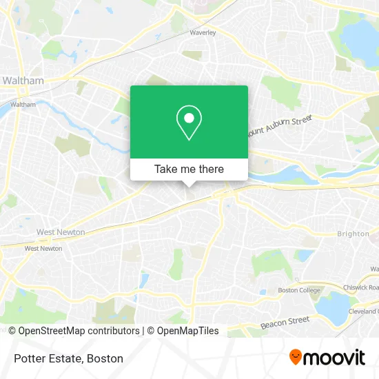
See Potter Estate, Newton, on the map
Public Transit to Potter Estate in Newton
Wondering how to get to Potter Estate in Newton? Moovit helps you find the best way to get to Potter Estate with step-by-step directions from the nearest public transit station.
Moovit provides free maps and live directions to help you navigate through your city. View schedules, routes, timetables, and find out how long does it take to get to Potter Estate in real time.
Looking for the nearest stop or station to Potter Estate? Check out this list of stops closest to your destination: Watertown St Opp Pond St; Washington St @ Jewett St; Newtonville; Newton Centre; Waverley; Boston College.
Bus: 504, 553, 556, 558, 57, 59, 554.Train: FRAMINGHAM/WORCESTER, FITCHBURG.Subway: GREEN LINE D, GREEN LINE B.
Want to see if there’s another route that gets you there at an earlier time? Moovit helps you find alternative routes or times. Get directions from and directions to Potter Estate easily from the Moovit App or Website.
We make riding to Potter Estate easy, which is why over 1.7 million users, including users in Newton, trust Moovit as the best app for public transit. You don’t need to download an individual bus app or train app, Moovit is your all-in-one transit app that helps you find the best bus time or train time available.
For information on prices of bus, subway and train, costs and ride fares to Potter Estate, please check the Moovit app.
Use the app to navigate to popular places including to the airport, hospital, stadium, grocery store, mall, coffee shop, school, college, and university.
Potter Estate Address: 65 Walnut Park street in Newton
- Genova Construction,
- Mariann Burke Psychotherapy,
- Ewer Raymond S,
- Jeffrey S Levine,
- Cradles To Crayons,
- FOUR POINTS BY SHERATON Boston Newton,
- Locks 4 You,
- Buff's Pub,
- Beth Yeshua Messianic Congregation,
- Arabic Baptist Church,
- Atm,
- Vape Daddy's (Lake Smoke and Vape),
- I-90 Mass Pike, Exit 17,
- MBTA Bus Route 502,
- Newton Corner,
- Five Star Associates Limited Partnership,
- Brigham and Women's at Newton Corner (Brigham & Womens-Newton Corner - Harley A Simeone MD),
- Vows Bridal Outlet,
- Vows Bridal Outlet & Bridepower,
- Castle Slate Roofing Company
Places Near Potter Estate (Newton)
- Boston Common, Boston,
- Massachusetts General Hospital, Boston,
- Seaport District, Boston,
- Boston Children's Hospital, Boston,
- Wilbur Theatre, Boston,
- Museum Of Science, Boston,
- Prudential Center, Boston,
- Isabella Stewart Gardner Museum, Boston,
- Td Garden, Boston,
- Wang Theater, Boston,
- House Of Blues, Boston,
- Faneuil Hall, Boston,
- Boston Medical Center, Boston,
- Castle Island, Boston,
- Cheers, Boston,
- Mgm Music Hall, Boston,
- North End, Boston,
- Quincy Market, Boston,
- Leader Bank Pavilion (Leader Bank Pavillion), Boston,
- Boston Convention & Exhibition Center, Boston
How to get to popular places in Boston with public transit
Get around Newton by public transit!
Traveling around Newton has never been so easy. See step by step directions as you travel to any attraction, street or major public transit station. View bus and train schedules, arrival times, service alerts and detailed routes on a map, so you know exactly how to get to anywhere in Newton.
When traveling to any destination around Newton use Moovit's Live Directions with Get Off Notifications to know exactly where and how far to walk, how long to wait for your line, and how many stops are left. Moovit will alert you when it's time to get off — no need to constantly re-check whether yours is the next stop.
Wondering how to use public transit in Newton or how to pay for public transit in Newton? Moovit public transit app can help you navigate your way with public transit easily, and at minimum cost. It includes public transit fees, ticket prices, and costs. Looking for a map of Newton public transit lines? Moovit public transit app shows all public transit maps in Newton with all Bus, Train, Subway and Ferry routes and stops on an interactive map.
Boston has 4 transit type(s), including: Bus, Train, Subway and Ferry, operated by several transit agencies, including MBTA, Southeastern Regional Transit Authority, MetroWest Regional Transit Authority, Rhode Island Public Transit Authority, WRTA, Lowell Regional Transit Authority, Merrimack Valley Transit, Montachusett Regional Transit Authority, Cape Cod Regional Transit Authority, Brockton Area Transit Authority, Martha's Vineyard Transit Authority, the WAVE - Nantucket Regional Transit Authority, GATRA, Cape Ann Transportation Authority and Massport