How to get to Pout by bus?
Click on the bus route to see step by step directions with maps, line arrival times and updated time schedules.
How to get to Pout by train?
Click on the train route to see step by step directions with maps, line arrival times and updated time schedules.
Bus stops near Pout in Andover
Train station near Pout in Andover
- Andover, 16 min walk,VIEW
What are the closest stations to Pout?
The closest stations to Pout are:
- 44 School Street is 502 yards away, 7 min walk.
- School St & Central St is 512 yards away, 7 min walk.
- Andover is 1280 yards away, 16 min walk.
Which bus line stops near Pout?
2 (Main And School)
Which train line stops near Pout?
HAVERHILL (#232 | North Station)
What’s the nearest train station to Pout in Andover?
The nearest train station to Pout in Andover is Andover. It’s a 16 min walk away.
What’s the nearest bus station to Pout in Andover?
The nearest bus stations to Pout in Andover are 44 School Street and School St & Central St. The closest one is a 7 min walk away.
What time is the first train to Pout in Andover?
The HAVERHILL is the first train that goes to Pout in Andover. It stops nearby at 4:58 AM.
What time is the last train to Pout in Andover?
The HAVERHILL is the last train that goes to Pout in Andover. It stops nearby at 12:31 AM.
What time is the first bus to Pout in Andover?
The 2 is the first bus that goes to Pout in Andover. It stops nearby at 5:16 AM.
What time is the last bus to Pout in Andover?
The 2 is the last bus that goes to Pout in Andover. It stops nearby at 9:28 PM.
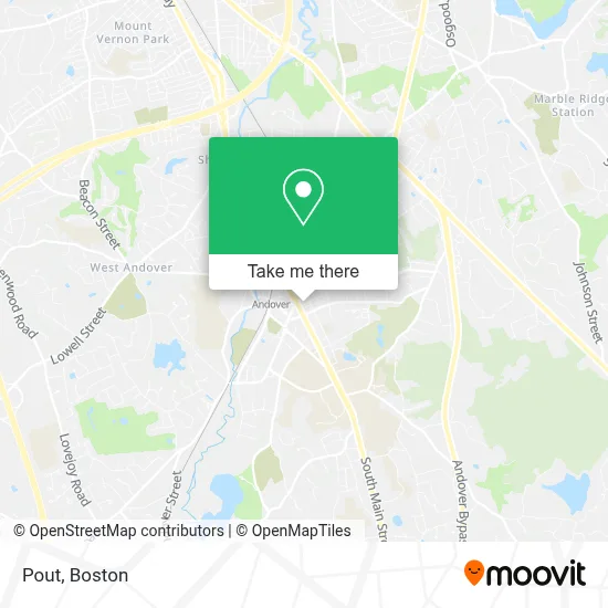
See Pout, Andover, on the map
Public Transit to Pout in Andover
Wondering how to get to Pout in Andover? Moovit helps you find the best way to get to Pout with step-by-step directions from the nearest public transit station.
Moovit provides free maps and live directions to help you navigate through your city. View schedules, routes, timetables, and find out how long does it take to get to Pout in real time.
Looking for the nearest stop or station to Pout? Check out this list of stops closest to your destination: 44 School Street; School St & Central St; Andover.
Bus: 2, 21.Train: HAVERHILL.
Want to see if there’s another route that gets you there at an earlier time? Moovit helps you find alternative routes or times. Get directions from and directions to Pout easily from the Moovit App or Website.
We make riding to Pout easy, which is why over 1.7 million users, including users in Andover, trust Moovit as the best app for public transit. You don’t need to download an individual bus app or train app, Moovit is your all-in-one transit app that helps you find the best bus time or train time available.
For information on prices of bus and train, costs and ride fares to Pout, please check the Moovit app.
Use the app to navigate to popular places including to the airport, hospital, stadium, grocery store, mall, coffee shop, school, college, and university.
Pout Address: 22 Park St street in Andover
- Andover Ma Cosmetic Dentistry Directory,
- Salon Beau,
- Barnard Block,
- Physical Therapy Hip Pain,
- Monica's Mithai Cafe & Bar,
- Moulton Irrigation,
- Kokoro Craft Udon,
- P&P Home Buyers,
- Belen Reyes Avila at Guaranteed Rate (NMLS #1087139),
- Browell & Murphy - Andover,
- Dahlia Gonzalez at Guaranteed Rate - NMLS #2015735,
- Harty Financial,
- Morgan Stanley,
- Max & Riley,
- C-Suite,
- Michael Suffoletto at Guaranteed Rate ,
- Eric Inman Daum, Architect, LLC,
- Waxing by Ari,
- Cooperstown Environmental,
- Exquisite Linens and Florals
Places Near Pout (Andover)
- Faneuil Hall, Boston,
- Quincy Market, Boston,
- House Of Blues, Boston,
- Td Garden, Boston,
- Boston Convention & Exhibition Center, Boston,
- North End, Boston,
- Boston Children's Hospital, Boston,
- Prudential Center, Boston,
- Boston Medical Center, Boston,
- Cheers, Boston,
- Castle Island, Boston,
- Leader Bank Pavilion (Leader Bank Pavillion), Boston,
- Wang Theater, Boston,
- Seaport District, Boston,
- Massachusetts General Hospital, Boston,
- Boston Common, Boston,
- Isabella Stewart Gardner Museum, Boston,
- Mgm Music Hall, Boston,
- Museum Of Science, Boston,
- Wilbur Theatre, Boston
How to get to popular places in Boston with public transit
Get around Andover by public transit!
Traveling around Andover has never been so easy. See step by step directions as you travel to any attraction, street or major public transit station. View bus and train schedules, arrival times, service alerts and detailed routes on a map, so you know exactly how to get to anywhere in Andover.
When traveling to any destination around Andover use Moovit's Live Directions with Get Off Notifications to know exactly where and how far to walk, how long to wait for your line, and how many stops are left. Moovit will alert you when it's time to get off — no need to constantly re-check whether yours is the next stop.
Wondering how to use public transit in Andover or how to pay for public transit in Andover? Moovit public transit app can help you navigate your way with public transit easily, and at minimum cost. It includes public transit fees, ticket prices, and costs. Looking for a map of Andover public transit lines? Moovit public transit app shows all public transit maps in Andover with all Bus, Train, Subway and Ferry routes and stops on an interactive map.
Boston has 4 transit type(s), including: Bus, Train, Subway and Ferry, operated by several transit agencies, including MBTA, Southeastern Regional Transit Authority, MetroWest Regional Transit Authority, Rhode Island Public Transit Authority, WRTA, Lowell Regional Transit Authority, Merrimack Valley Transit, Montachusett Regional Transit Authority, Cape Cod Regional Transit Authority, Brockton Area Transit Authority, Martha's Vineyard Transit Authority, the WAVE - Nantucket Regional Transit Authority, GATRA, Cape Ann Transportation Authority and Massport